Yao-Yi Chiang
University of Minnesota, University of Southern California
Academic Profile
Statistics
Similar Authors
Papers on arXiv
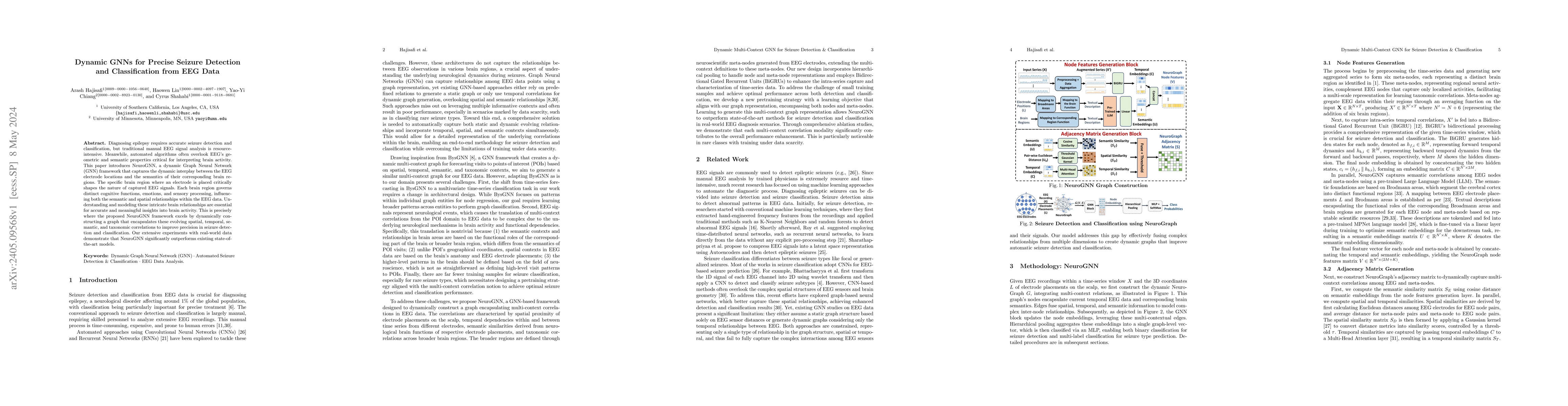
Diagnosing epilepsy requires accurate seizure detection and classification, but traditional manual EEG signal analysis is resource-intensive. Meanwhile, automated algorithms often overlook EEG's geo...
Humans subconsciously engage in geospatial reasoning when reading articles. We recognize place names and their spatial relations in text and mentally associate them with their physical locations on ...
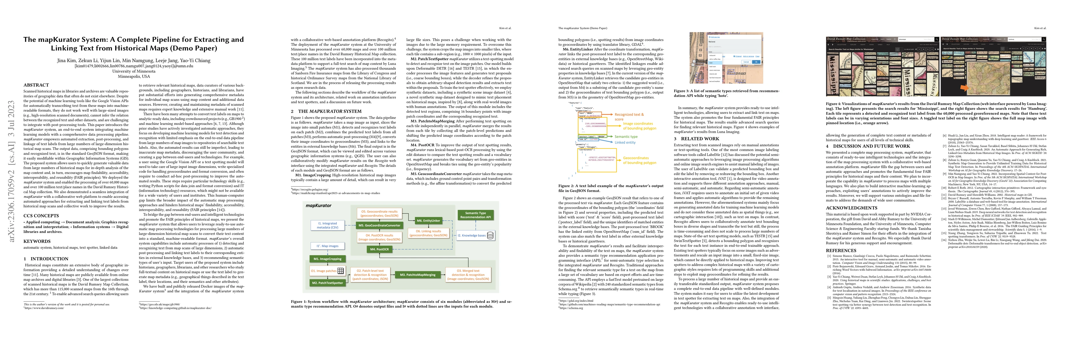
Scanned historical maps in libraries and archives are valuable repositories of geographic data that often do not exist elsewhere. Despite the potential of machine learning tools like the Google Visi...
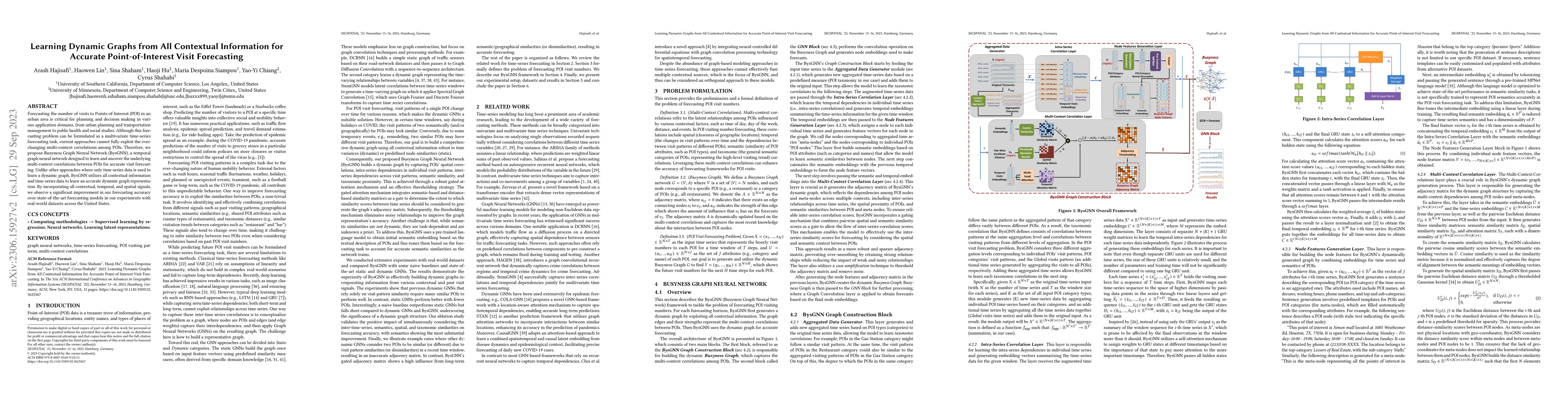
Forecasting the number of visits to Points-of-Interest (POI) in an urban area is critical for planning and decision-making for various application domains, from urban planning and transportation man...
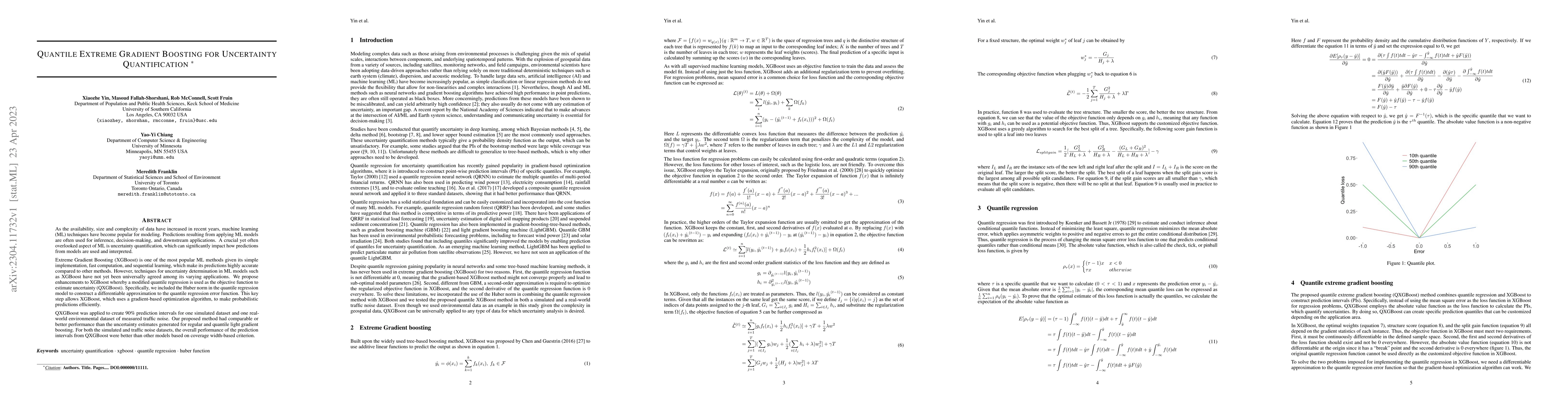
As the availability, size and complexity of data have increased in recent years, machine learning (ML) techniques have become popular for modeling. Predictions resulting from applying ML models are ...
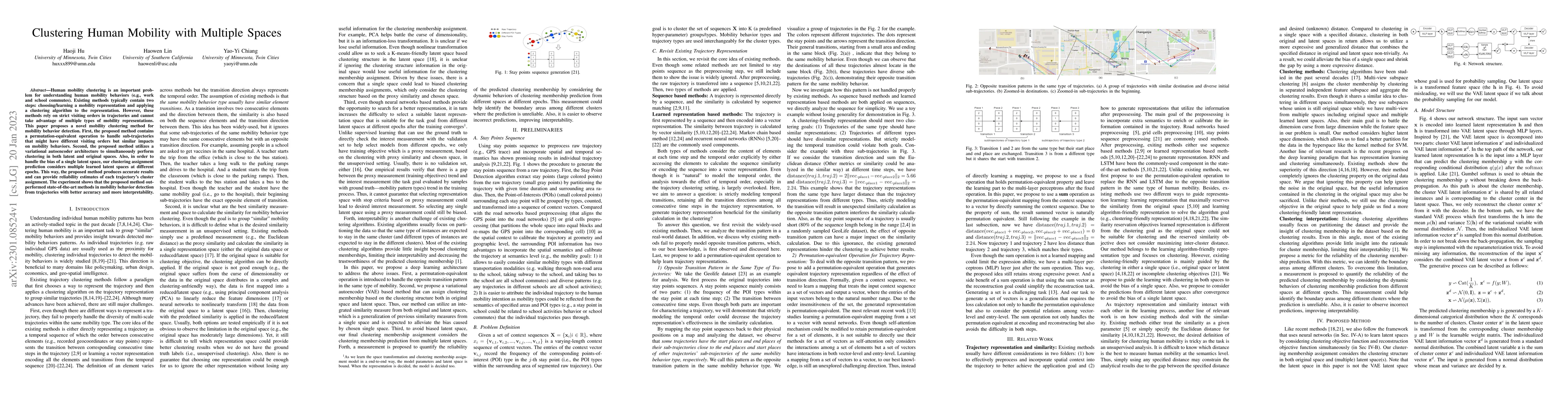
Human mobility clustering is an important problem for understanding human mobility behaviors (e.g., work and school commutes). Existing methods typically contain two steps: choosing or learning a mo...
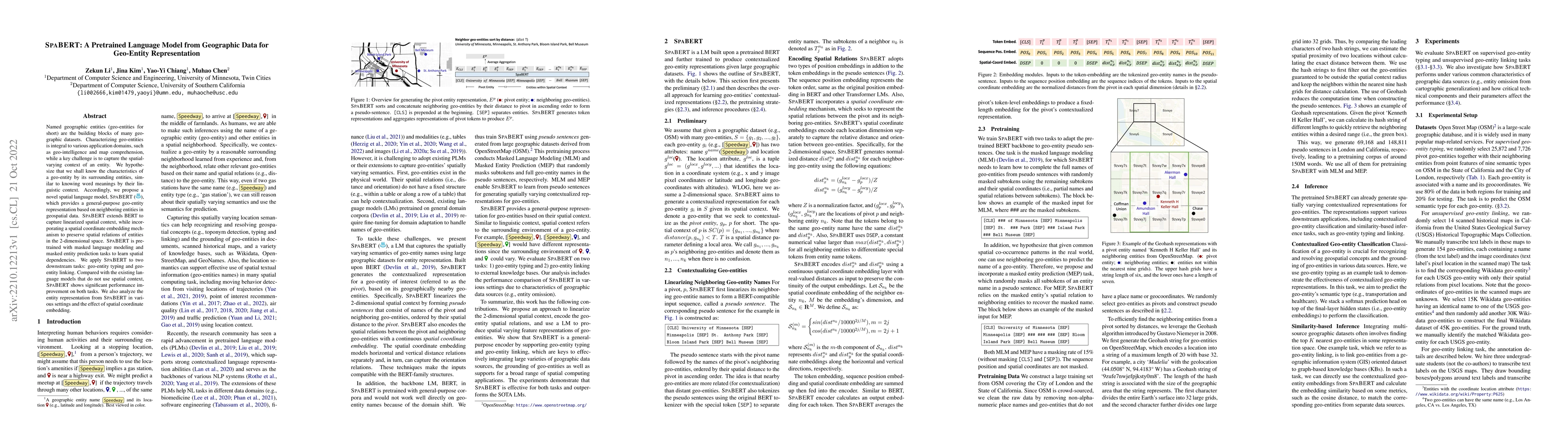
Named geographic entities (geo-entities for short) are the building blocks of many geographic datasets. Characterizing geo-entities is integral to various application domains, such as geo-intelligen...
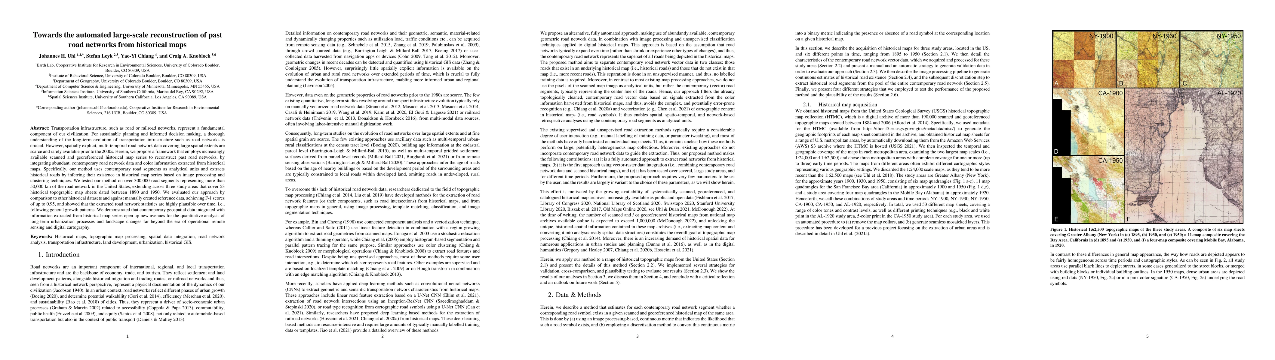
Transportation infrastructure, such as road or railroad networks, represent a fundamental component of our civilization. For sustainable planning and informed decision making, a thorough understandi...
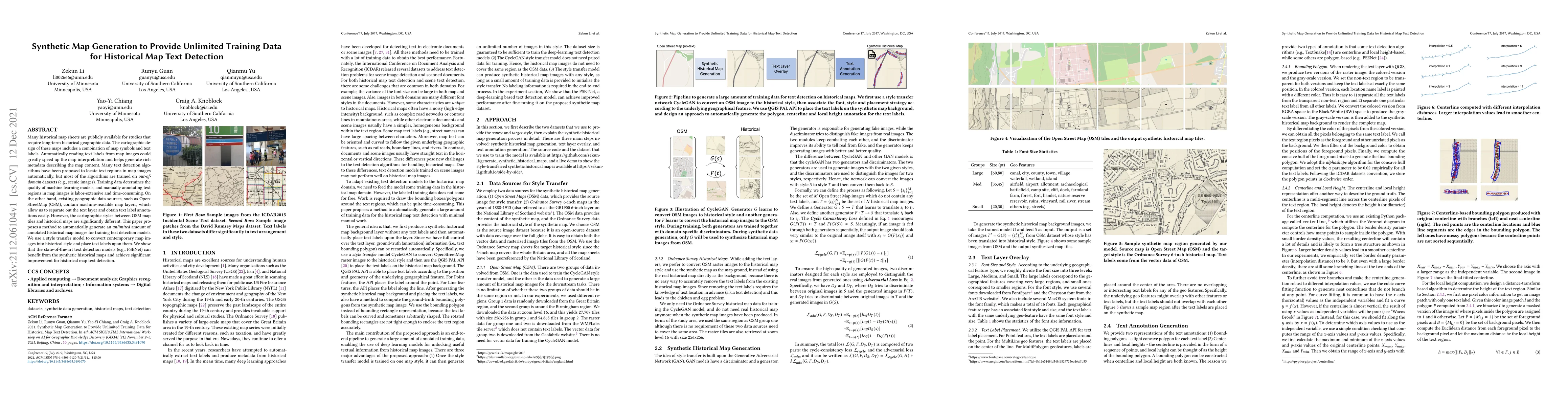
Many historical map sheets are publicly available for studies that require long-term historical geographic data. The cartographic design of these maps includes a combination of map symbols and text ...
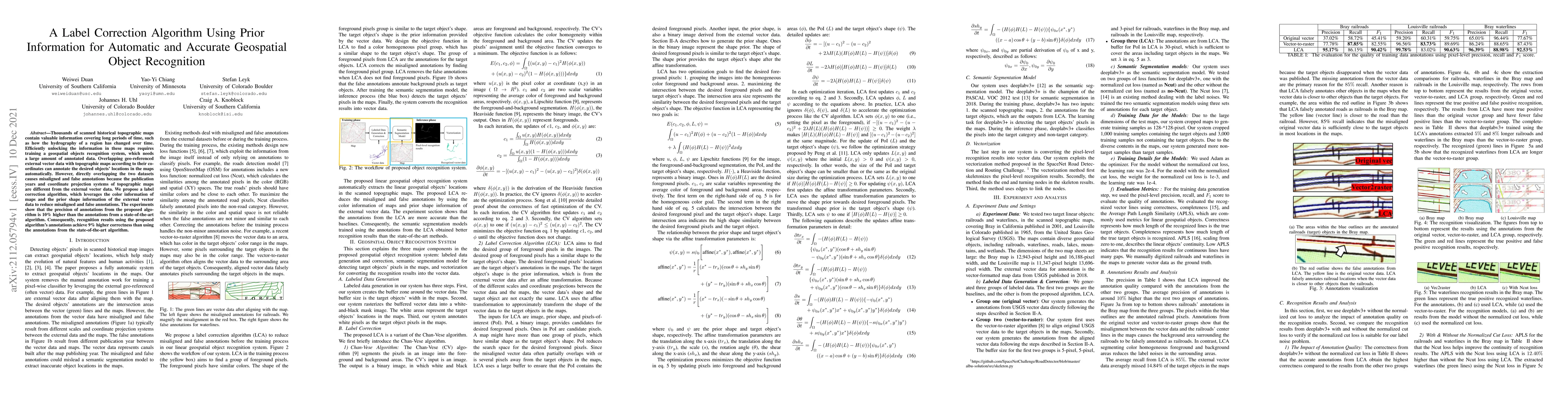
Thousands of scanned historical topographic maps contain valuable information covering long periods of time, such as how the hydrography of a region has changed over time. Efficiently unlocking the ...
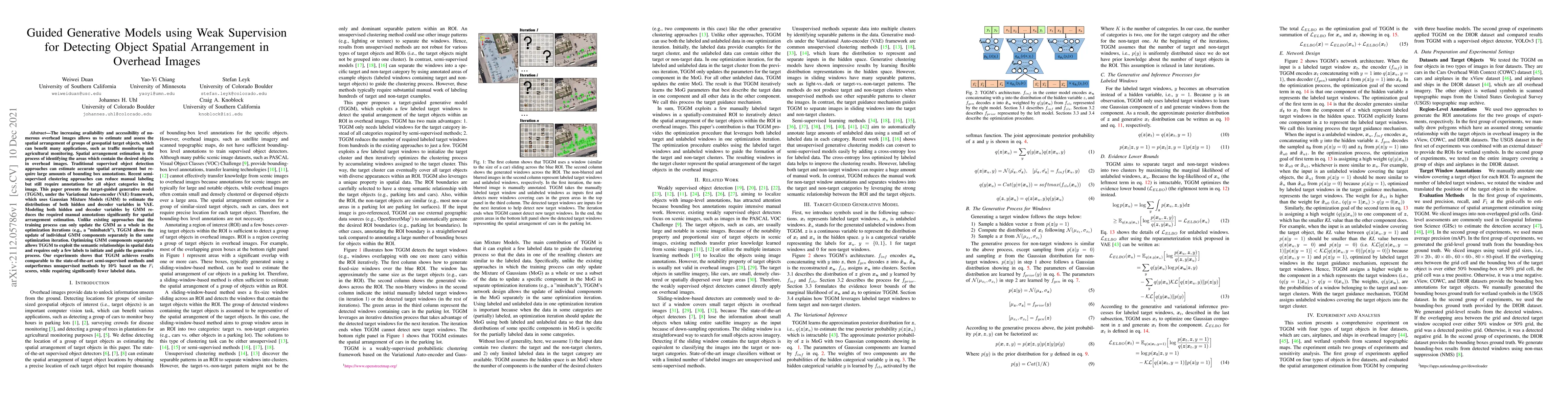
The increasing availability and accessibility of numerous overhead images allows us to estimate and assess the spatial arrangement of groups of geospatial target objects, which can benefit many appl...
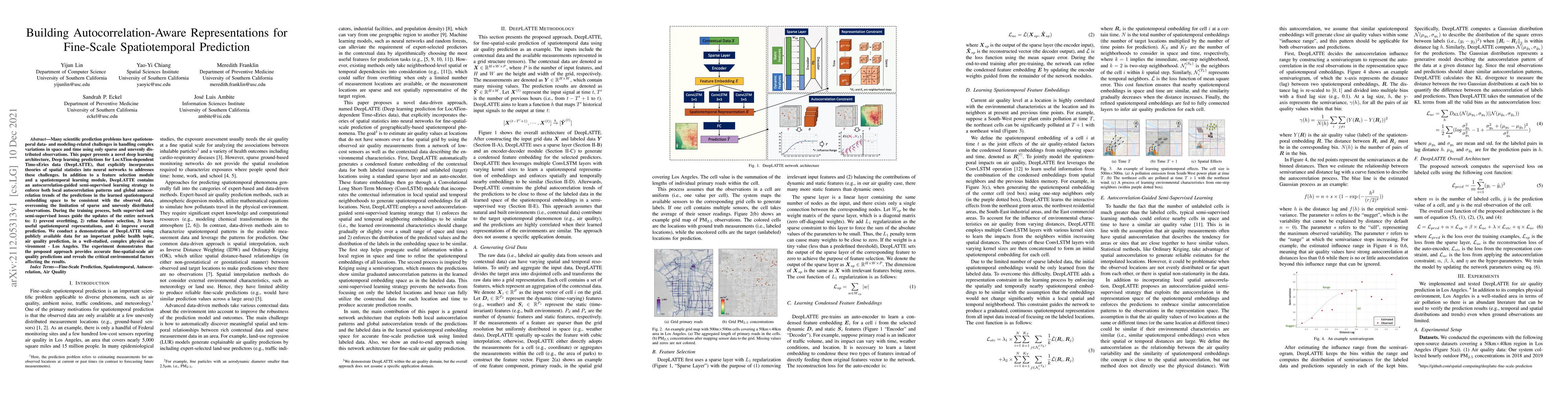
Many scientific prediction problems have spatiotemporal data- and modeling-related challenges in handling complex variations in space and time using only sparse and unevenly distributed observations...
Historical maps contain detailed geographic information difficult to find elsewhere covering long-periods of time (e.g., 125 years for the historical topographic maps in the US). However, these maps...
We introduce the modular and scalable design of Kartta Labs, an open source, open data, and scalable system for virtually reconstructing cities from historical maps and photos. Kartta Labs relies on...
Identifying mobility behaviors in rich trajectory data is of great economic and social interest to various applications including urban planning, marketing and intelligence. Existing work on traject...
With the widespread installation of location-enabled devices on public transportation, public vehicles are generating massive amounts of trajectory data in real time. However, using these trajectory...
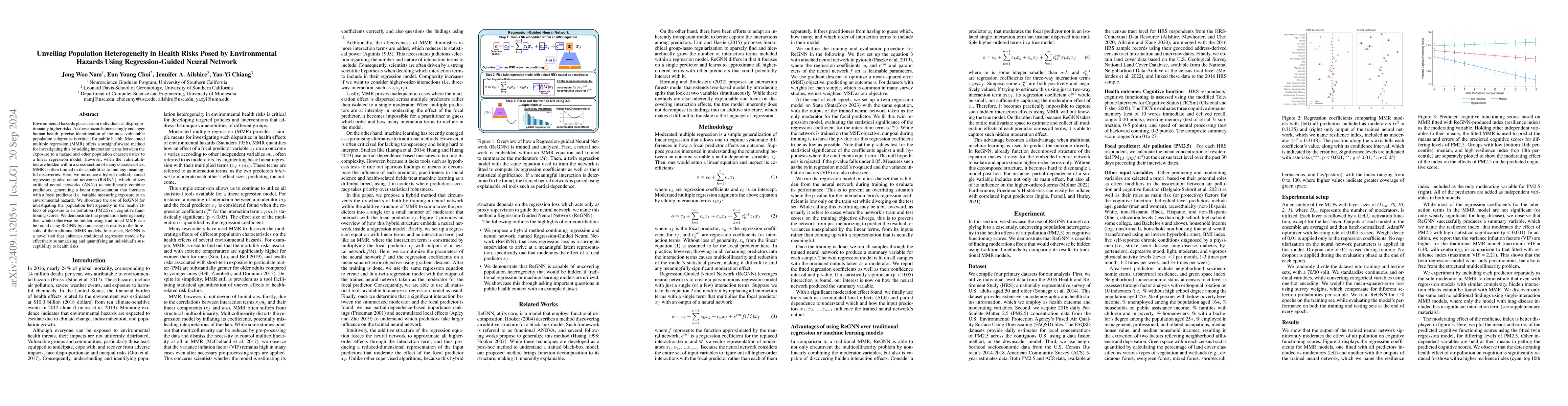
Environmental hazards place certain individuals at disproportionately higher risks. As these hazards increasingly endanger human health, precise identification of the most vulnerable population subgro...
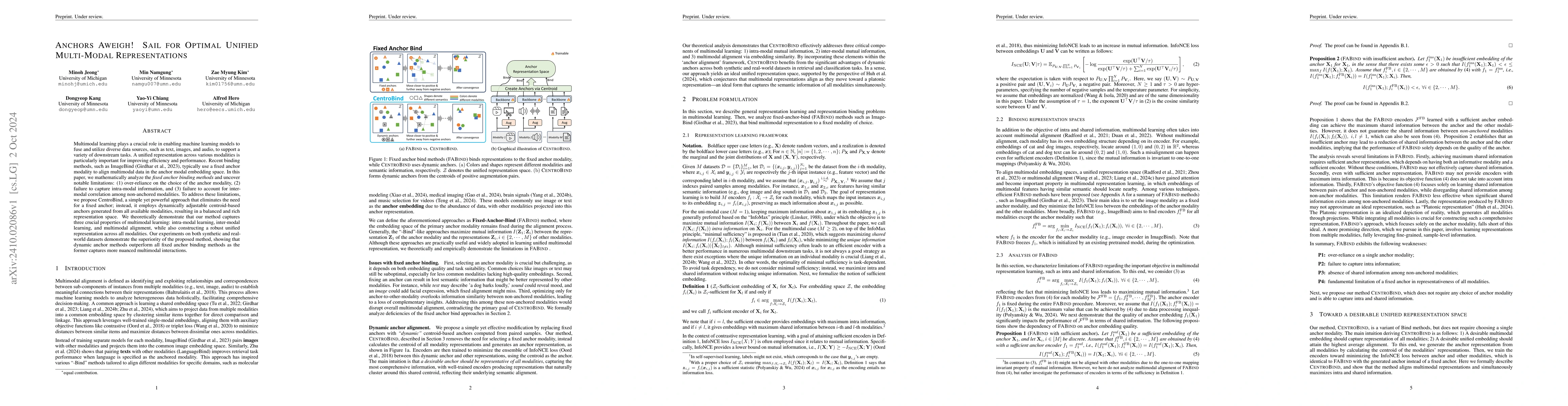
Multimodal learning plays a crucial role in enabling machine learning models to fuse and utilize diverse data sources, such as text, images, and audio, to support a variety of downstream tasks. A unif...
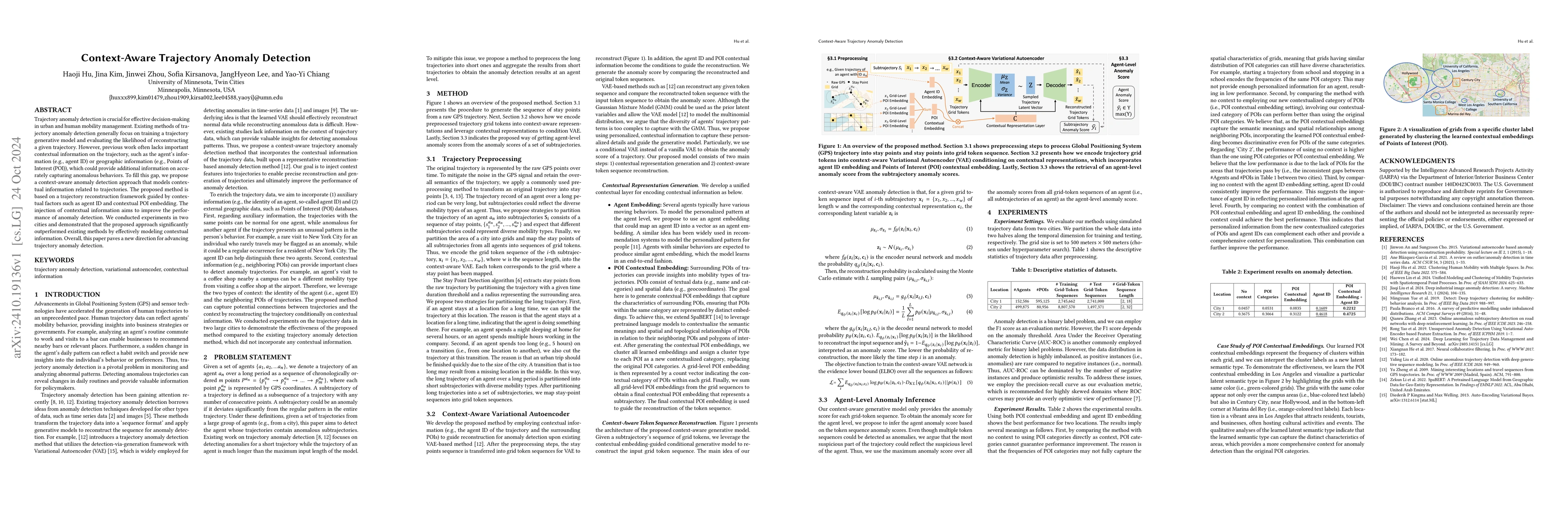
Trajectory anomaly detection is crucial for effective decision-making in urban and human mobility management. Existing methods of trajectory anomaly detection generally focus on training a trajectory ...
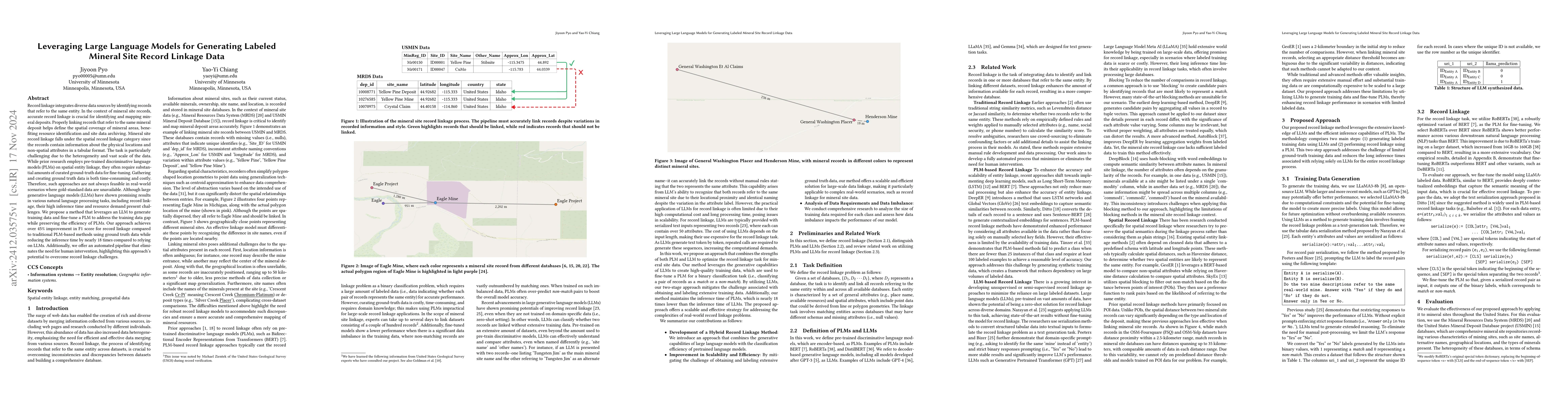
Record linkage integrates diverse data sources by identifying records that refer to the same entity. In the context of mineral site records, accurate record linkage is crucial for identifying and mapp...
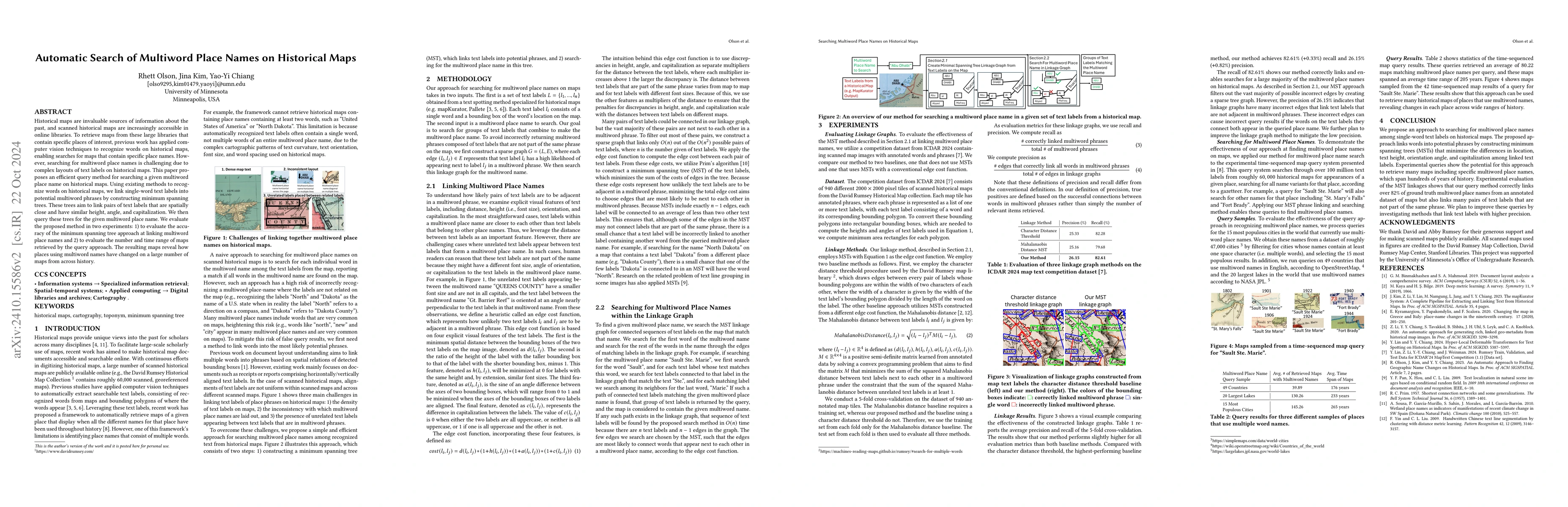
Historical maps are invaluable sources of information about the past, and scanned historical maps are increasingly accessible in online libraries. To retrieve maps from these large libraries that cont...
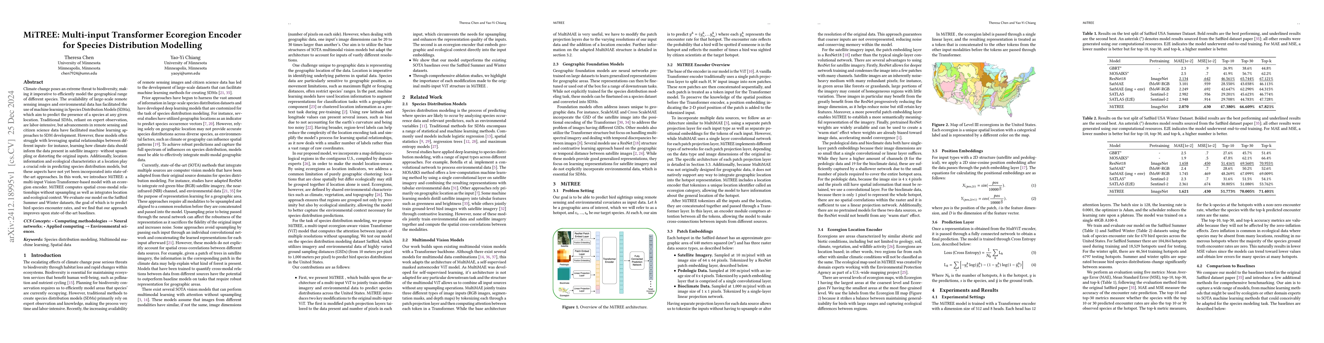
Climate change poses an extreme threat to biodiversity, making it imperative to efficiently model the geographical range of different species. The availability of large-scale remote sensing images and...
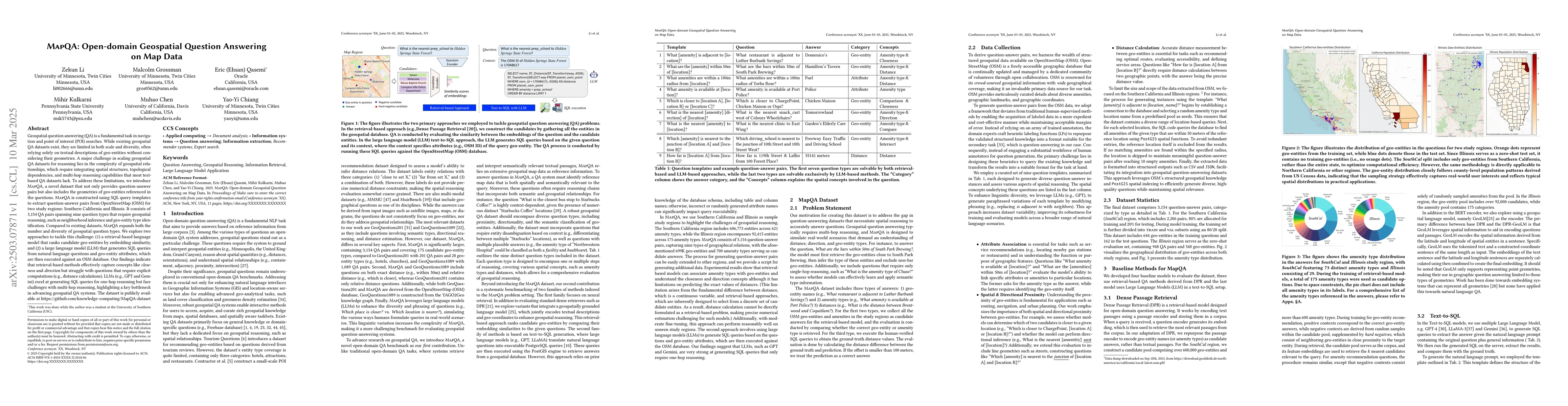
Geospatial question answering (QA) is a fundamental task in navigation and point of interest (POI) searches. While existing geospatial QA datasets exist, they are limited in both scale and diversity, ...
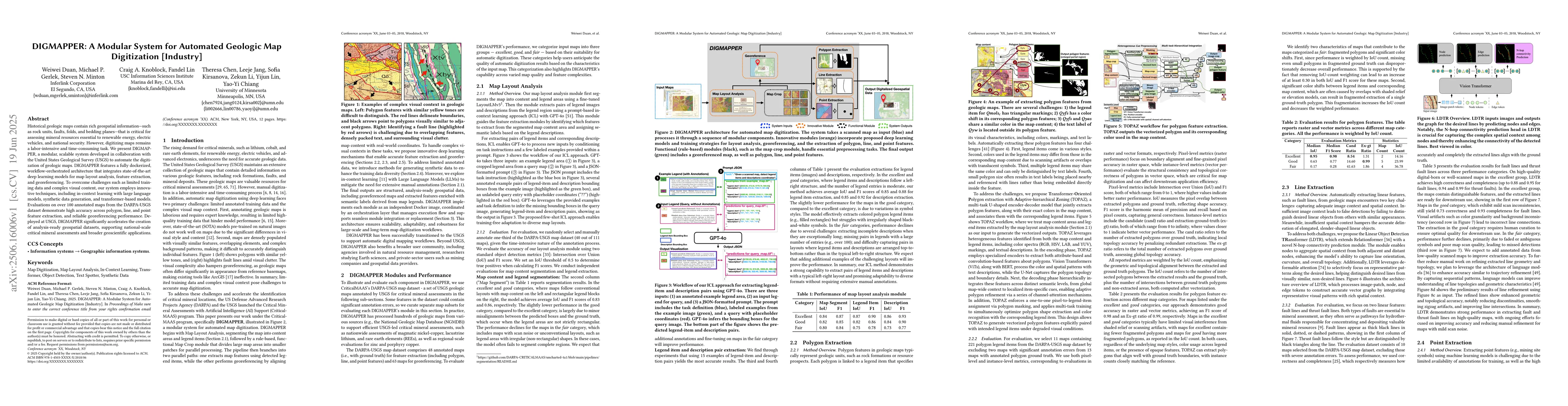
Historical geologic maps contain rich geospatial information, such as rock units, faults, folds, and bedding planes, that is critical for assessing mineral resources essential to renewable energy, ele...
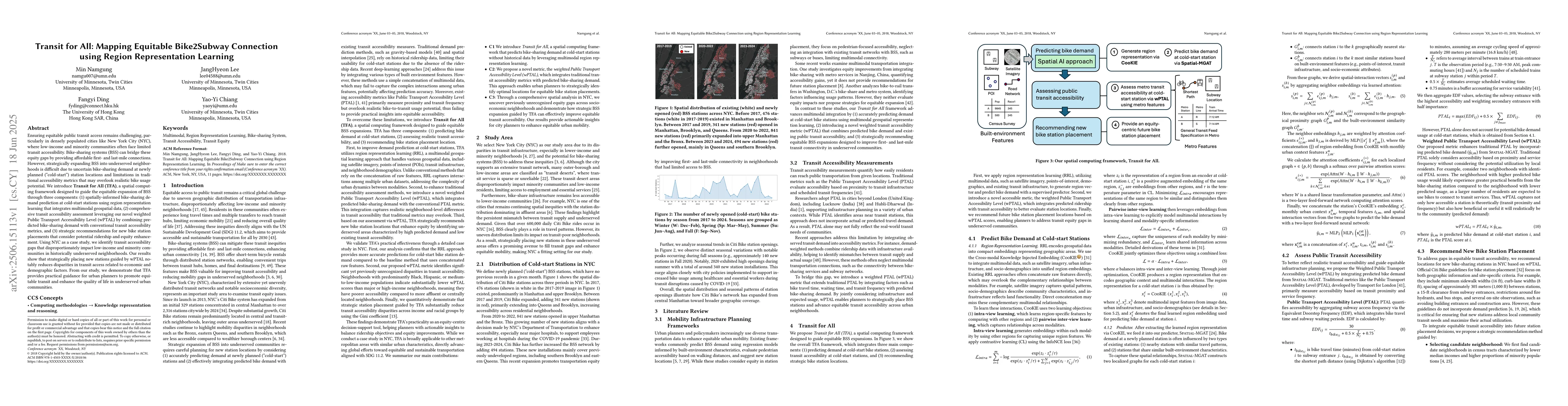
Ensuring equitable public transit access remains challenging, particularly in densely populated cities like New York City (NYC), where low-income and minority communities often face limited transit ac...
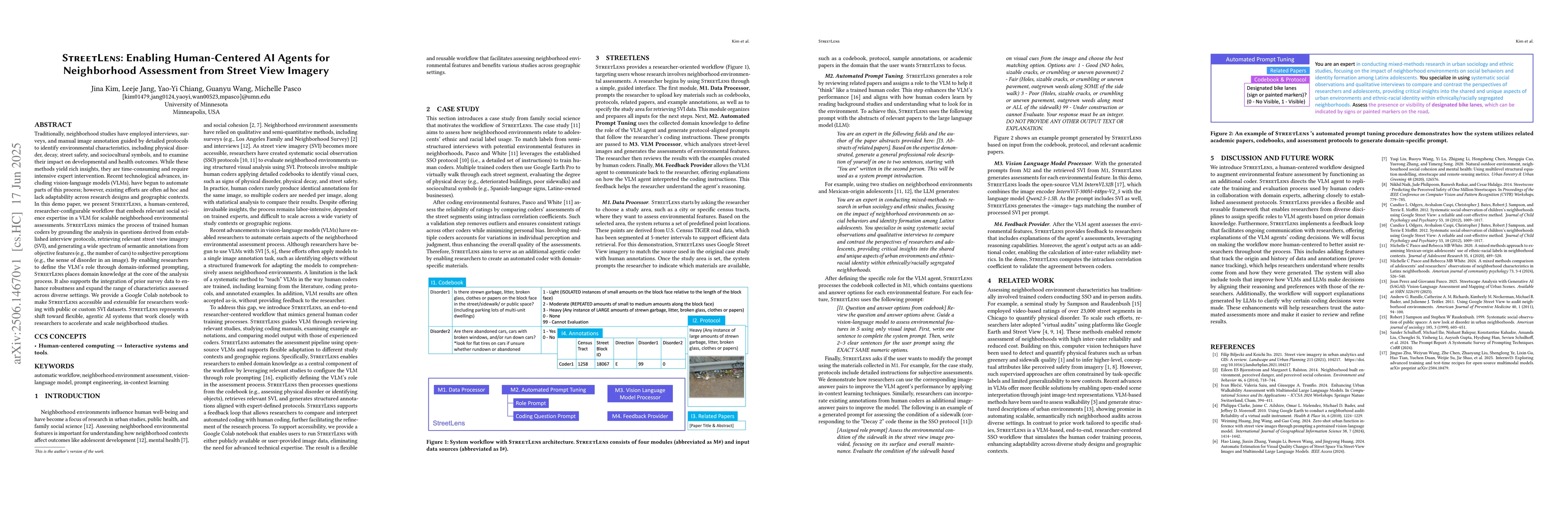
Traditionally, neighborhood studies have employed interviews, surveys, and manual image annotation guided by detailed protocols to identify environmental characteristics, including physical disorder, ...
Text on historical maps contains valuable information providing georeferenced historical, political, and cultural contexts. However, text extraction from historical maps is challenging due to the lack...
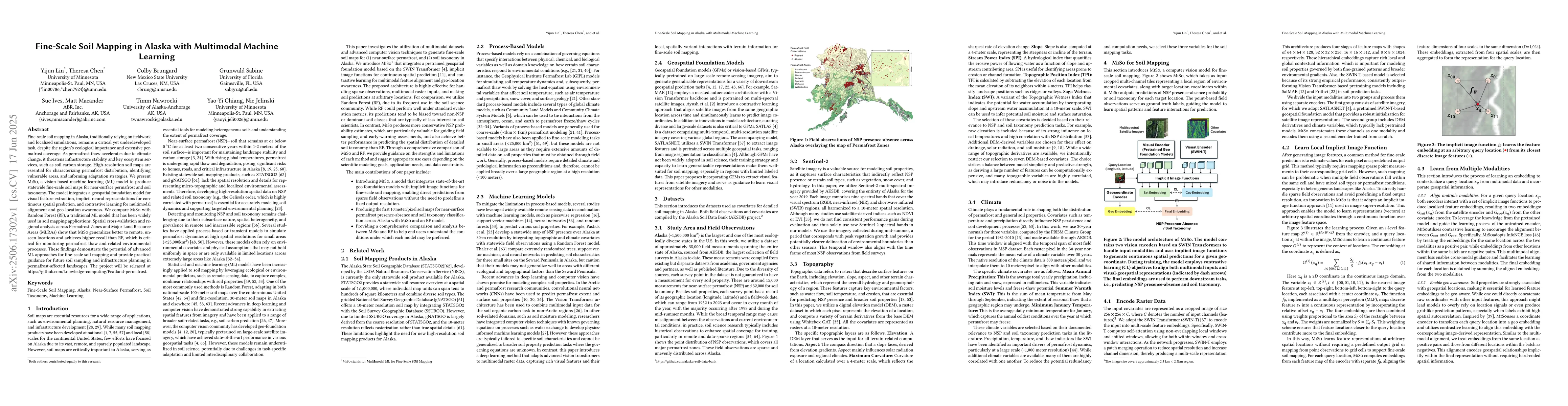
Fine-scale soil mapping in Alaska, traditionally relying on fieldwork and localized simulations, remains a critical yet underdeveloped task, despite the region's ecological importance and extensive pe...
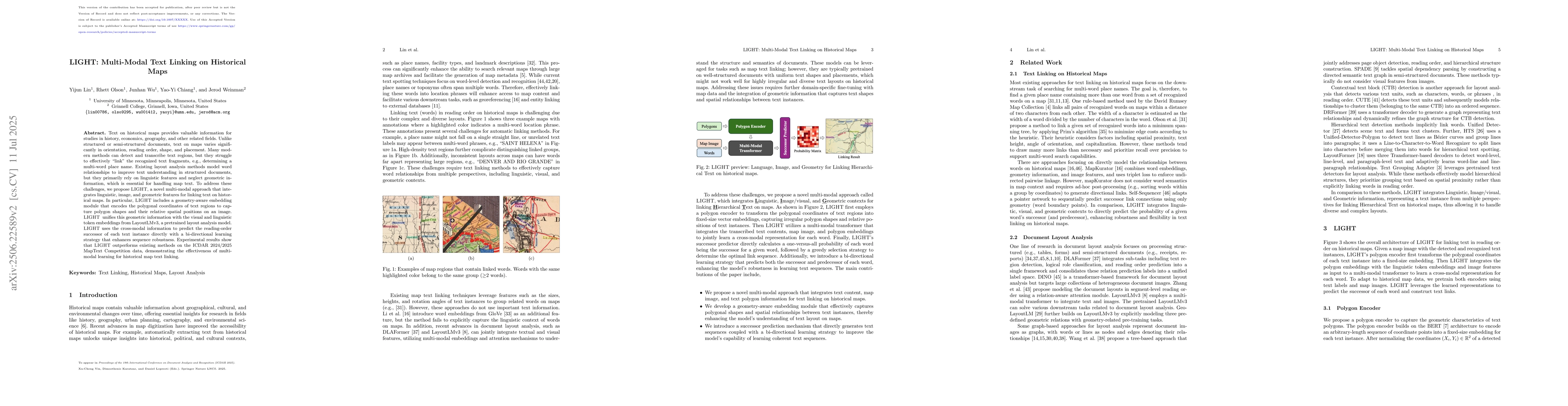
Text on historical maps provides valuable information for studies in history, economics, geography, and other related fields. Unlike structured or semi-structured documents, text on maps varies signif...
Though no longer legally enforceable, racial covenants in twentieth-century property deeds continue to shape spatial and socioeconomic inequalities. Understanding this legacy requires identifying raci...
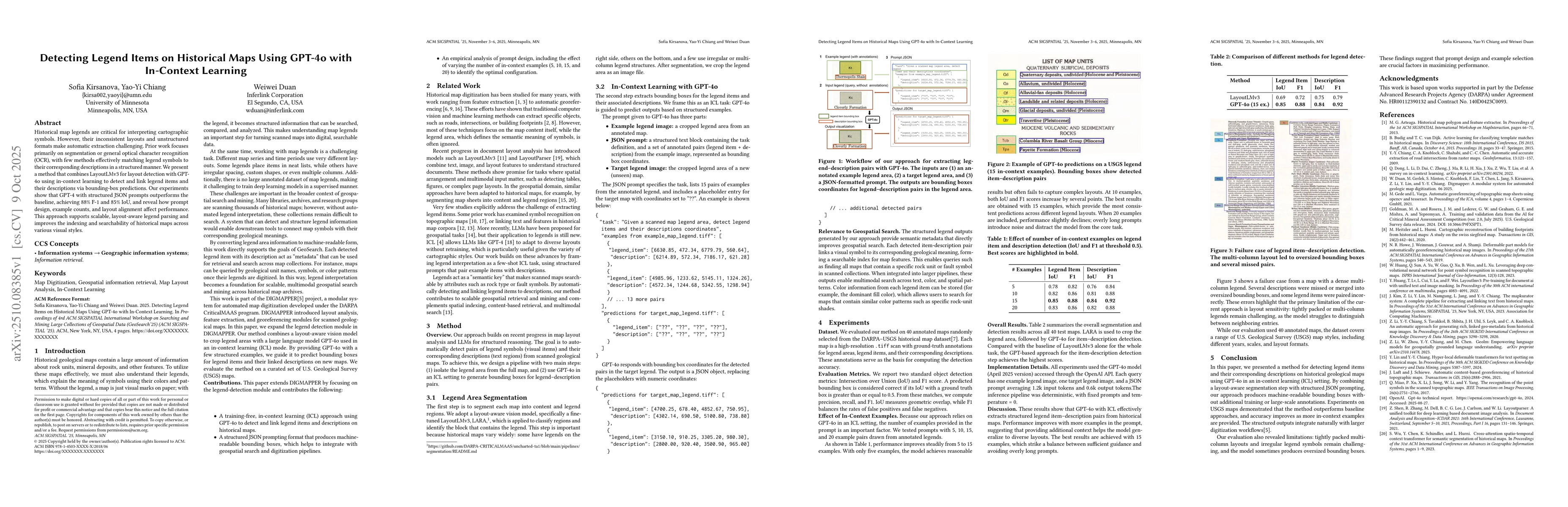
Historical map legends are critical for interpreting cartographic symbols. However, their inconsistent layouts and unstructured formats make automatic extraction challenging. Prior work focuses primar...
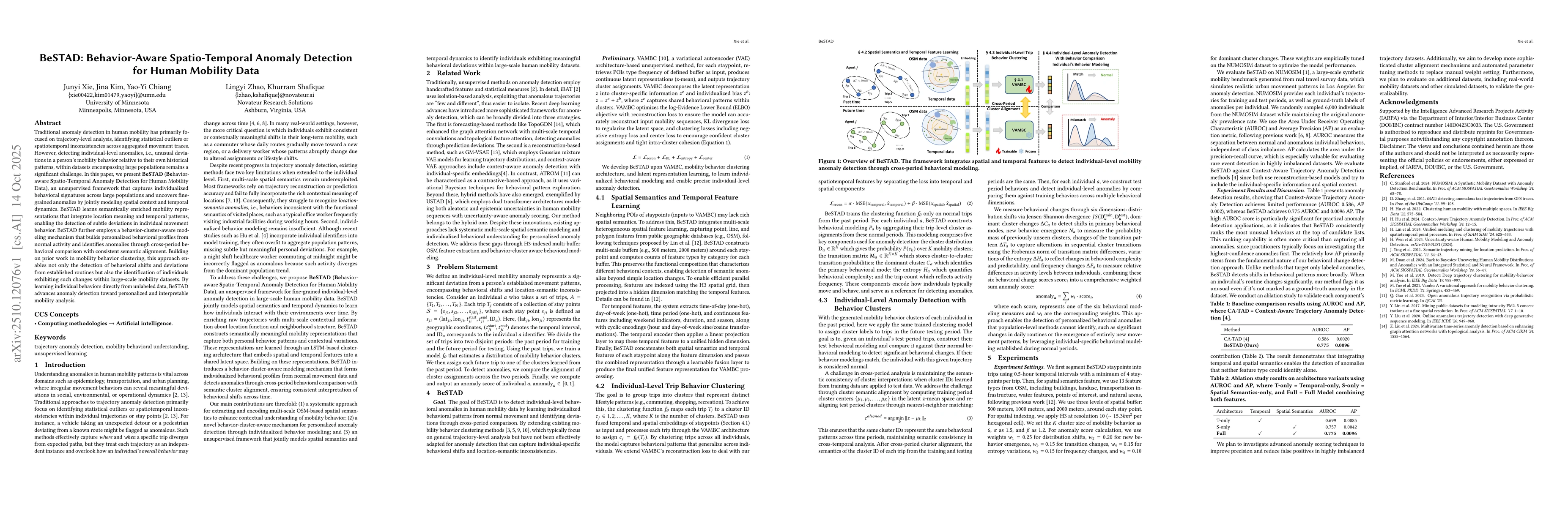
Traditional anomaly detection in human mobility has primarily focused on trajectory-level analysis, identifying statistical outliers or spatiotemporal inconsistencies across aggregated movement traces...
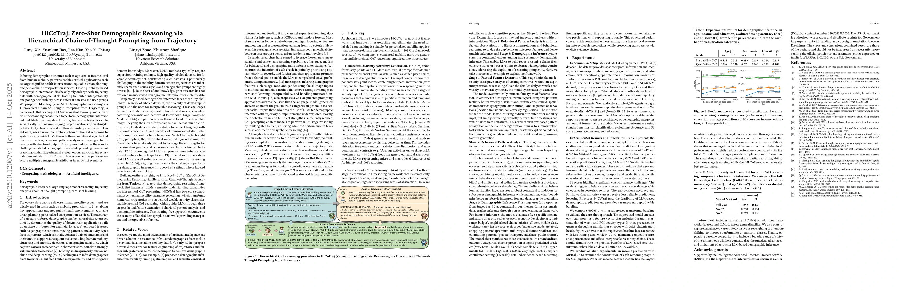
Inferring demographic attributes such as age, sex, or income level from human mobility patterns enables critical applications such as targeted public health interventions, equitable urban planning, an...
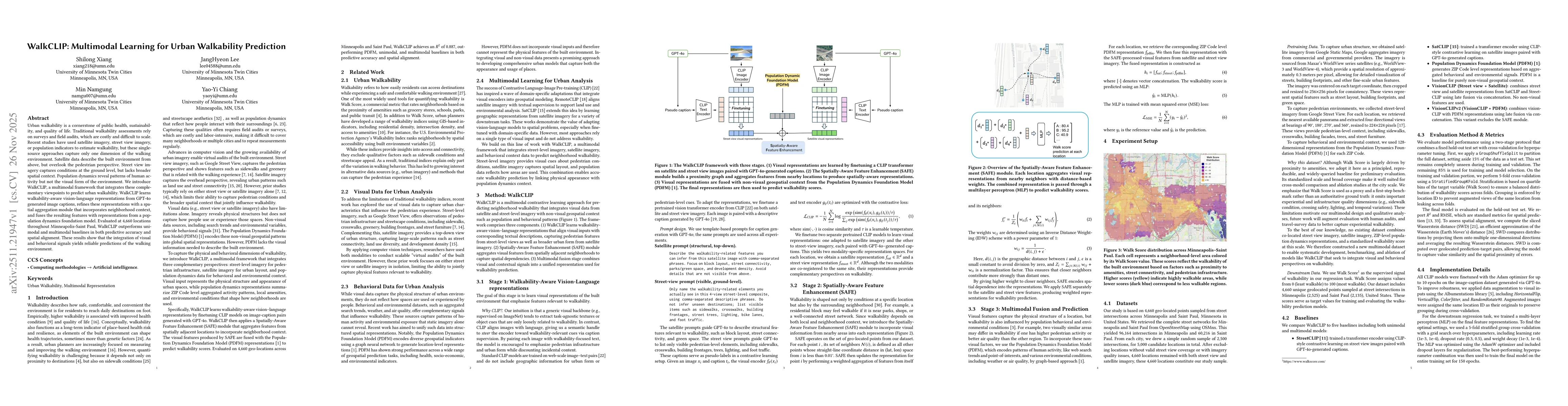
Urban walkability is a cornerstone of public health, sustainability, and quality of life. Traditional walkability assessments rely on surveys and field audits, which are costly and difficult to scale....
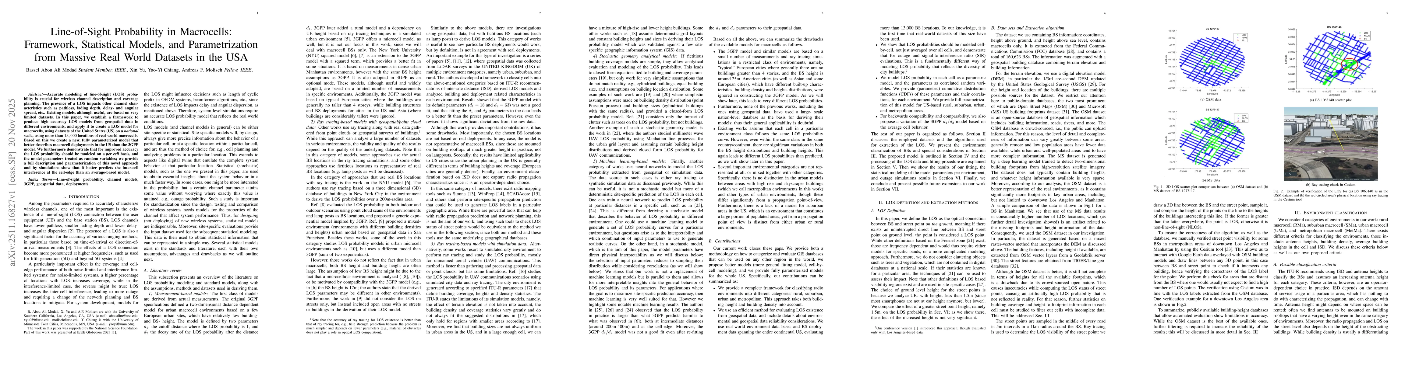
Accurate modeling of line-of-sight (LOS) probability is crucial for wireless channel description and coverage planning. The presence of a LOS impacts other channel characteristics such as pathloss, fa...
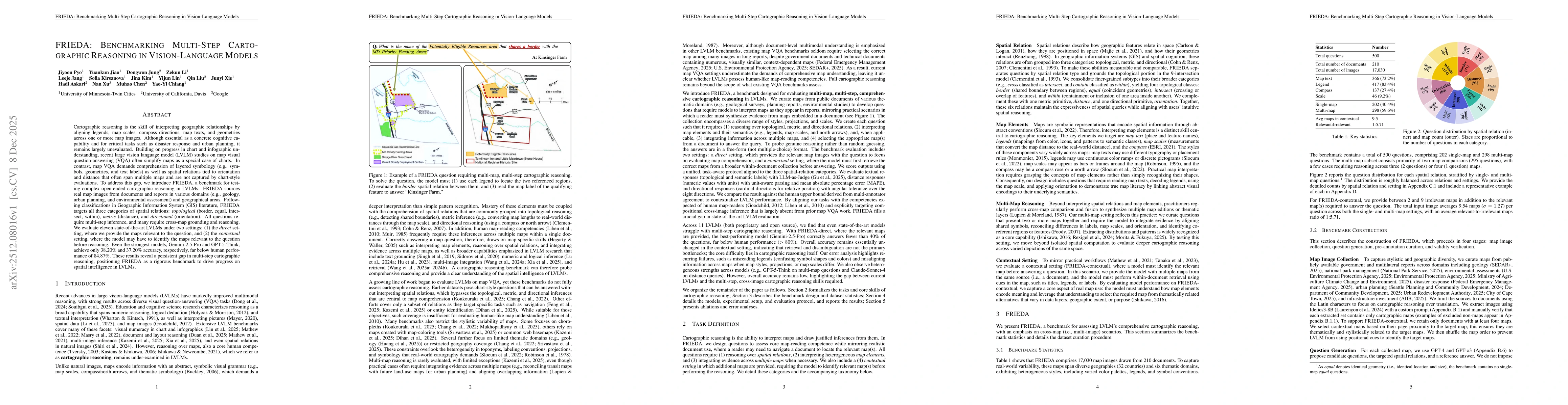
Cartographic reasoning is the skill of interpreting geographic relationships by aligning legends, map scales, compass directions, map texts, and geometries across one or more map images. Although esse...
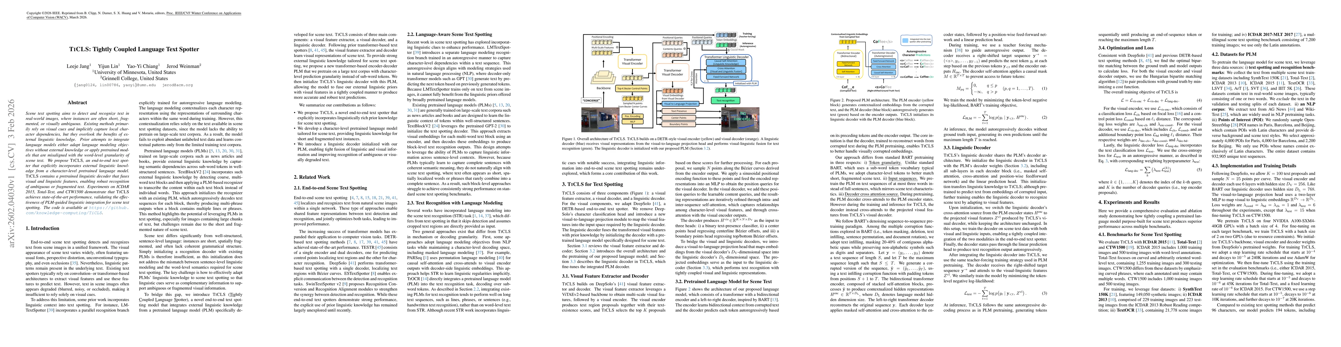
Scene text spotting aims to detect and recognize text in real-world images, where instances are often short, fragmented, or visually ambiguous. Existing methods primarily rely on visual cues and impli...
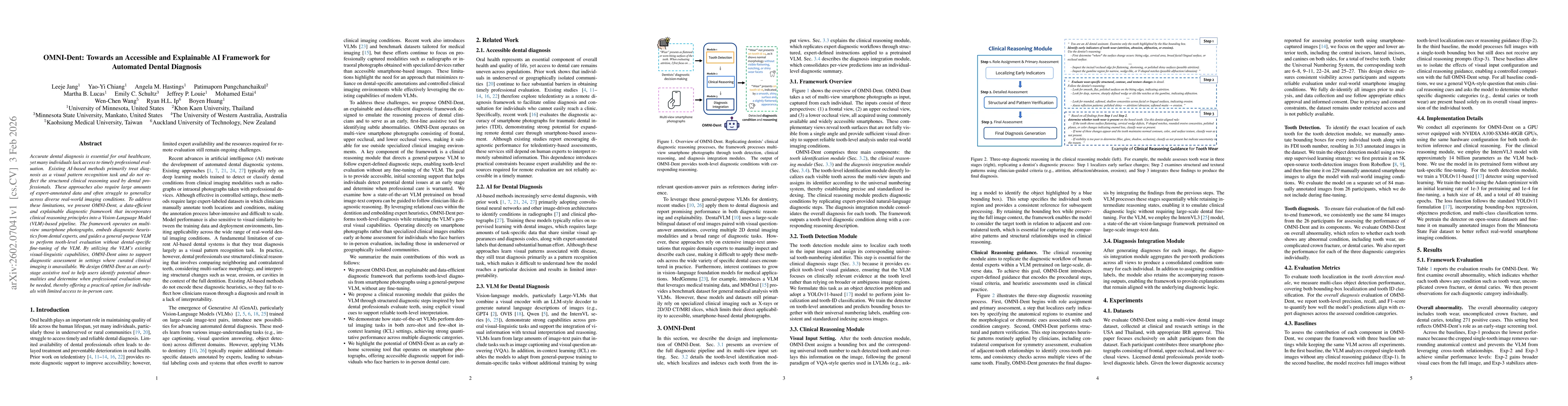
Accurate dental diagnosis is essential for oral healthcare, yet many individuals lack access to timely professional evaluation. Existing AI-based methods primarily treat diagnosis as a visual pattern ...
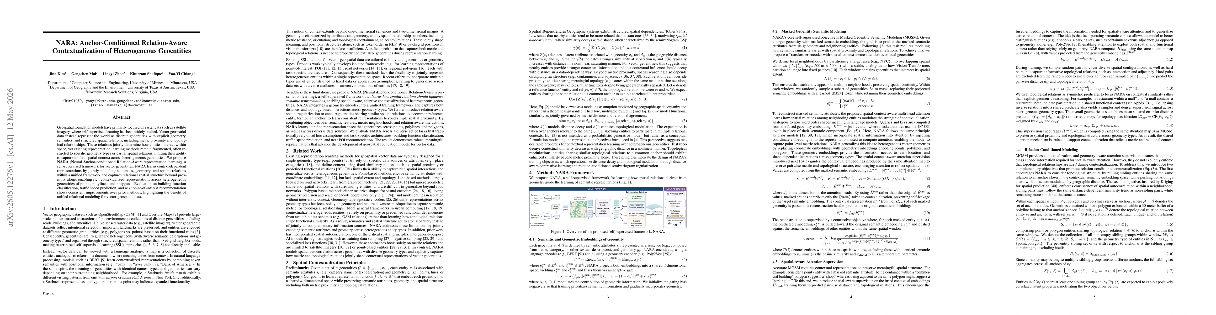
Geospatial foundation models have primarily focused on raster data such as satellite imagery, where self-supervised learning has been widely studied. Vector geospatial data instead represent the world...
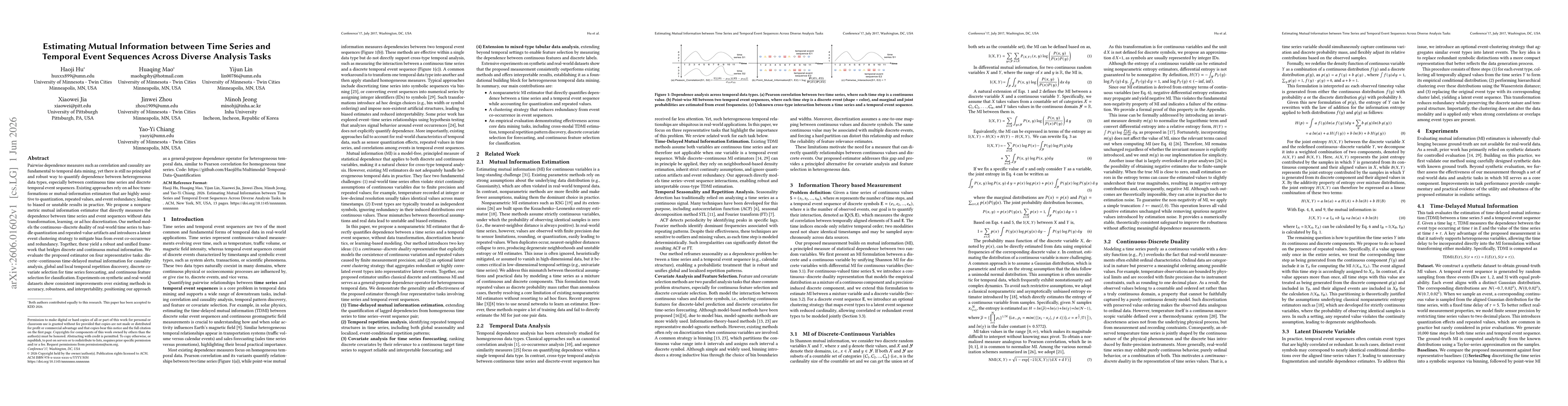
Pairwise dependence measures such as correlation and causality are fundamental to temporal data mining, yet there is still no principled and robust way to quantify dependence between heterogeneous dat...