Academic Profile
Statistics
Similar Authors
Papers on arXiv
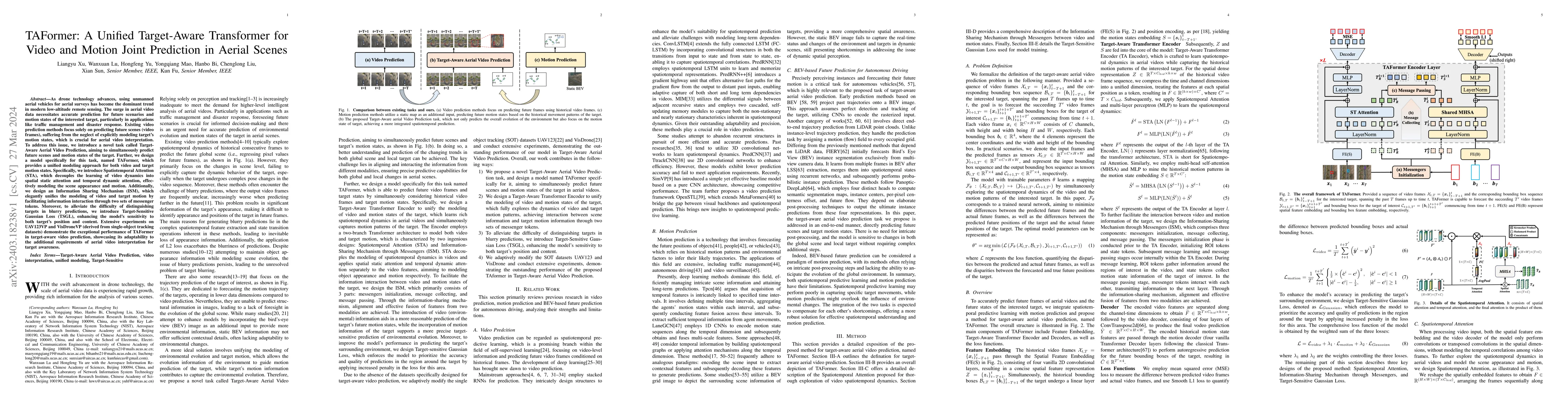
As drone technology advances, using unmanned aerial vehicles for aerial surveys has become the dominant trend in modern low-altitude remote sensing. The surge in aerial video data necessitates accur...
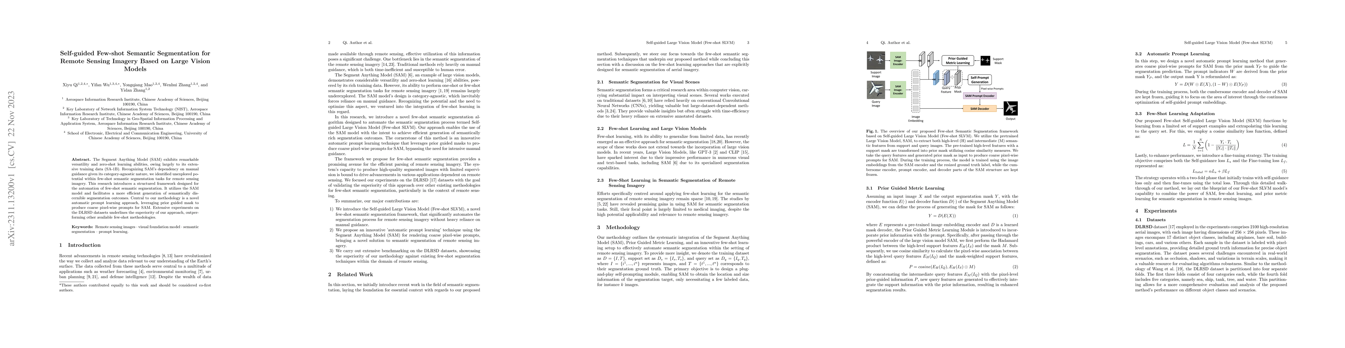
The Segment Anything Model (SAM) exhibits remarkable versatility and zero-shot learning abilities, owing largely to its extensive training data (SA-1B). Recognizing SAM's dependency on manual guidan...
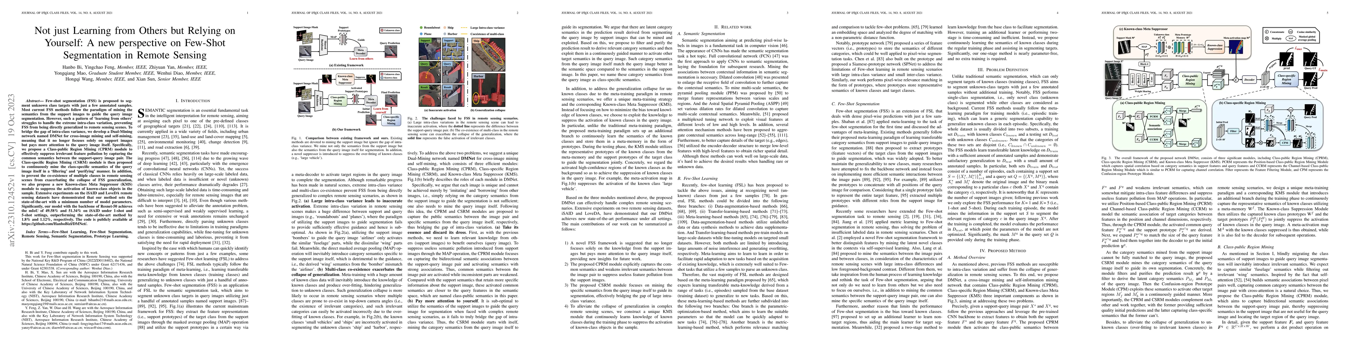
Few-shot segmentation (FSS) is proposed to segment unknown class targets with just a few annotated samples. Most current FSS methods follow the paradigm of mining the semantics from the support imag...
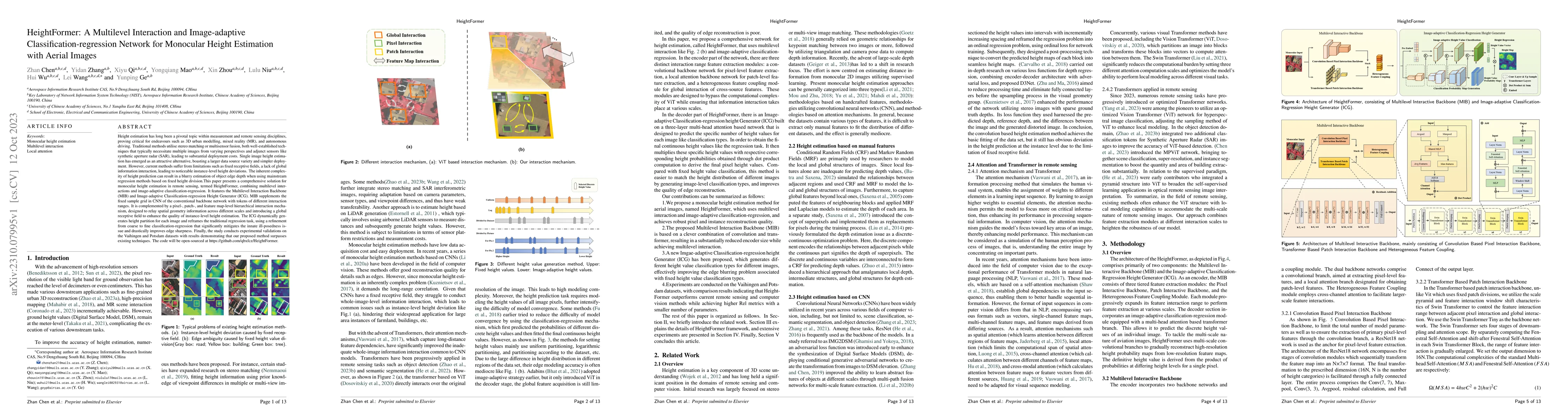
Height estimation has long been a pivotal topic within measurement and remote sensing disciplines, proving critical for endeavours such as 3D urban modelling, MR and autonomous driving. Traditional ...
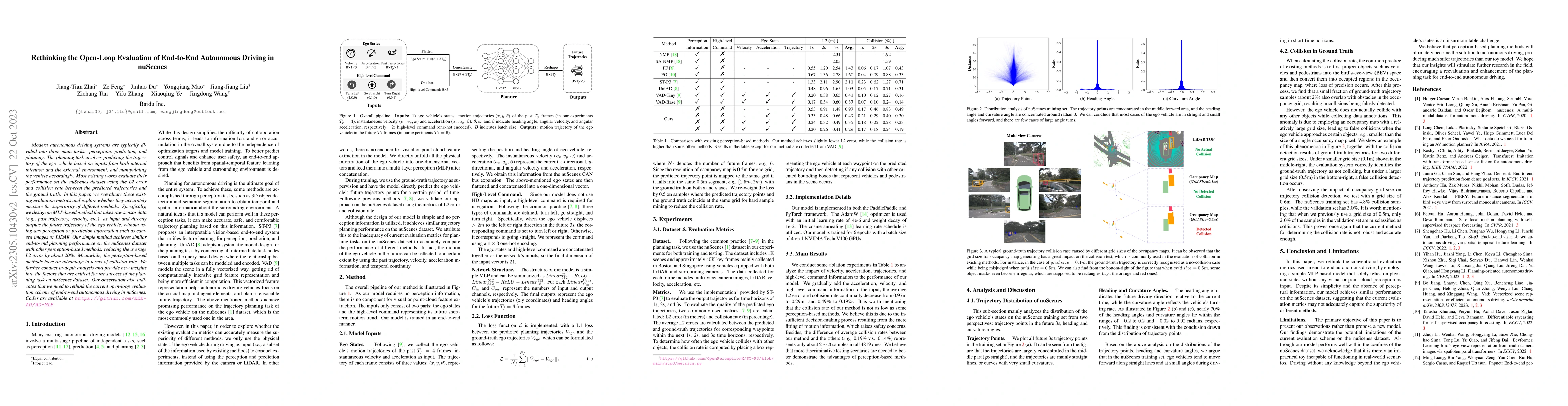
Modern autonomous driving systems are typically divided into three main tasks: perception, prediction, and planning. The planning task involves predicting the trajectory of the ego vehicle based on ...
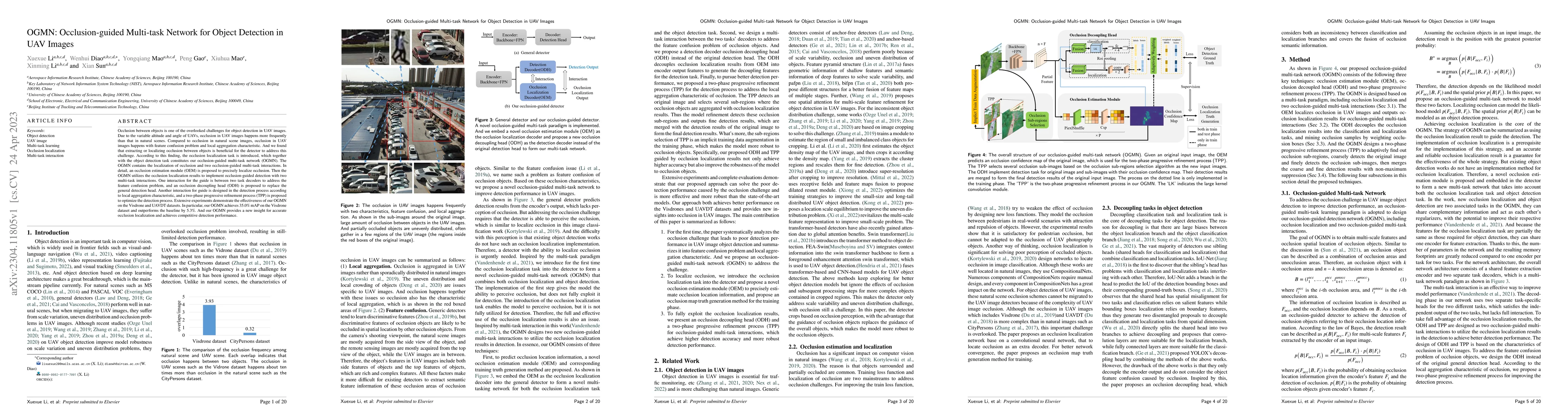
Occlusion between objects is one of the overlooked challenges for object detection in UAV images. Due to the variable altitude and angle of UAVs, occlusion in UAV images happens more frequently than...
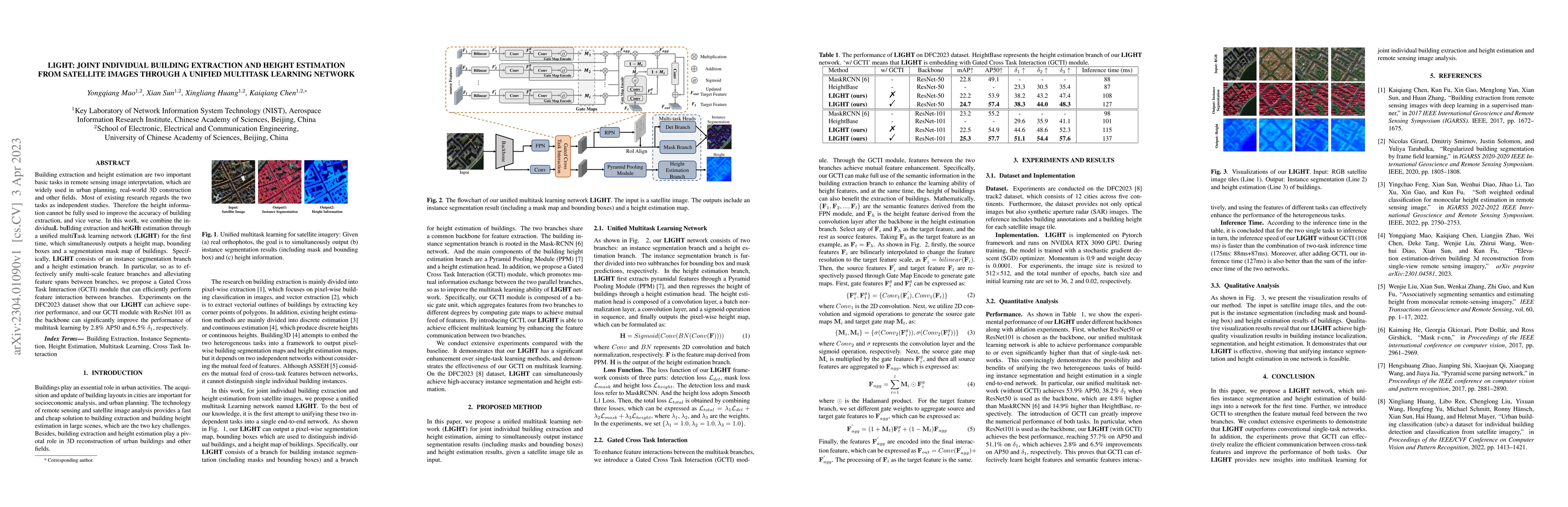
Building extraction and height estimation are two important basic tasks in remote sensing image interpretation, which are widely used in urban planning, real-world 3D construction, and other fields....
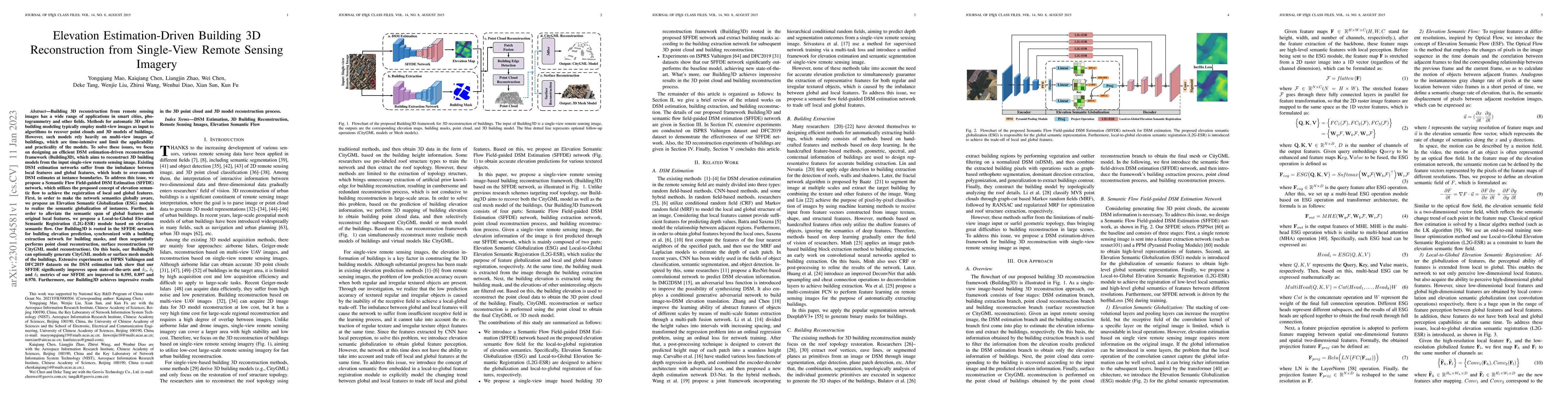
Building 3D reconstruction from remote sensing images has a wide range of applications in smart cities, photogrammetry and other fields. Methods for automatic 3D urban building modeling typically em...
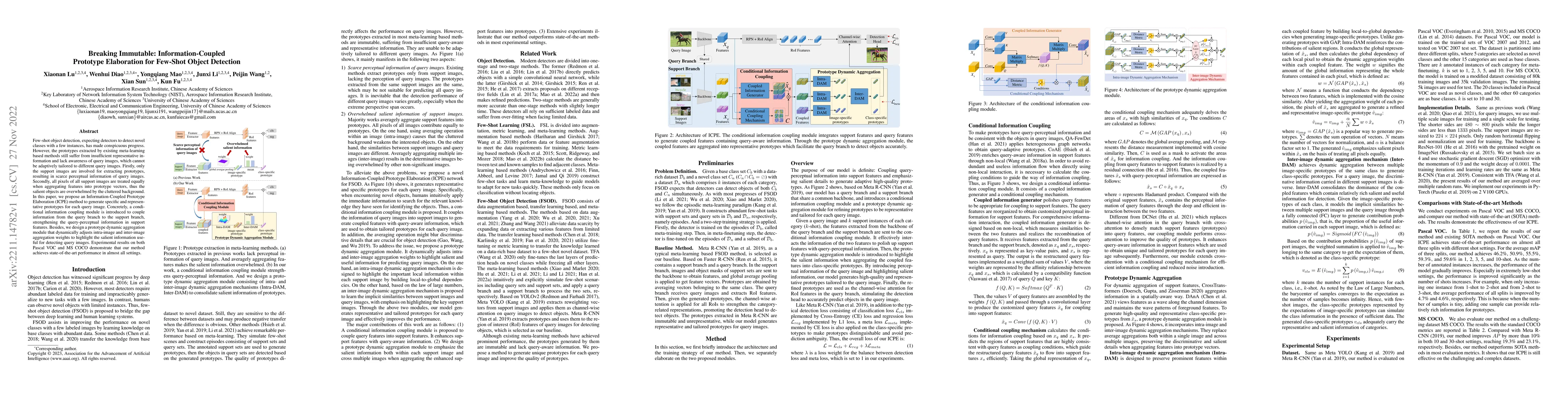
Few-shot object detection, expecting detectors to detect novel classes with a few instances, has made conspicuous progress. However, the prototypes extracted by existing meta-learning based methods ...
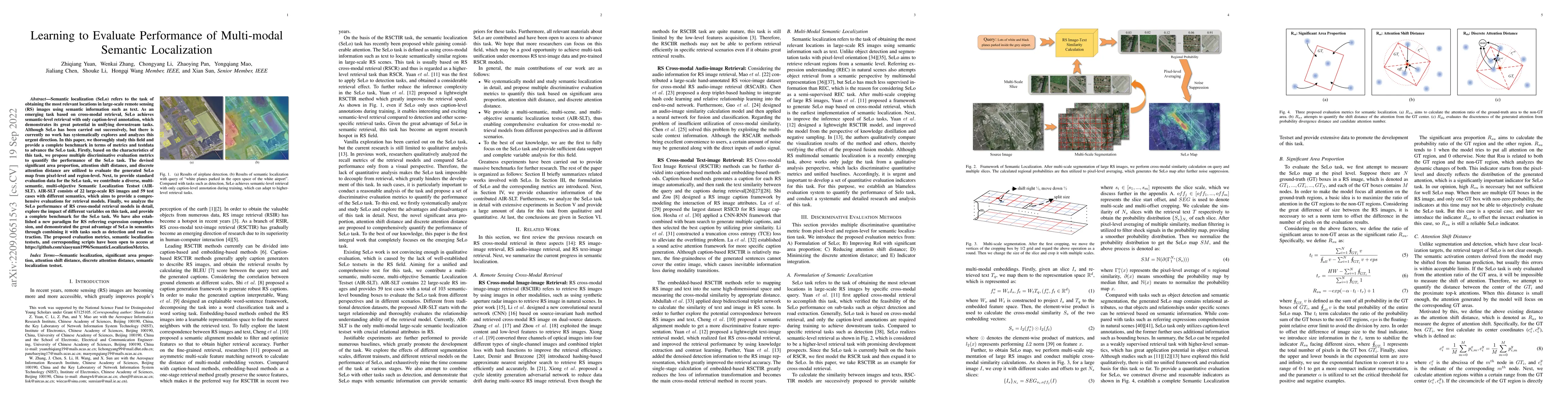
Semantic localization (SeLo) refers to the task of obtaining the most relevant locations in large-scale remote sensing (RS) images using semantic information such as text. As an emerging task based ...
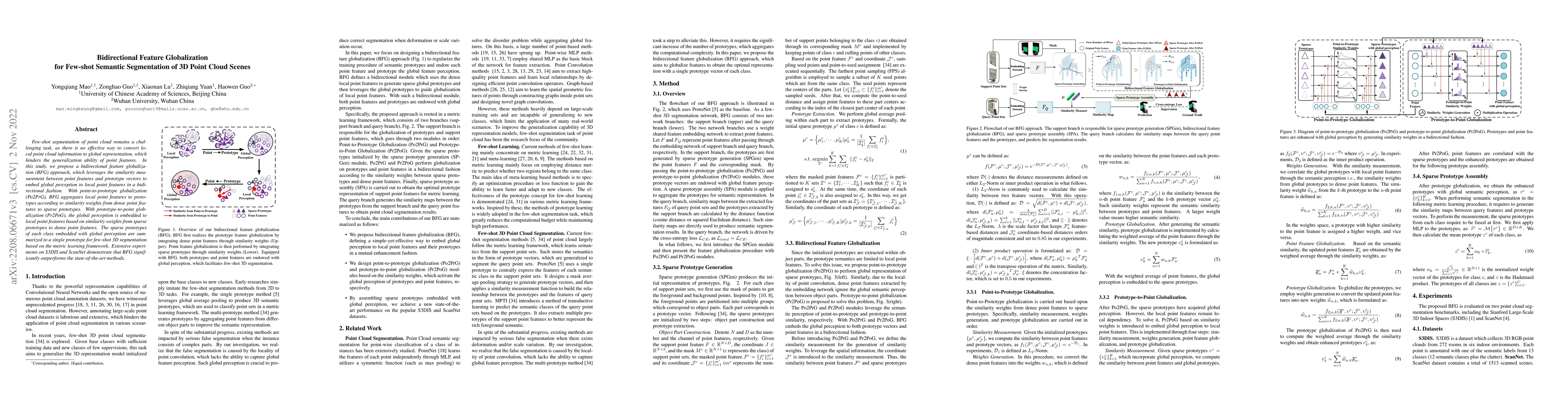
Few-shot segmentation of point cloud remains a challenging task, as there is no effective way to convert local point cloud information to global representation, which hinders the generalization abil...
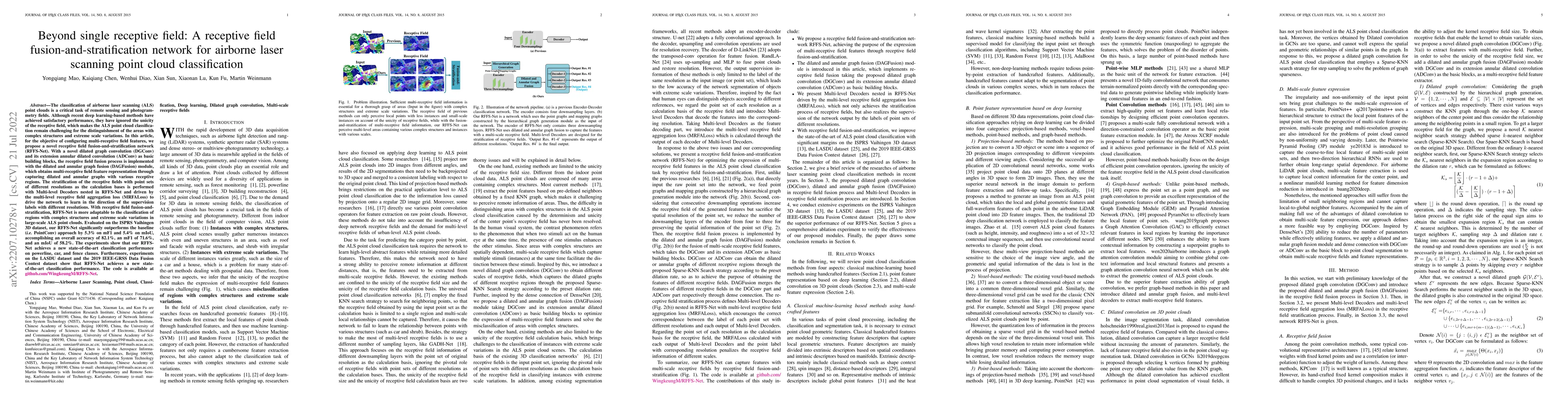
The classification of airborne laser scanning (ALS) point clouds is a critical task of remote sensing and photogrammetry fields. Although recent deep learning-based methods have achieved satisfactor...
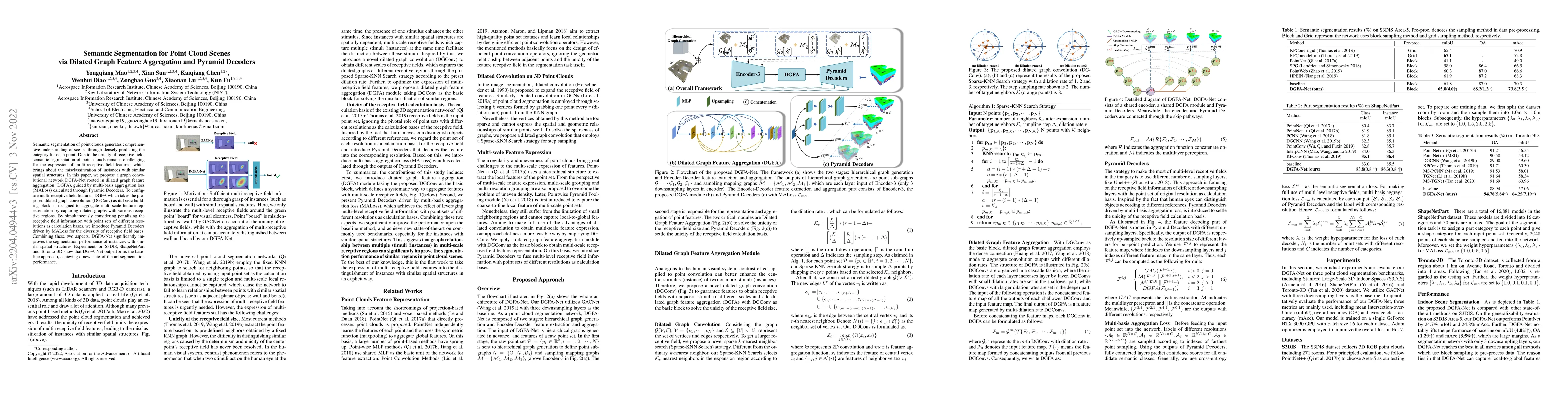
Semantic segmentation of point clouds generates comprehensive understanding of scenes through densely predicting the category for each point. Due to the unicity of receptive field, semantic segmenta...
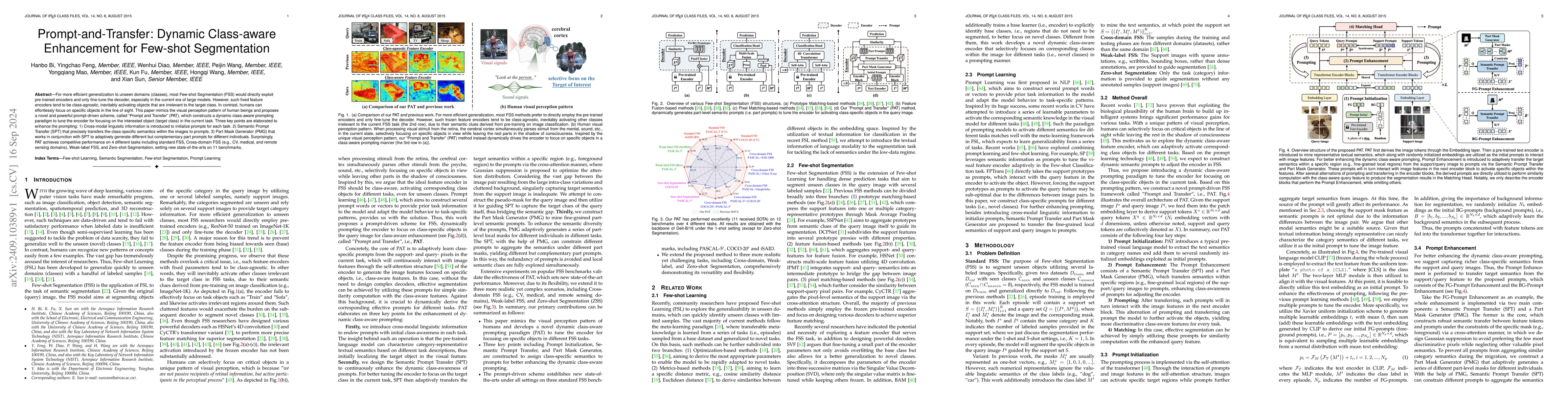
For more efficient generalization to unseen domains (classes), most Few-shot Segmentation (FSS) would directly exploit pre-trained encoders and only fine-tune the decoder, especially in the current er...
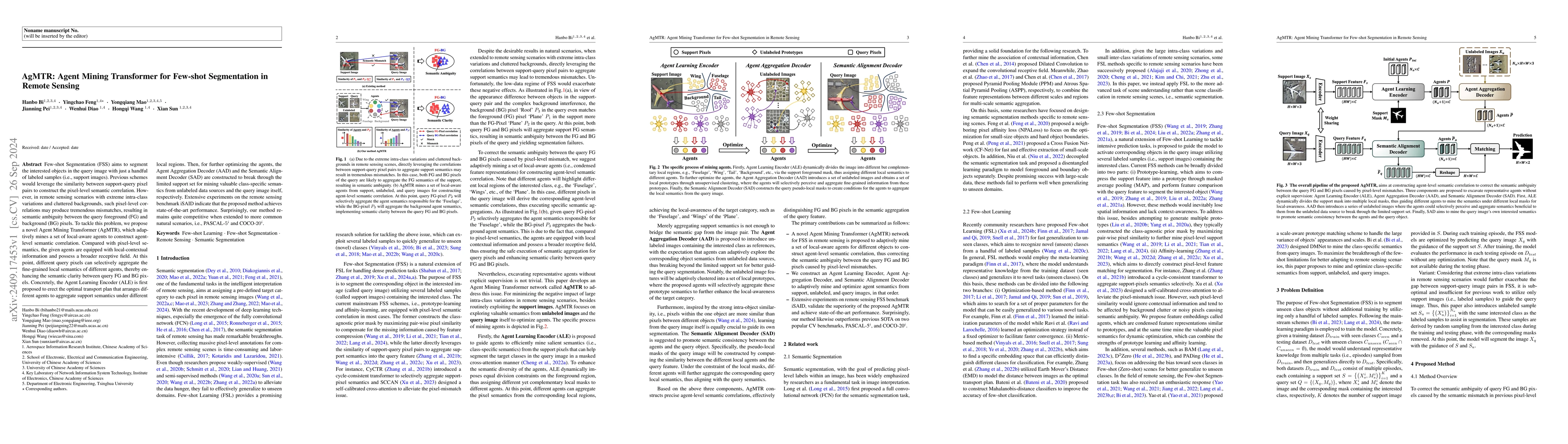
Few-shot Segmentation (FSS) aims to segment the interested objects in the query image with just a handful of labeled samples (i.e., support images). Previous schemes would leverage the similarity betw...
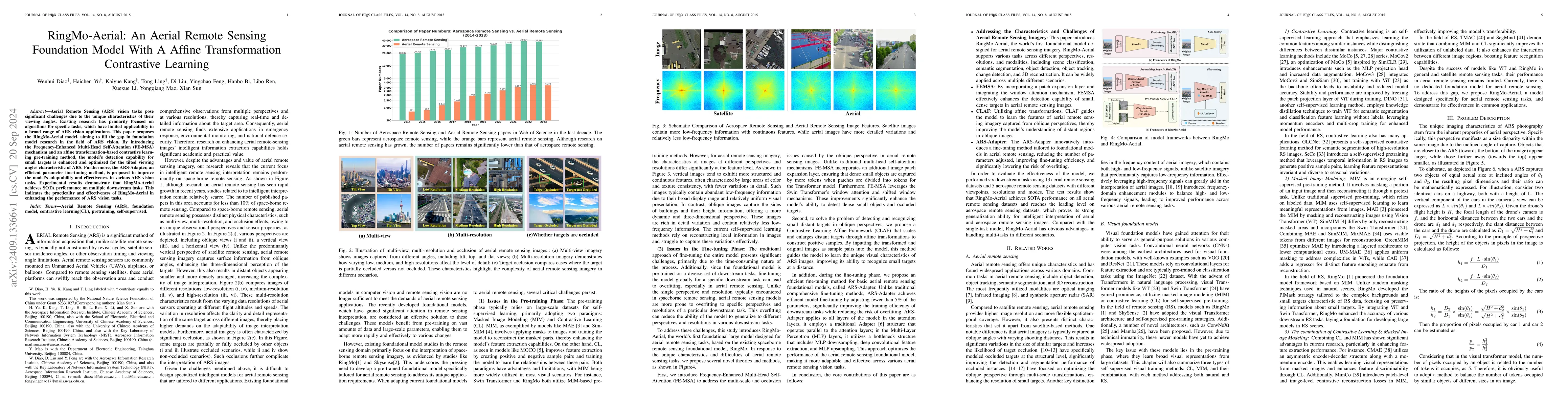
Aerial Remote Sensing (ARS) vision tasks pose significant challenges due to the unique characteristics of their viewing angles. Existing research has primarily focused on algorithms for specific tasks...
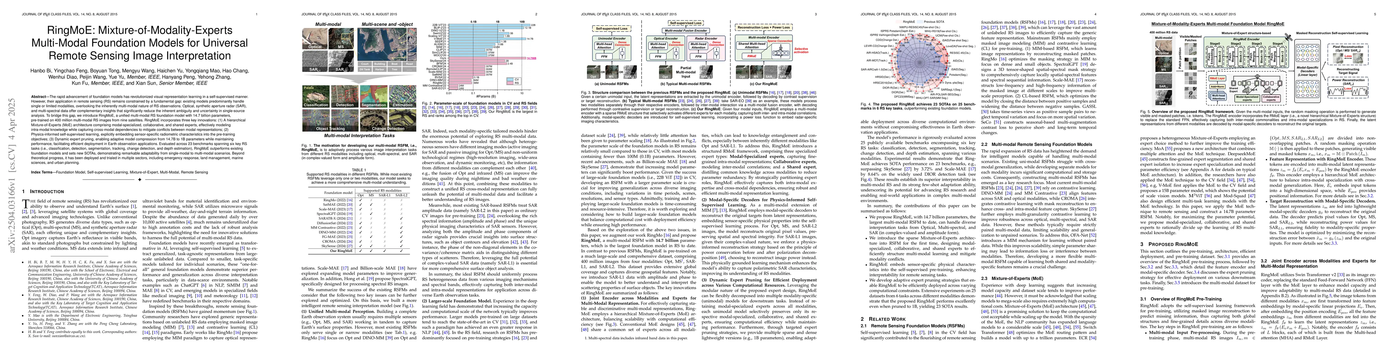
The rapid advancement of foundation models has revolutionized visual representation learning in a self-supervised manner. However, their application in remote sensing (RS) remains constrained by a fun...
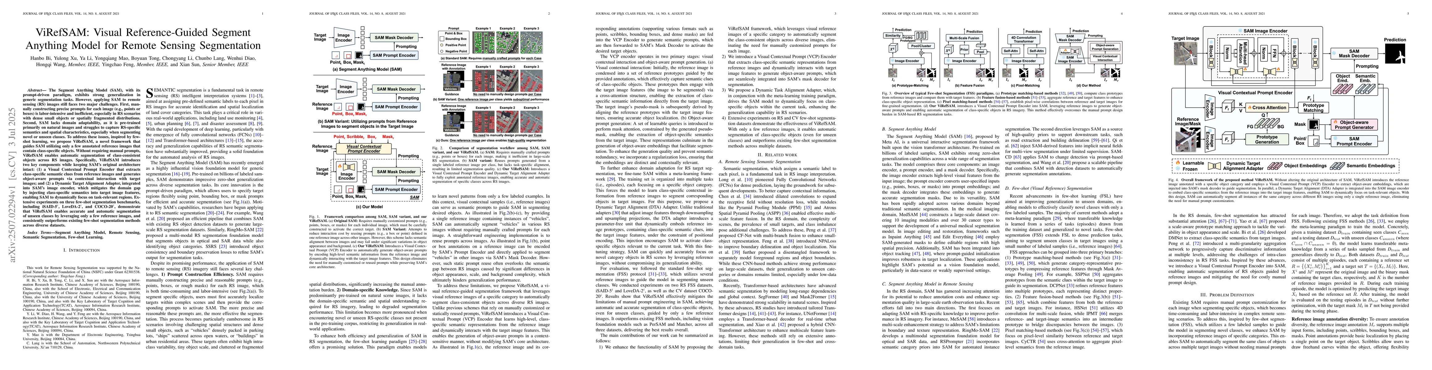
The Segment Anything Model (SAM), with its prompt-driven paradigm, exhibits strong generalization in generic segmentation tasks. However, applying SAM to remote sensing (RS) images still faces two maj...