Academic Profile
Statistics
Similar Authors
Papers on arXiv
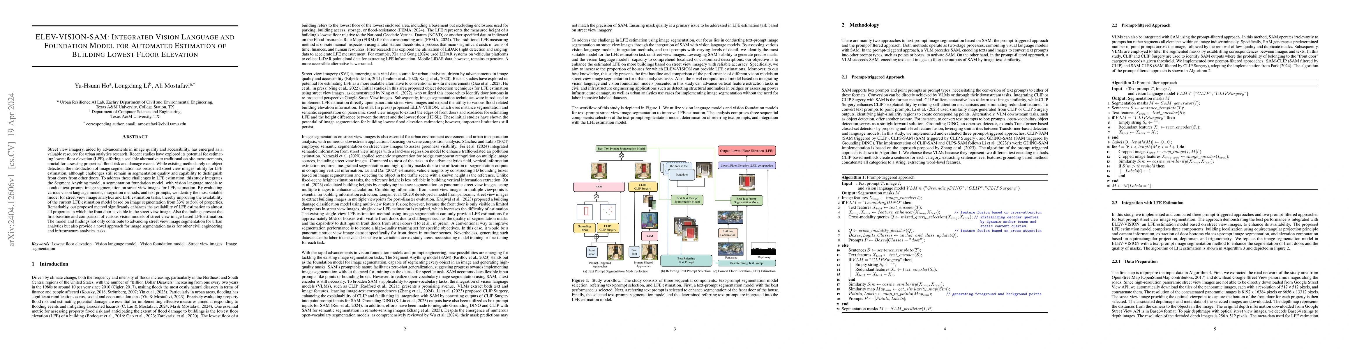
Street view imagery, aided by advancements in image quality and accessibility, has emerged as a valuable resource for urban analytics research. Recent studies have explored its potential for estimat...

Understanding the key factors shaping environmental hazard exposures and their associated environmental injustice issues is vital for formulating equitable policy measures. Traditional perspectives ...
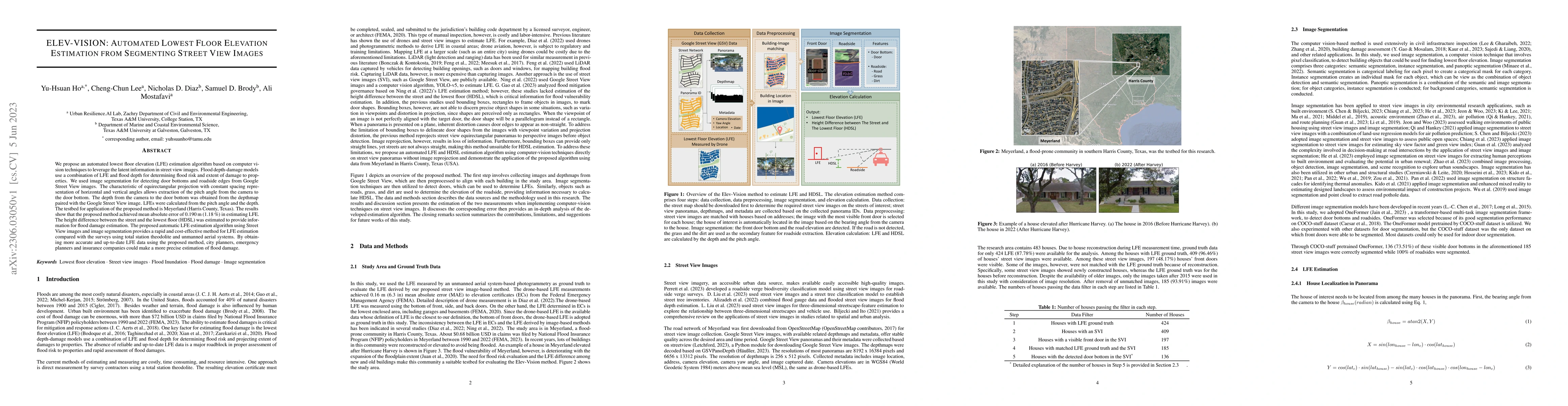
We propose an automated lowest floor elevation (LFE) estimation algorithm based on computer vision techniques to leverage the latent information in street view images. Flood depth-damage models use ...
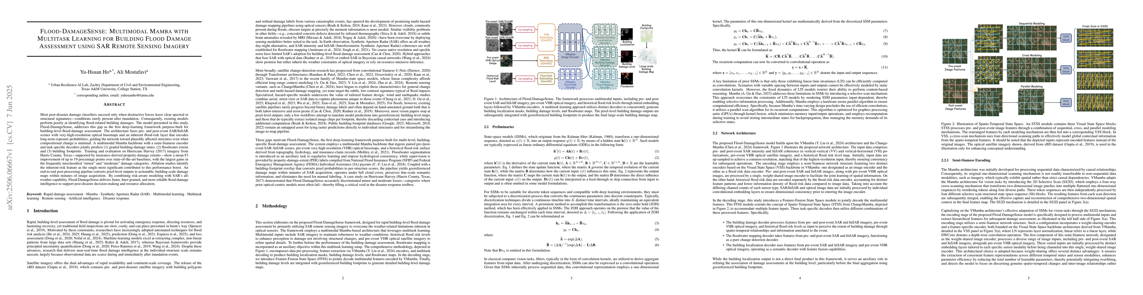
Most post-disaster damage classifiers succeed only when destructive forces leave clear spectral or structural signatures -- conditions rarely present after inundation. Consequently, existing models pe...
Building-level occupancy after disasters is vital for triage, inspections, utility re-energization, and equitable resource allocation. Overhead imagery provides rapid coverage but often misses facade ...
This paper argues that AI-enabled analysis of street-view imagery, complemented by performance-gated machine-learning imputation, provides a viable pathway for generating building-specific elevation d...
Decision-relevant building damage assessment is critical for prioritizing resources and recovery after a disaster, yet most automated methods either flatten damage into a single severity scale (no dam...
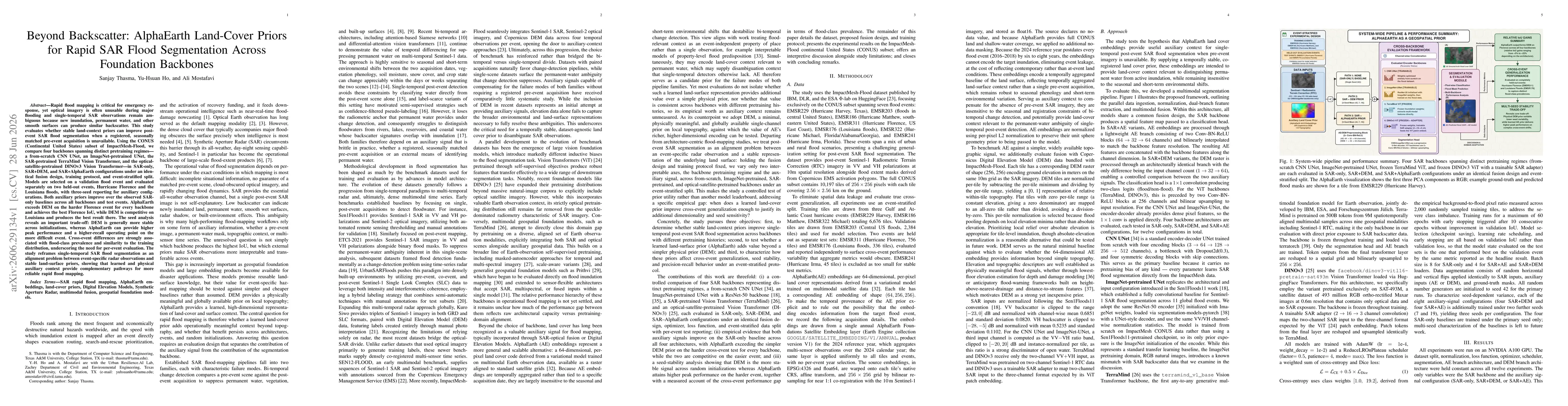
Rapid flood mapping is critical for emergency response, yet optical imagery is often unusable during major flooding and single-temporal SAR is ambiguous, since new inundation, permanent water, and oth...