Academic Profile
Statistics
Similar Authors
Papers on arXiv
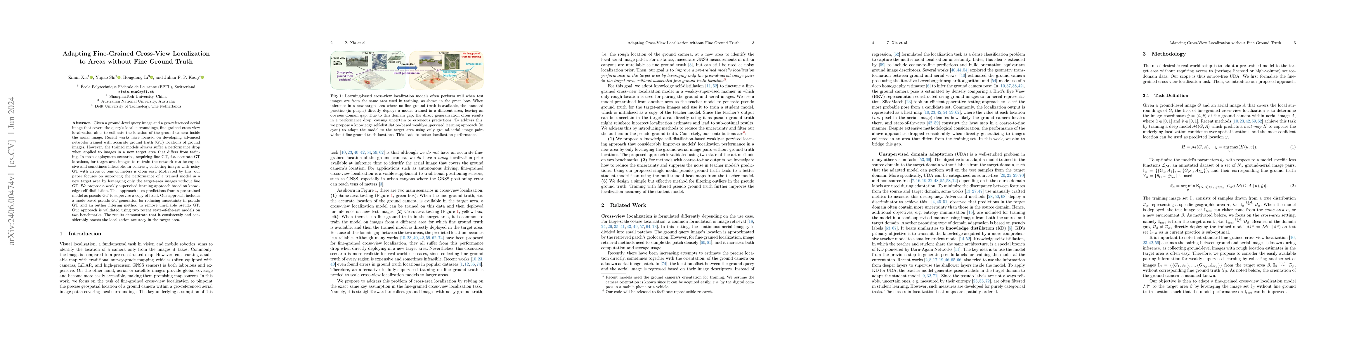
Given a ground-level query image and a geo-referenced aerial image that covers the query's local surroundings, fine-grained cross-view localization aims to estimate the location of the ground camera...
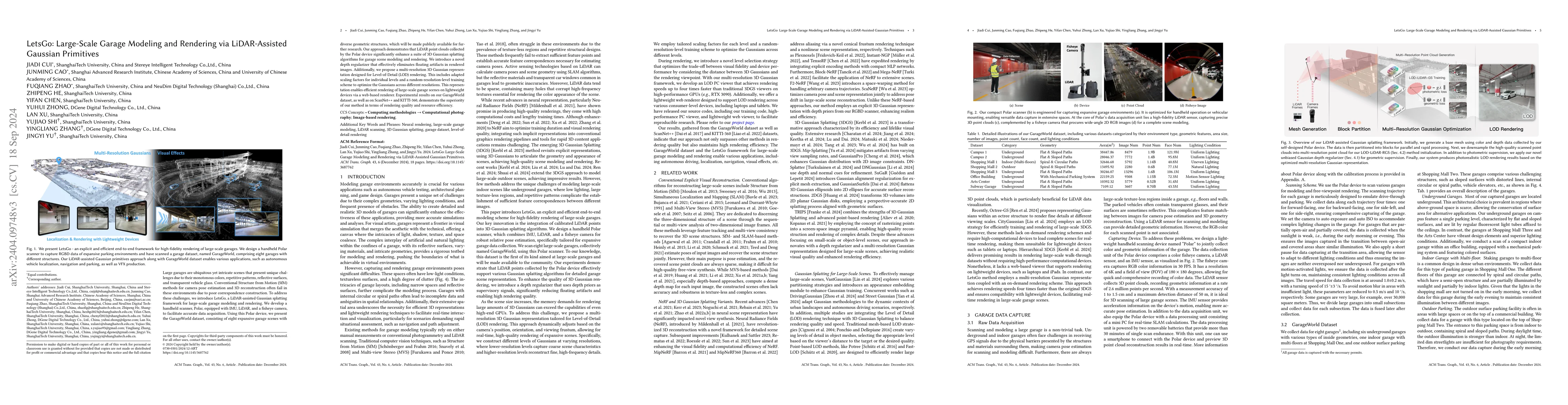
Large garages are ubiquitous yet intricate scenes that present unique challenges due to their monotonous colors, repetitive patterns, reflective surfaces, and transparent vehicle glass. Conventional...
Vision-based localization for autonomous driving has been of great interest among researchers. When a pre-built 3D map is not available, the techniques of visual simultaneous localization and mappin...
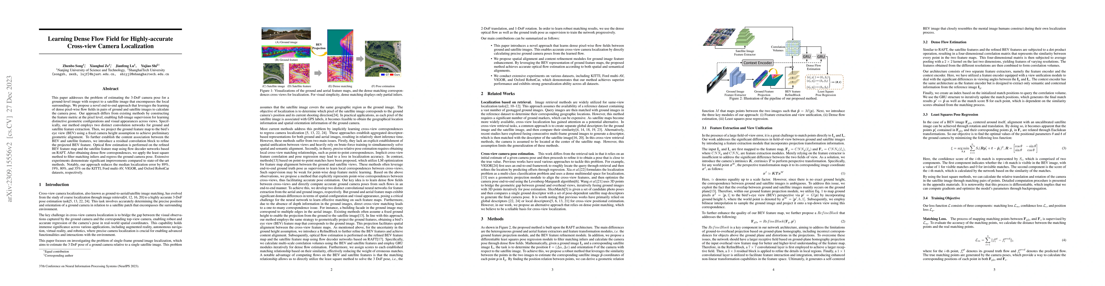
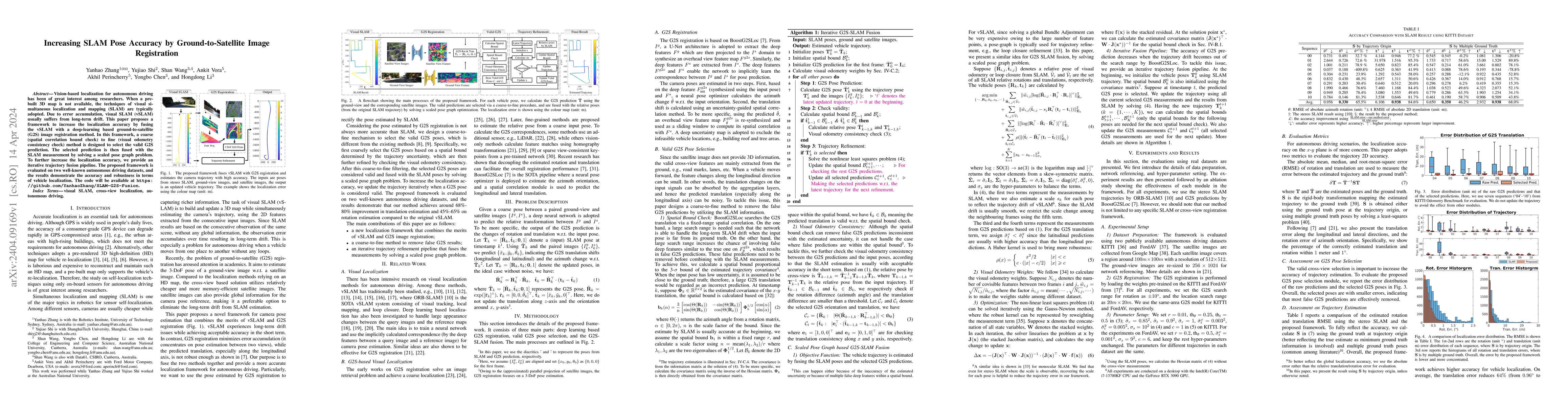
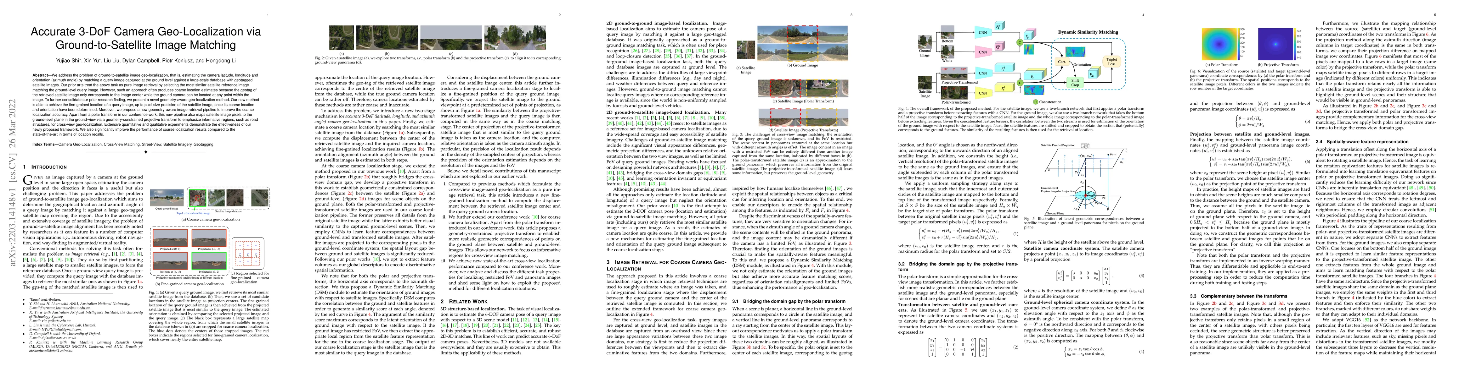
This paper addresses the problem of estimating the 3-DoF camera pose for a ground-level image with respect to a satellite image that encompasses the local surroundings. We propose a novel end-to-end...
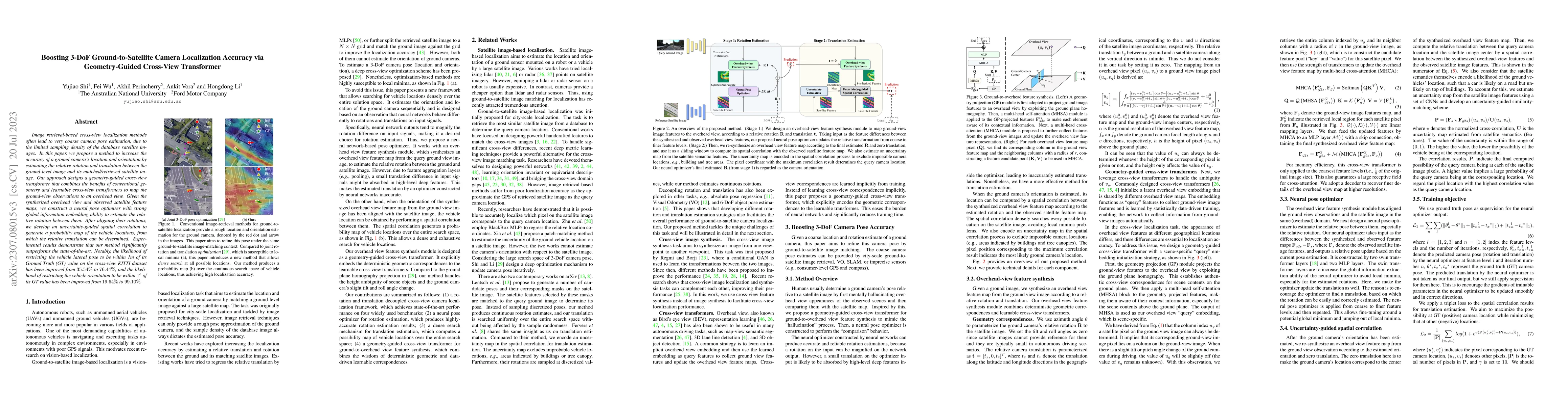
Image retrieval-based cross-view localization methods often lead to very coarse camera pose estimation, due to the limited sampling density of the database satellite images. In this paper, we propos...
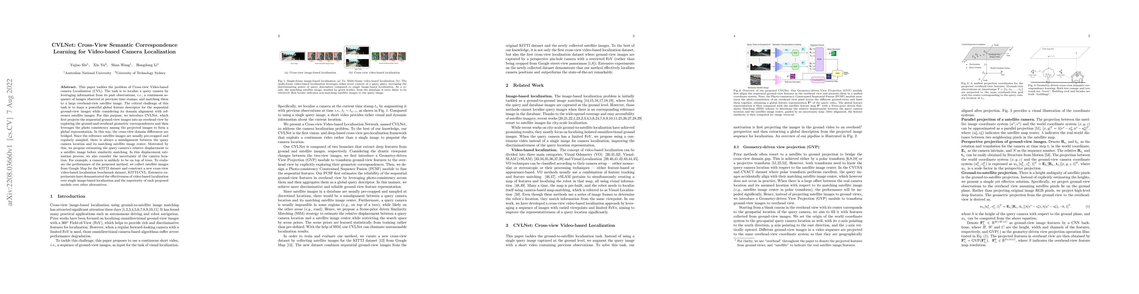
This paper tackles the problem of Cross-view Video-based camera Localization (CVL). The task is to localize a query camera by leveraging information from its past observations, i.e., a continuous se...
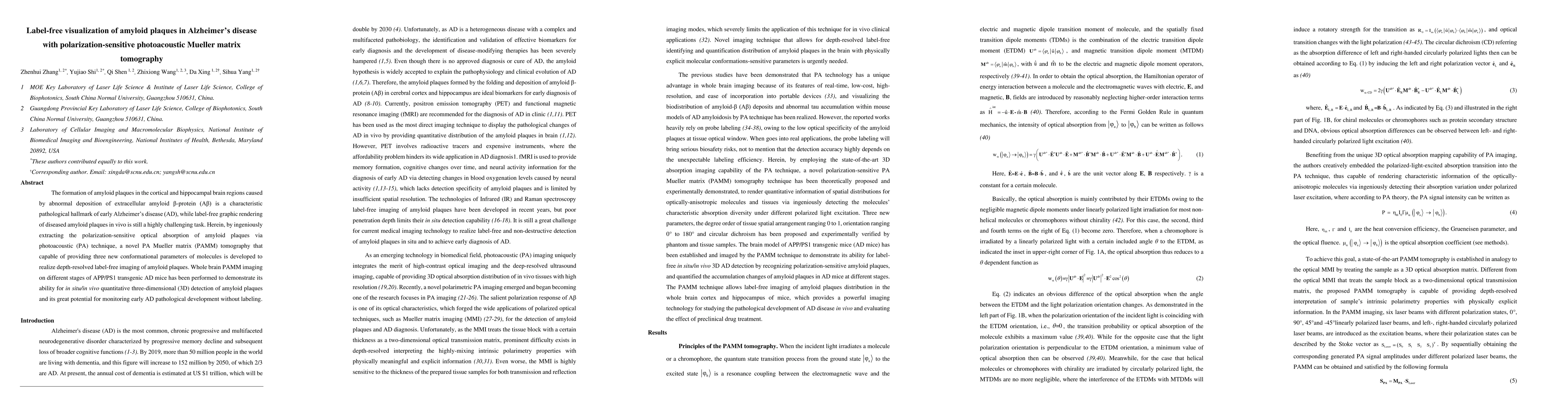
The formation of amyloid plaques in the cortical and hippocampal brain regions caused by abnormal deposition of extracellular amyloid \b{eta}-protein (A\b{eta}) is a characteristic pathological hall...
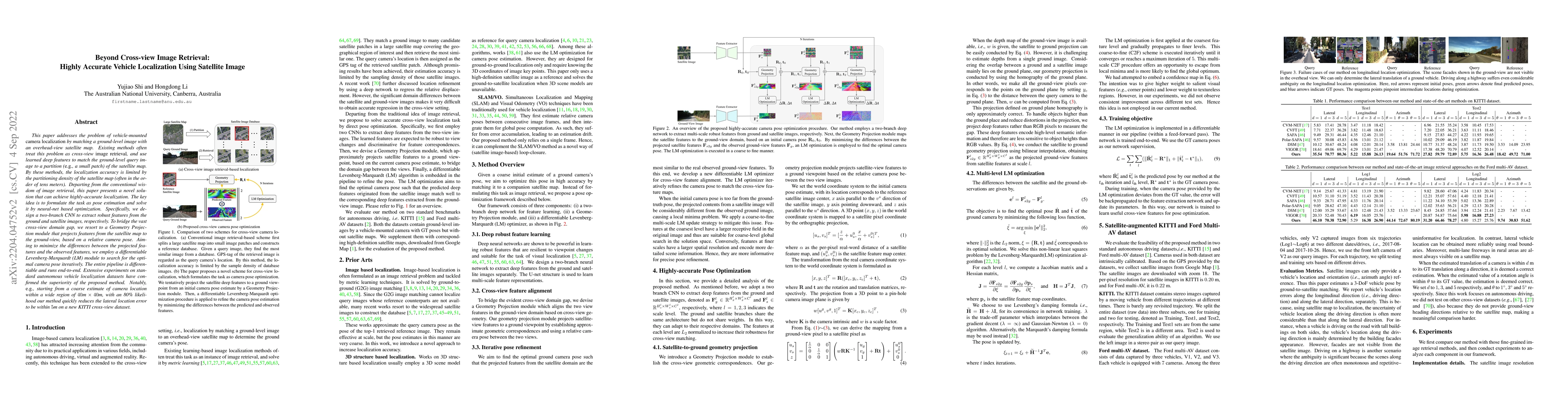
This paper addresses the problem of vehicle-mounted camera localization by matching a ground-level image with an overhead-view satellite map. Existing methods often treat this problem as cross-view ...
We address the problem of ground-to-satellite image geo-localization, that is, estimating the camera latitude, longitude and orientation (azimuth angle) by matching a query image captured at the gro...
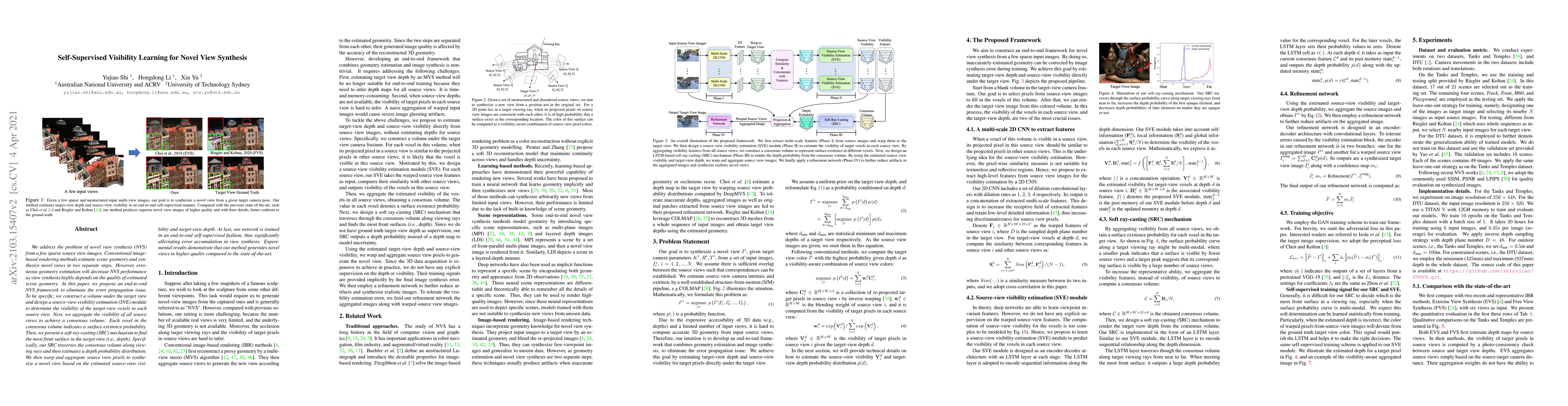
We address the problem of novel view synthesis (NVS) from a few sparse source view images. Conventional image-based rendering methods estimate scene geometry and synthesize novel views in two separa...
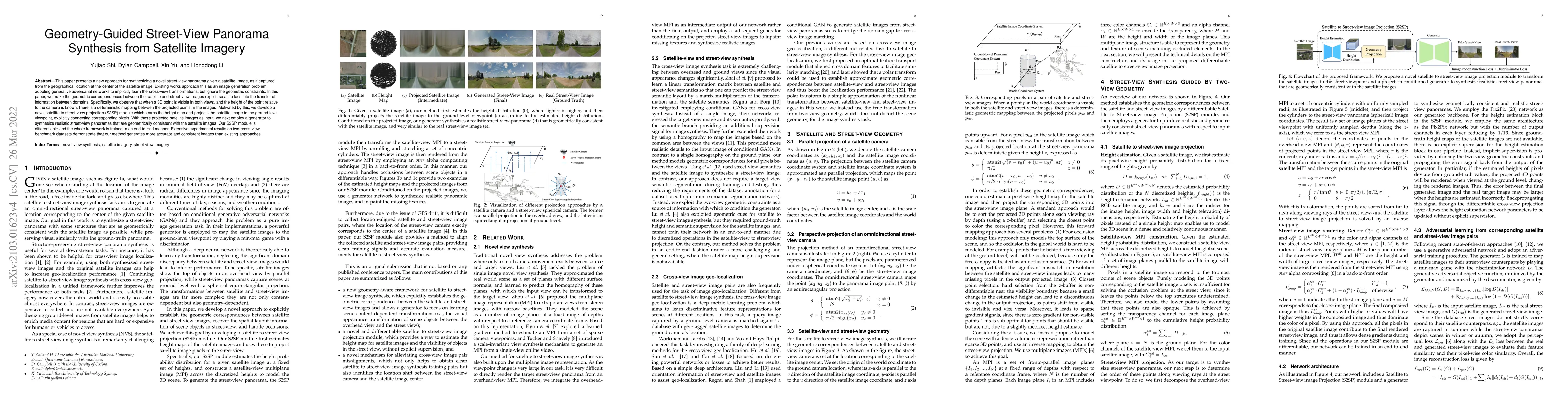
This paper presents a new approach for synthesizing a novel street-view panorama given an overhead satellite image. Taking a small satellite image patch as input, our method generates a Google's omn...
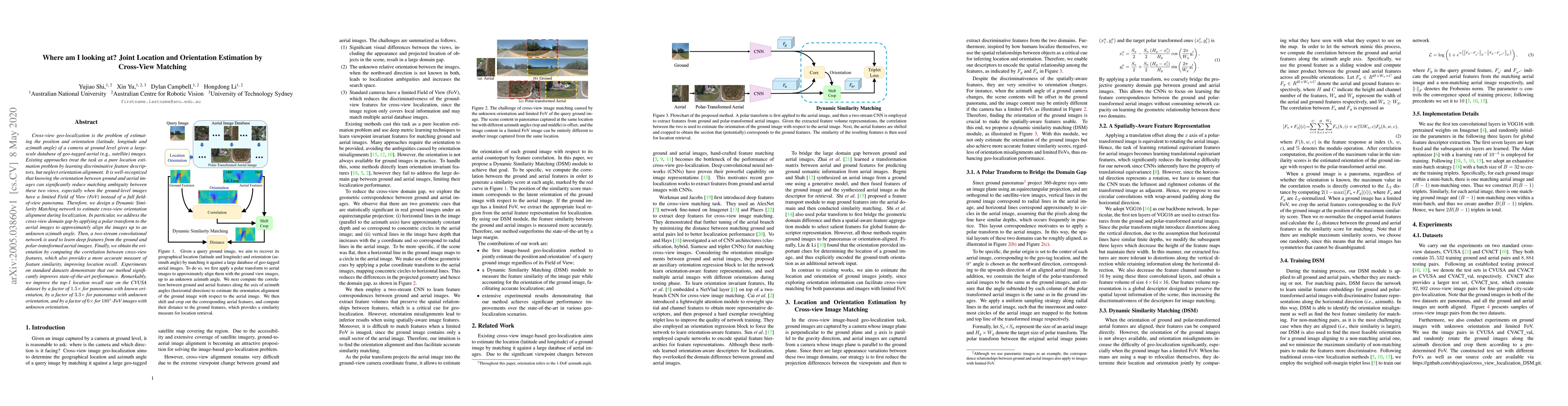
Cross-view geo-localization is the problem of estimating the position and orientation (latitude, longitude and azimuth angle) of a camera at ground level given a large-scale database of geo-tagged a...
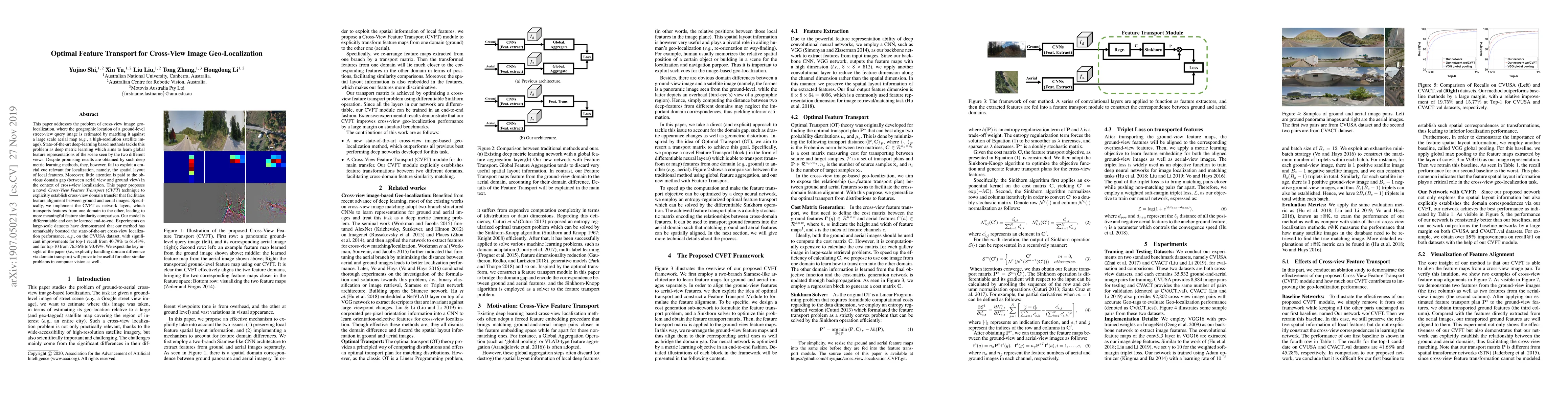
This paper addresses the problem of cross-view image geo-localization, where the geographic location of a ground-level street-view query image is estimated by matching it against a large scale aeria...
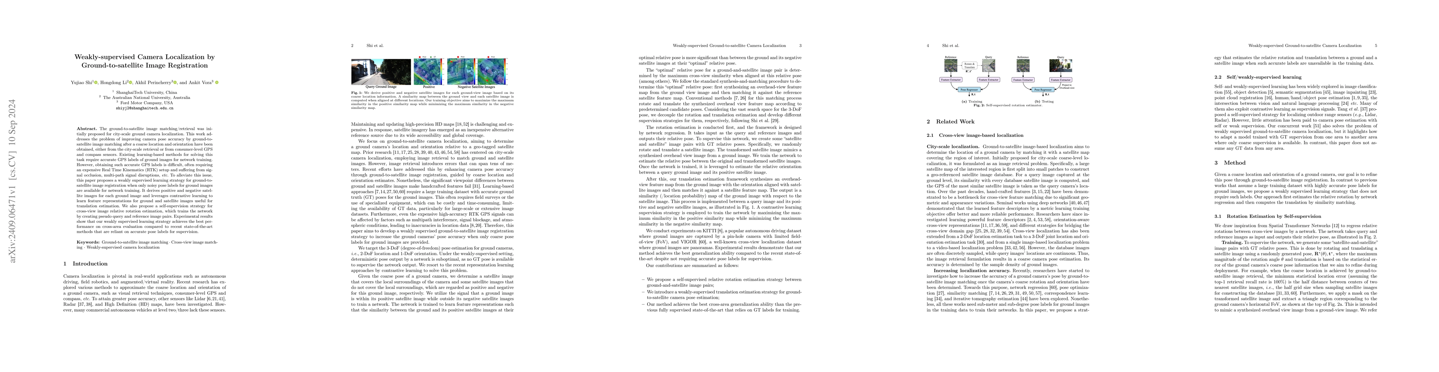
The ground-to-satellite image matching/retrieval was initially proposed for city-scale ground camera localization. This work addresses the problem of improving camera pose accuracy by ground-to-satell...
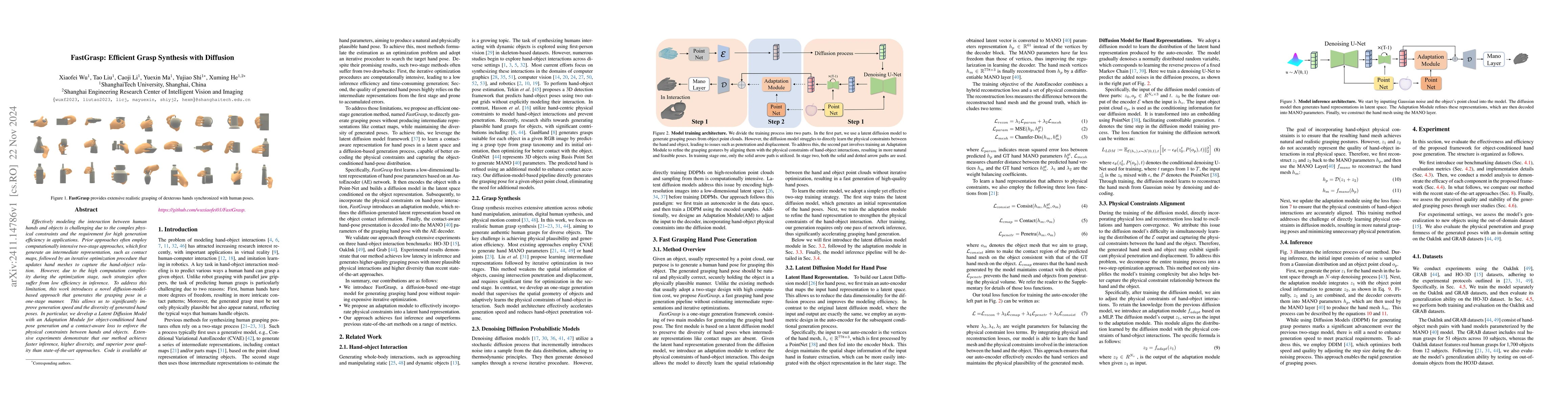
Effectively modeling the interaction between human hands and objects is challenging due to the complex physical constraints and the requirement for high generation efficiency in applications. Prior ap...
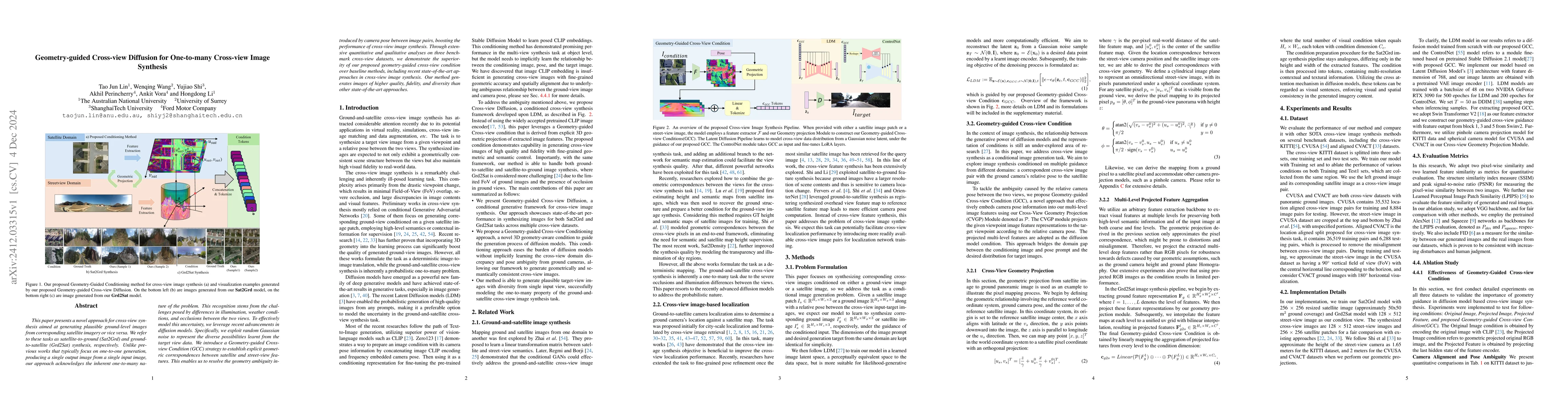
This paper presents a novel approach for cross-view synthesis aimed at generating plausible ground-level images from corresponding satellite imagery or vice versa. We refer to these tasks as satellite...
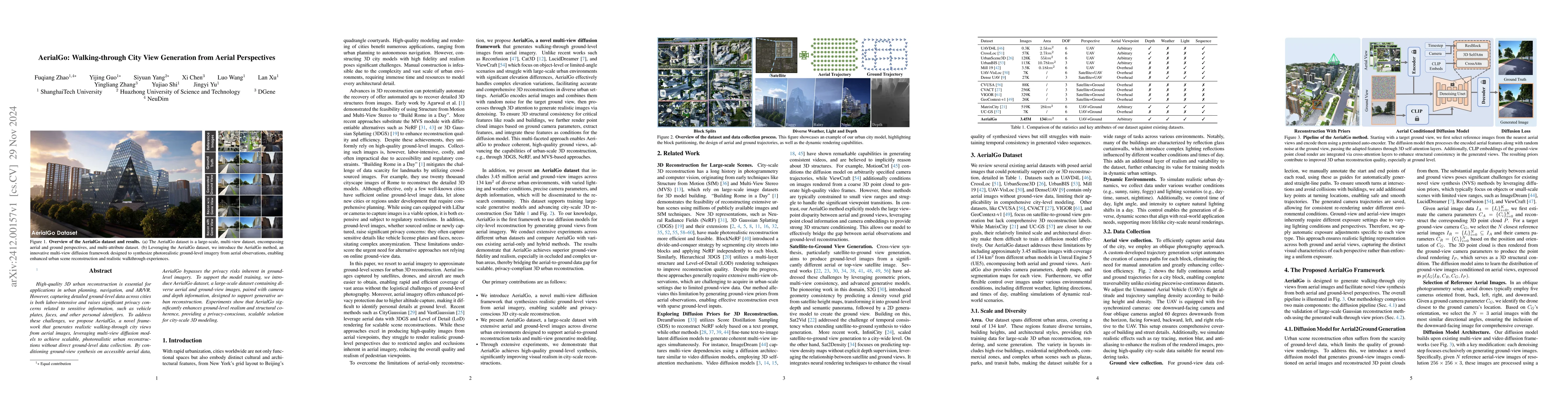
High-quality 3D urban reconstruction is essential for applications in urban planning, navigation, and AR/VR. However, capturing detailed ground-level data across cities is both labor-intensive and rai...
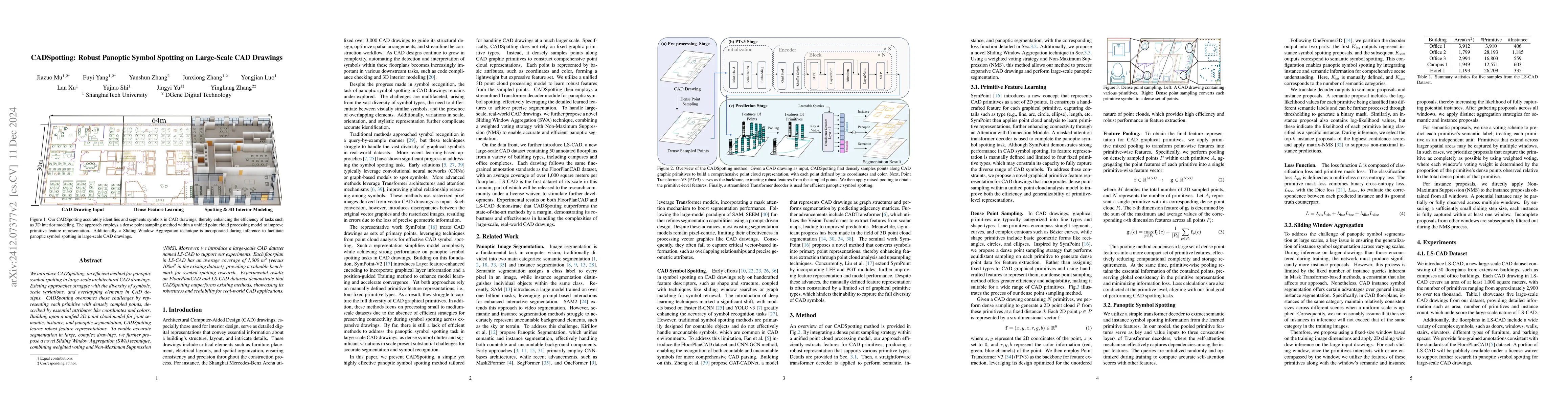
We introduce CADSpotting, an efficient method for panoptic symbol spotting in large-scale architectural CAD drawings. Existing approaches struggle with the diversity of symbols, scale variations, and ...
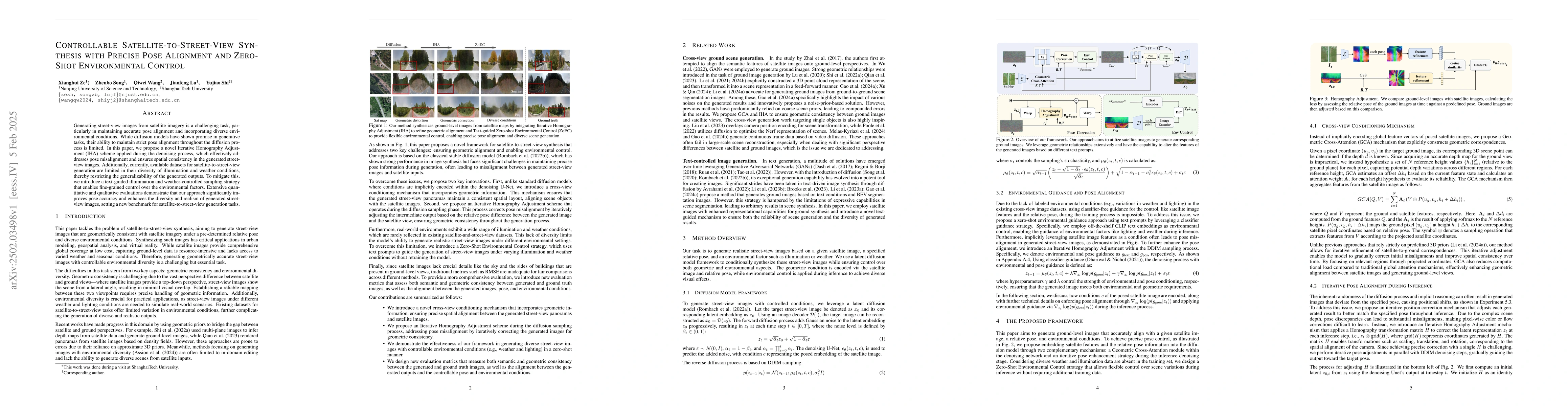
Generating street-view images from satellite imagery is a challenging task, particularly in maintaining accurate pose alignment and incorporating diverse environmental conditions. While diffusion mode...
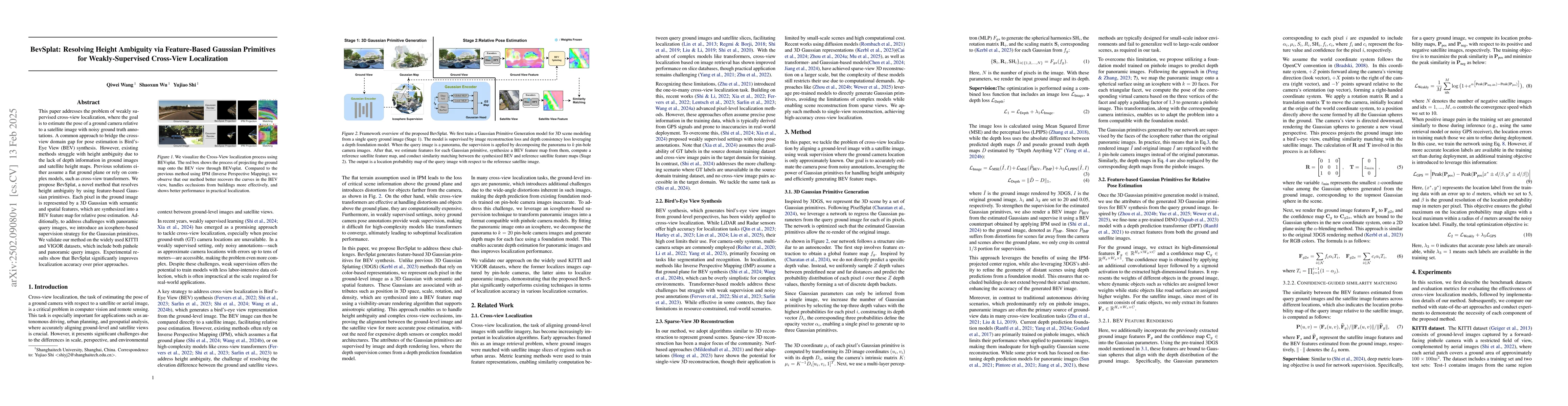
This paper addresses the problem of weakly supervised cross-view localization, where the goal is to estimate the pose of a ground camera relative to a satellite image with noisy ground truth annotatio...
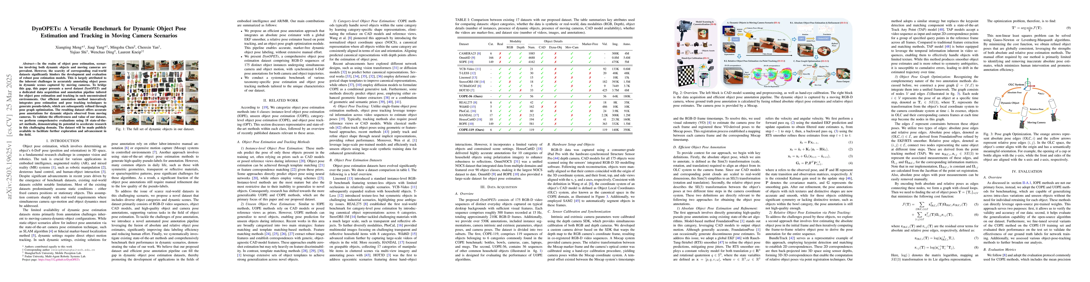
In the realm of object pose estimation, scenarios involving both dynamic objects and moving cameras are prevalent. However, the scarcity of corresponding real-world datasets significantly hinders the ...
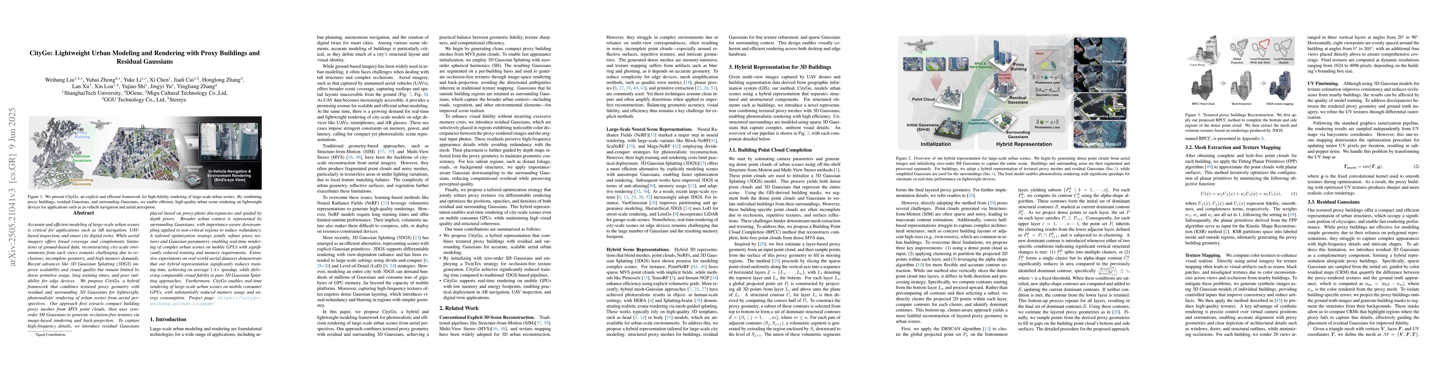
Accurate and efficient modeling of large-scale urban scenes is critical for applications such as AR navigation, UAV based inspection, and smart city digital twins. While aerial imagery offers broad co...
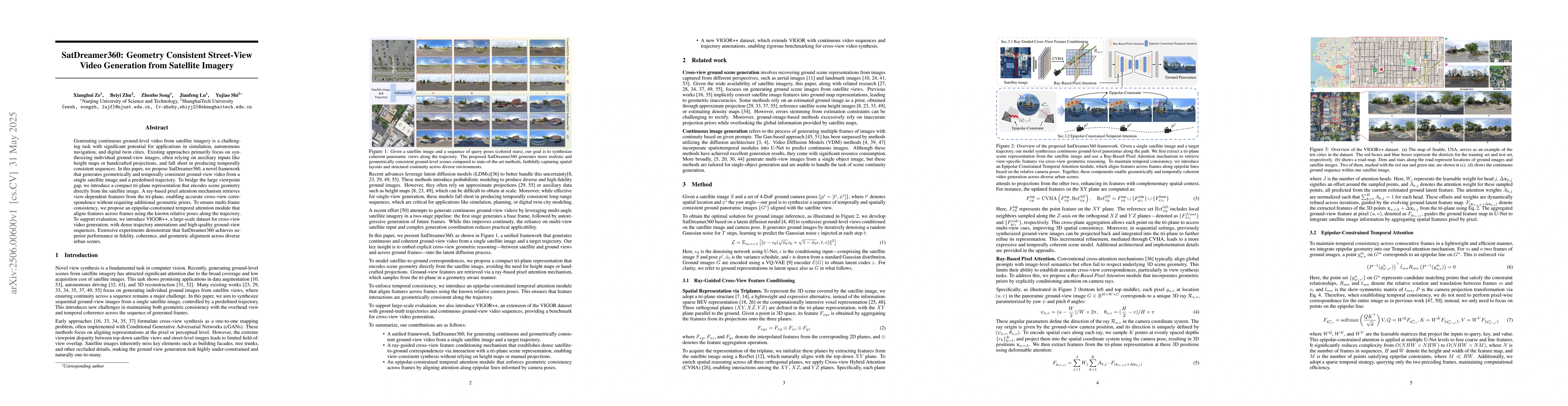
Generating continuous ground-level video from satellite imagery is a challenging task with significant potential for applications in simulation, autonomous navigation, and digital twin cities. Existin...
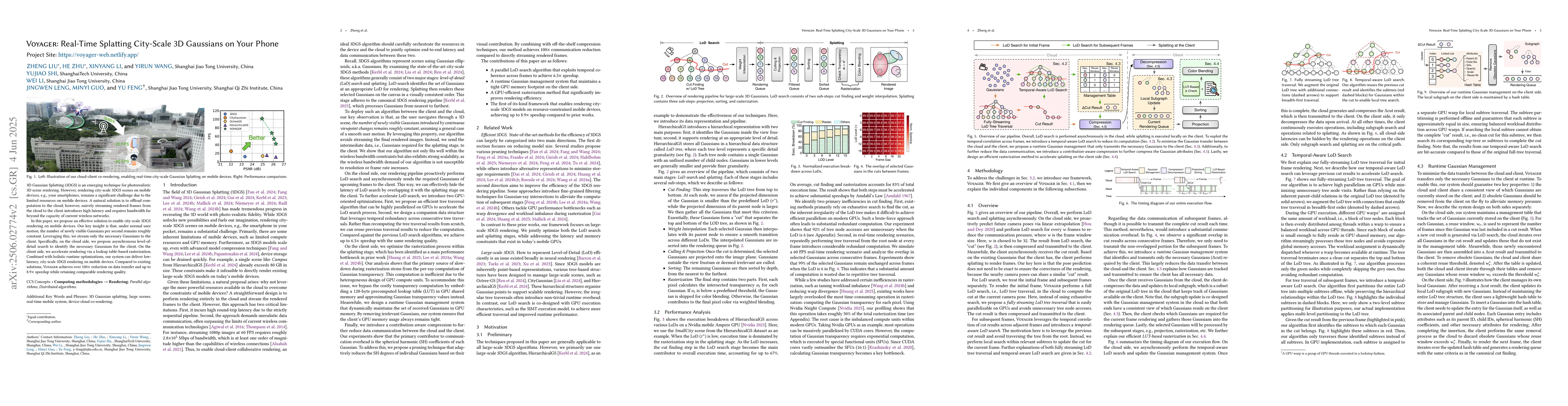
3D Gaussian Splatting (3DGS) is an emerging technique for photorealistic 3D scene rendering. However, rendering city-scale 3DGS scenes on mobile devices, e.g., your smartphones, remains a significant ...
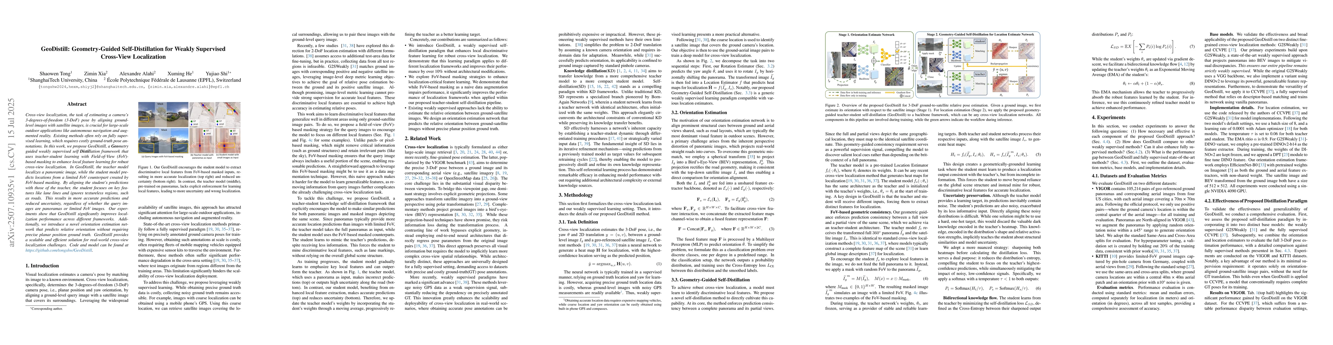
Cross-view localization, the task of estimating a camera's 3-degrees-of-freedom (3-DoF) pose by aligning ground-level images with satellite images, is crucial for large-scale outdoor applications like...
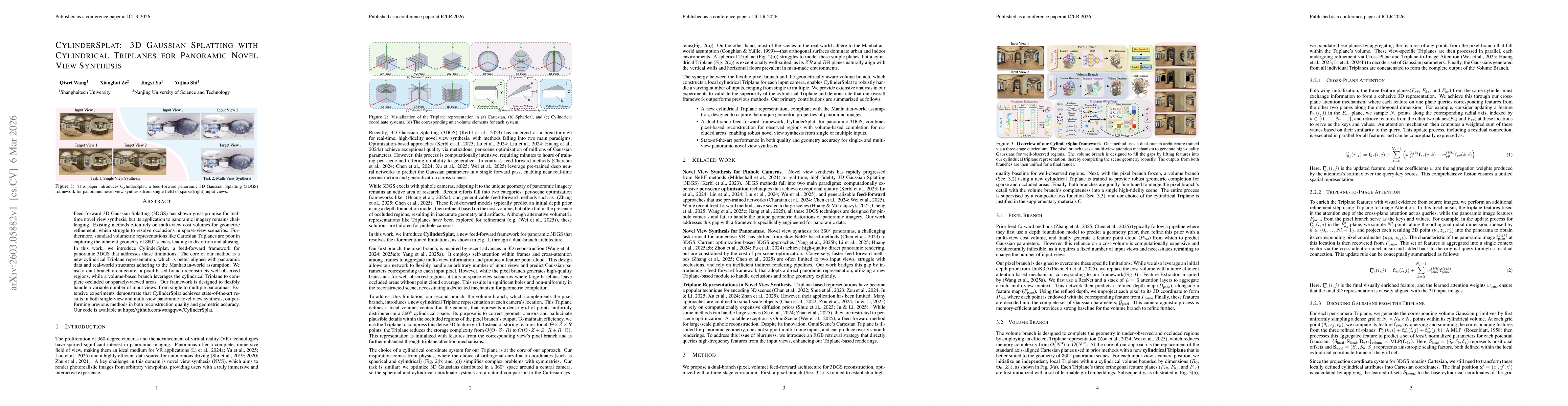
Feed-forward 3D Gaussian Splatting (3DGS) has shown great promise for real-time novel view synthesis, but its application to panoramic imagery remains challenging. Existing methods often rely on multi...
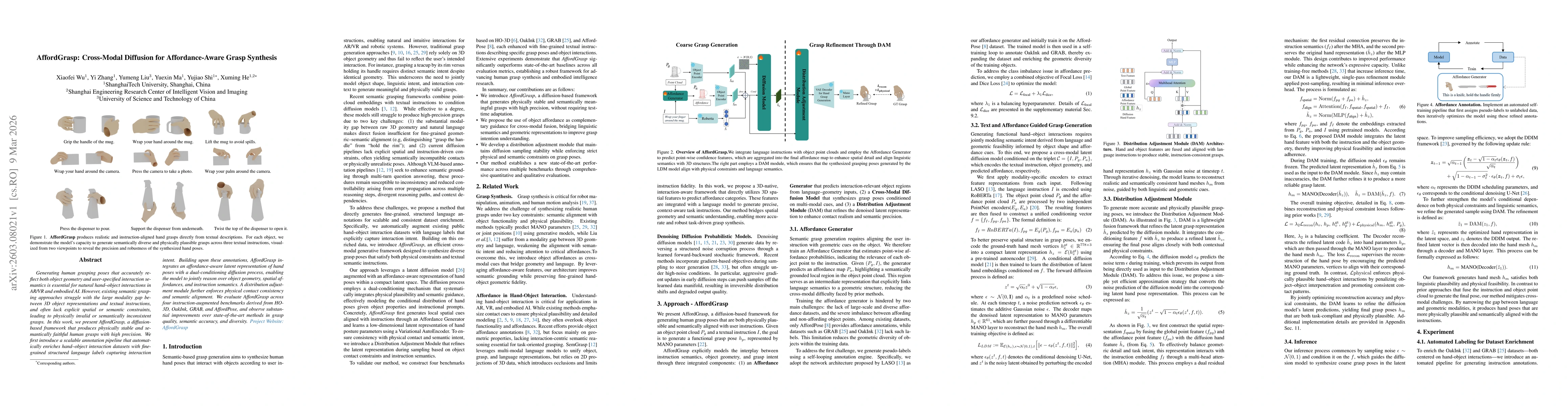
Generating human grasping poses that accurately reflect both object geometry and user-specified interaction semantics is essential for natural hand-object interactions in AR/VR and embodied AI. Howeve...
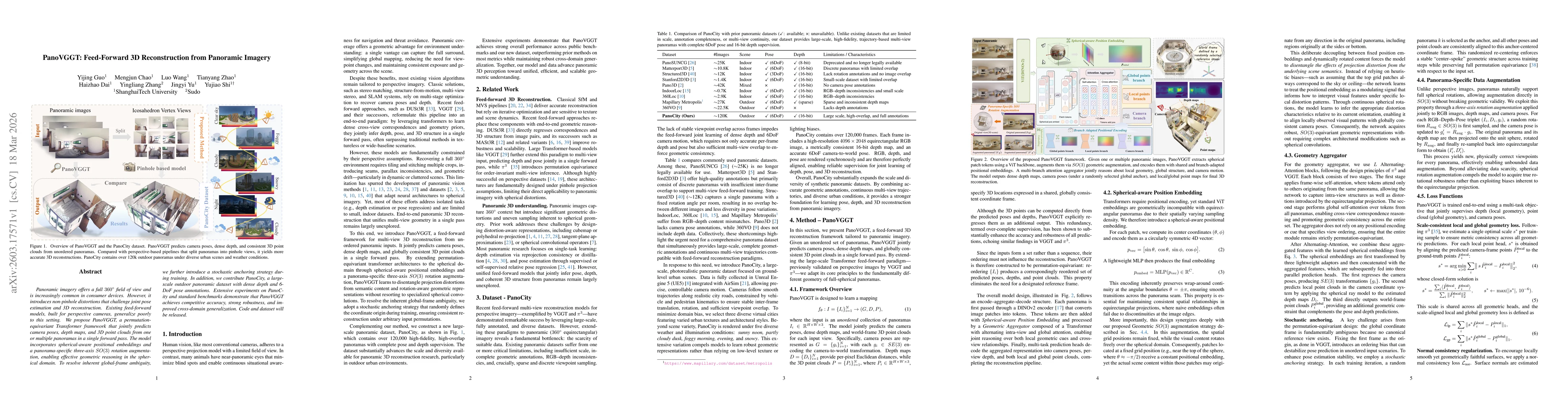
Panoramic imagery offers a full 360° field of view and is increasingly common in consumer devices. However, it introduces non-pinhole distortions that challenge joint pose estimation and 3D reconstruc...
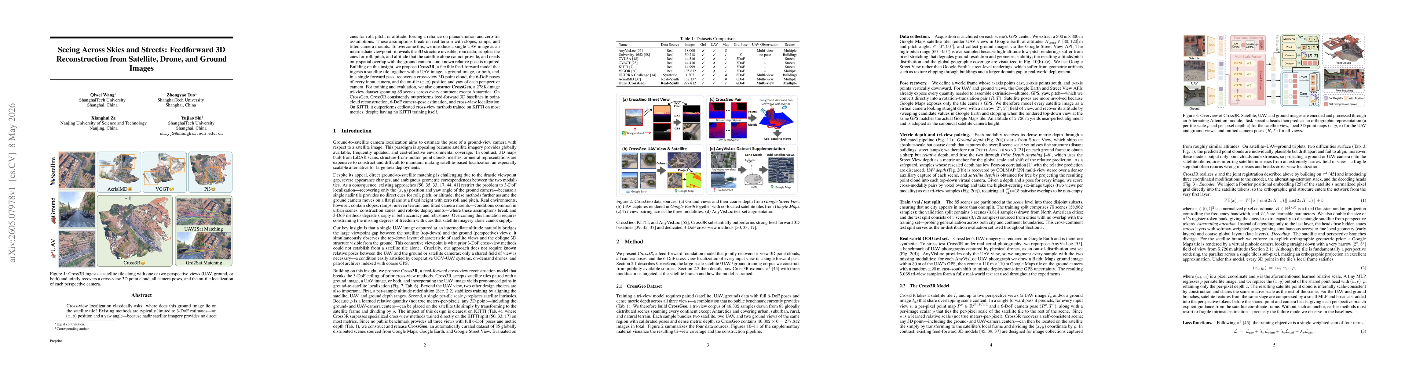
Cross-view localization classically asks: where does this ground image lie on the satellite tile? Existing methods are typically limited to 3-DoF estimates -- an $(x,y)$ position and a yaw angle -- be...
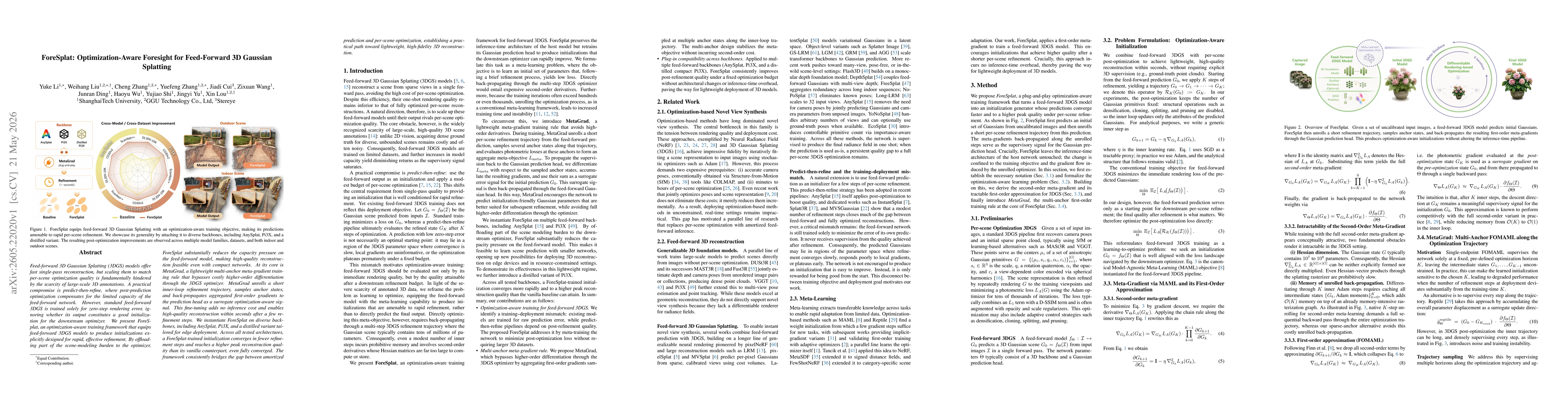
Feed-forward 3D Gaussian Splatting (3DGS) models offer fast single-pass reconstruction,but scaling them to match per-scene optimization quality is fundamentally hindered by the scarcity of large-scale...
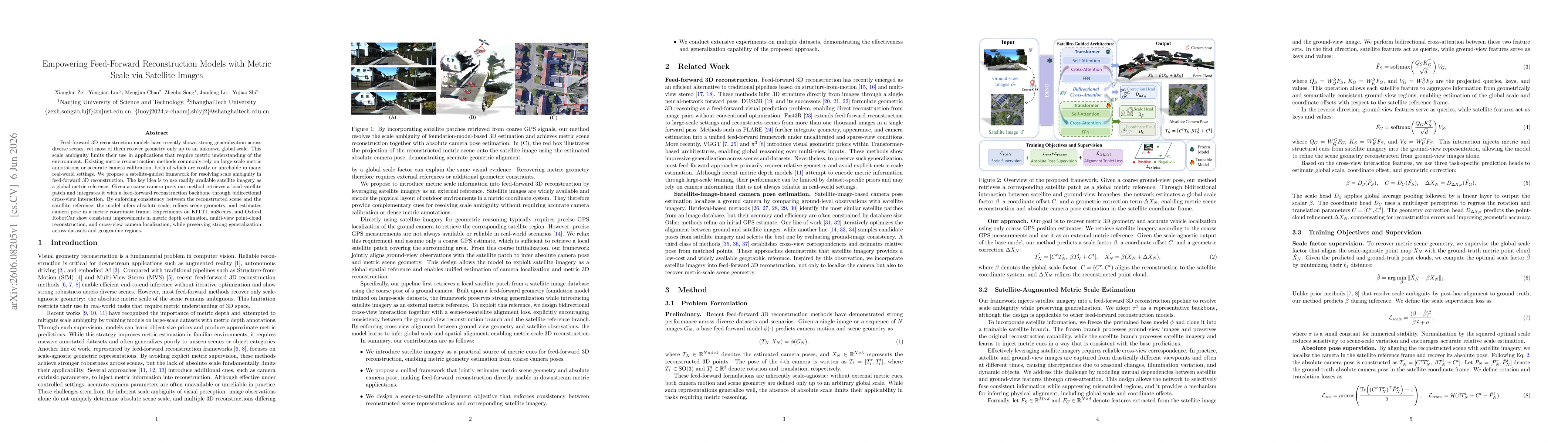
Feed-forward 3D reconstruction models have recently shown strong generalization across diverse scenes, yet most of them recover geometry only up to an unknown global scale. This scale ambiguity limits...
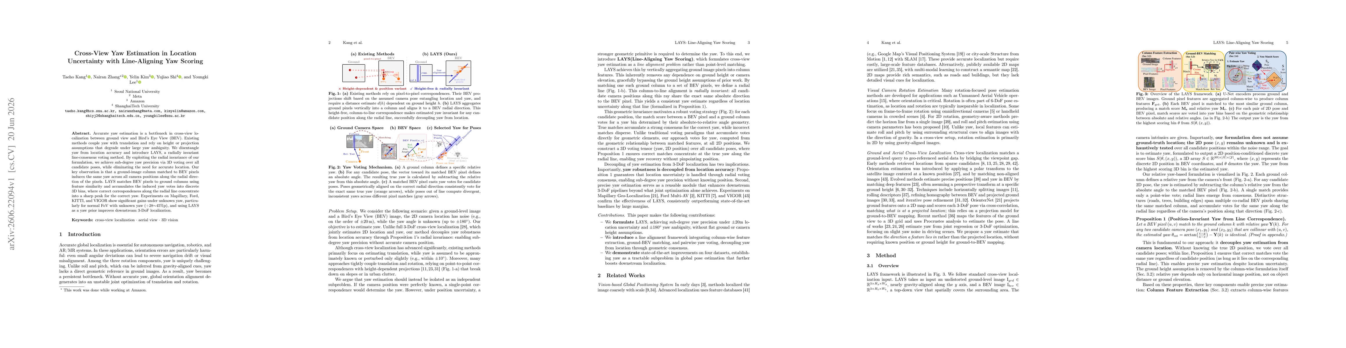
Accurate yaw estimation is a bottleneck in cross-view localization between ground view and Bird's Eye View (BEV). Existing methods couple yaw with translation and rely on height or projection assumpti...