Academic Profile
Statistics
Similar Authors
Papers on arXiv
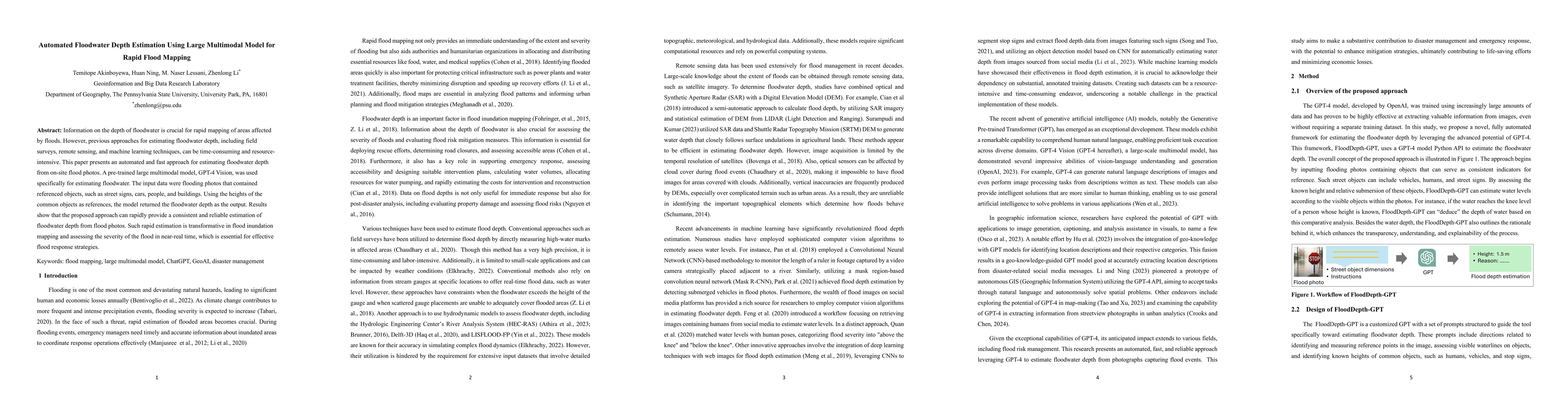
Information on the depth of floodwater is crucial for rapid mapping of areas affected by floods. However, previous approaches for estimating floodwater depth, including field surveys, remote sensing...
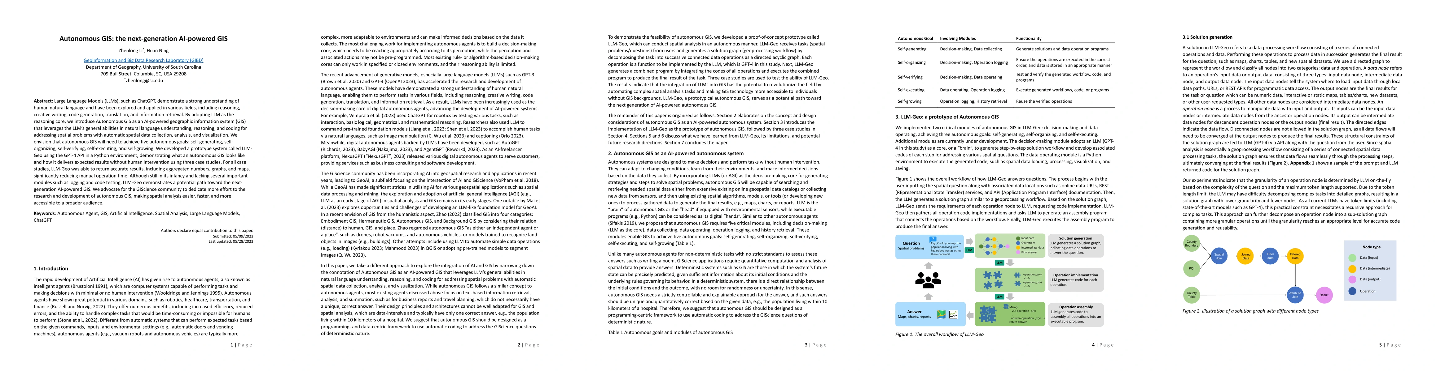
Large Language Models (LLMs), such as ChatGPT, demonstrate a strong understanding of human natural language and have been explored and applied in various fields, including reasoning, creative writin...
Multiple geographical feature label placement (MGFLP) has been a fundamental problem in geographic information visualization for decades. The nature of label positioning is proven an NP-hard problem...
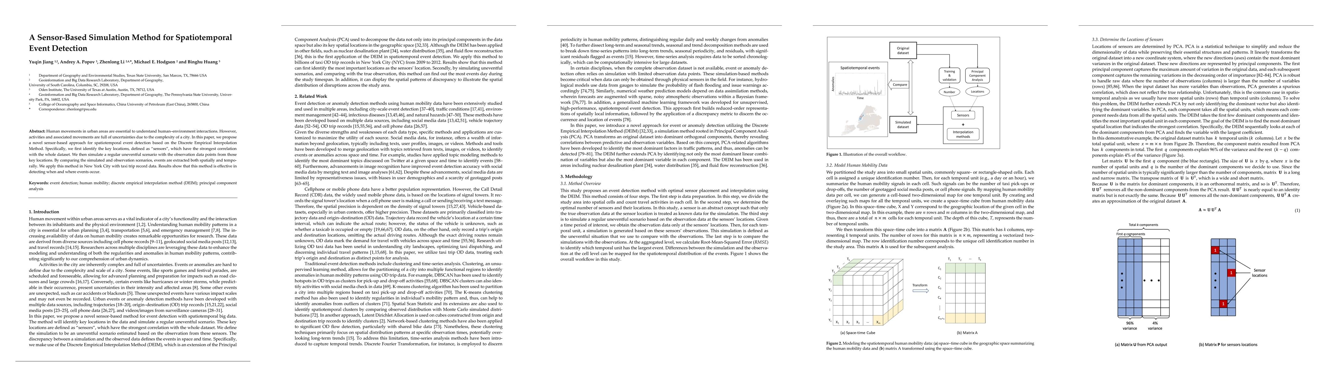
Human movements in urban areas are essential to understand human-environment interactions. However, activities and associated movements are full of uncertainties due to the complexity of a city. In ...
In response to the soaring needs of human mobility data, especially during disaster events such as the COVID-19 pandemic, and the associated big data challenges, we develop a scalable online platfor...
The study of migrations and mobility has historically been severely limited by the absence of reliable data or the temporal sparsity of the available data. Using geospatial digital trace data, the s...
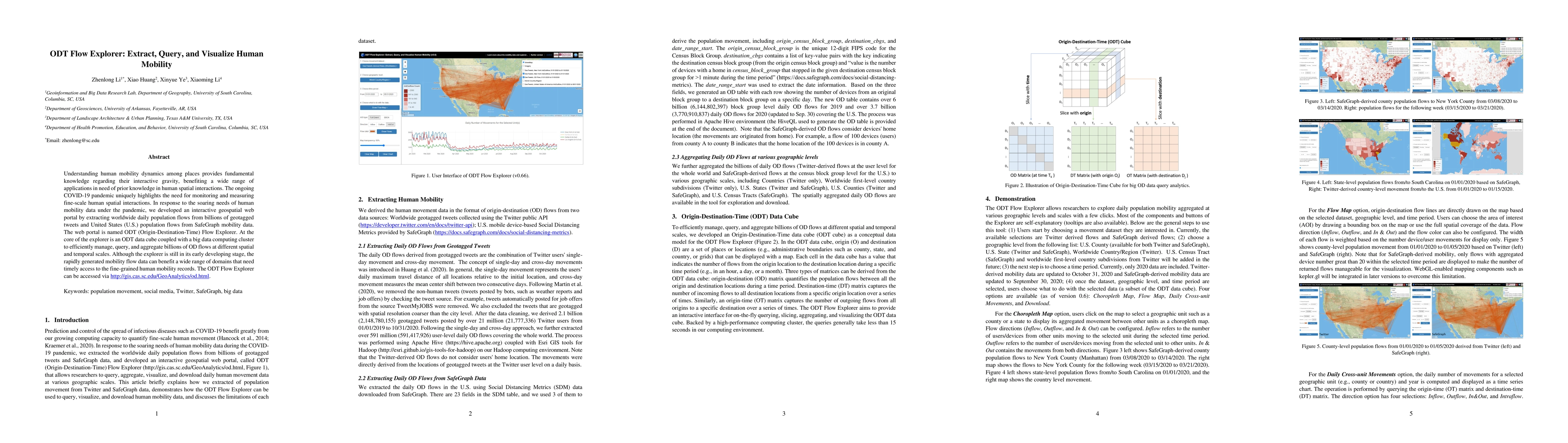
Understanding human mobility dynamics among places provides fundamental knowledge regarding their interactive gravity, benefiting a wide range of applications in need of prior knowledge in human spa...
Conventional simulations on multi-exit indoor evacuation focus primarily on how to determine a reasonable exit based on numerous factors in a changing environment. Results commonly include some cong...
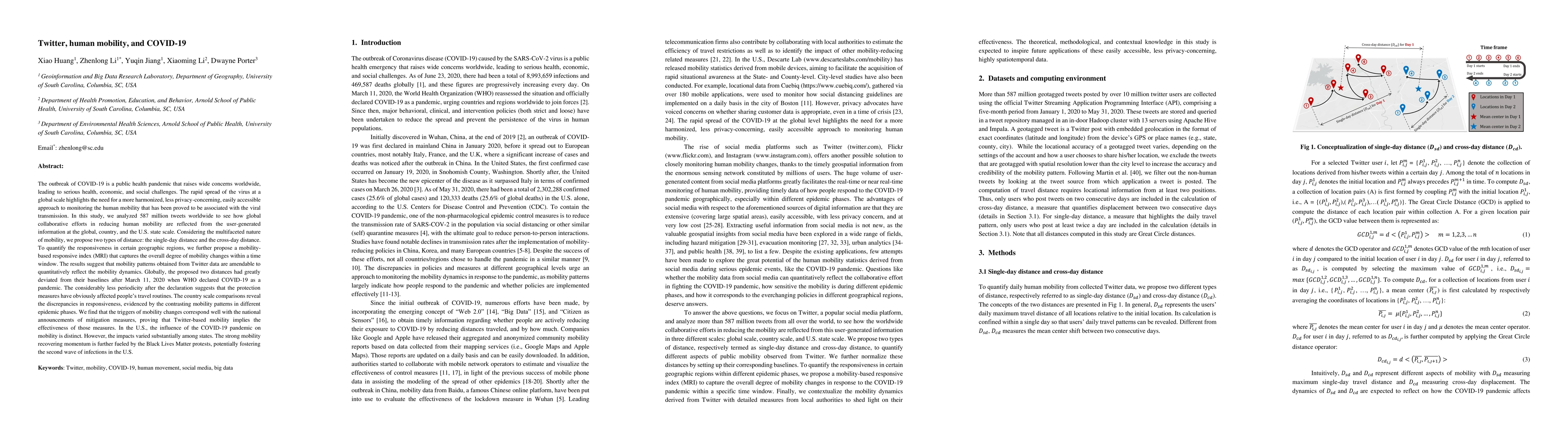
The outbreak of COVID-19 highlights the need for a more harmonized, less privacy-concerning, easily accessible approach to monitoring the human mobility that has been proved to be associated with th...
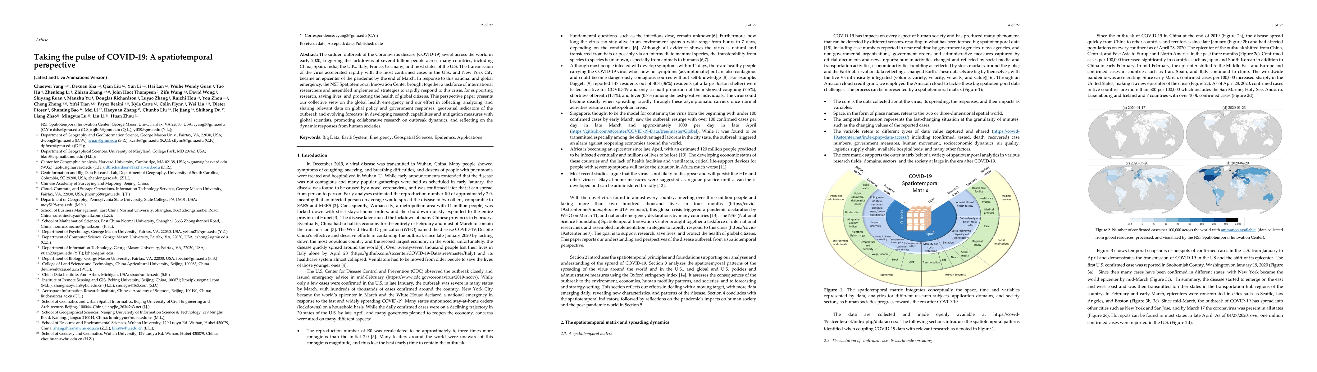
The sudden outbreak of the Coronavirus disease (COVID-19) swept across the world in early 2020, triggering the lockdowns of several billion people across many countries, including China, Spain, Indi...
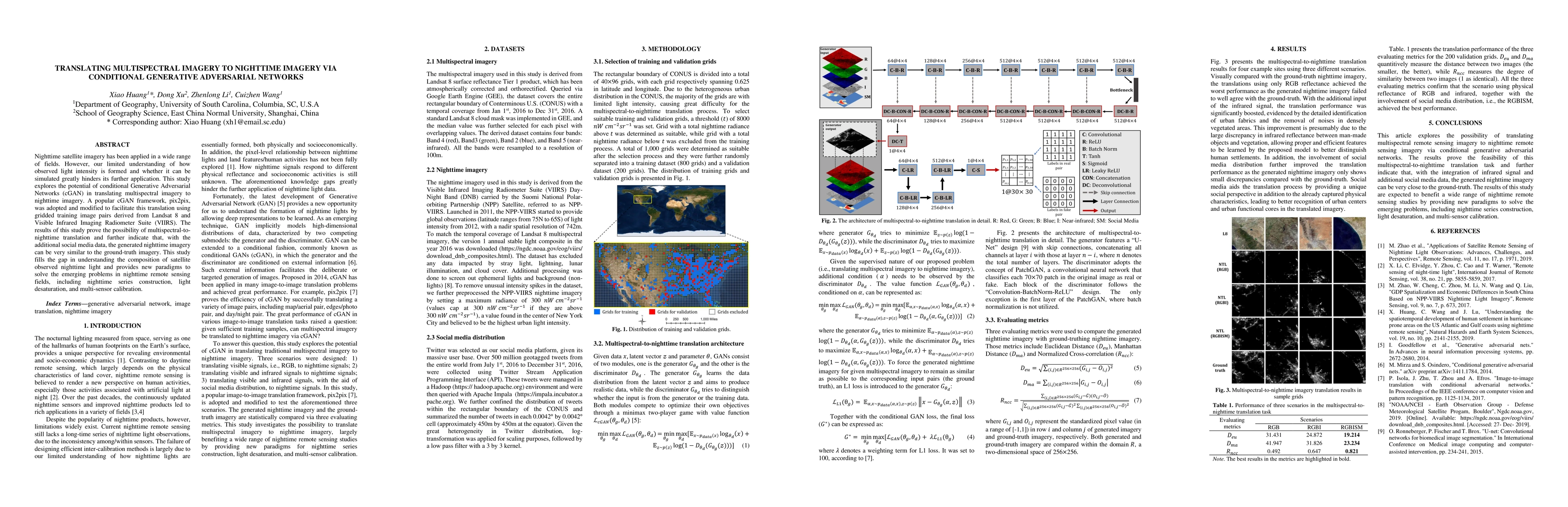
Nighttime satellite imagery has been applied in a wide range of fields. However, our limited understanding of how observed light intensity is formed and whether it can be simulated greatly hinders i...
Geospatial big data plays a major role in the era of big data, as most data today are inherently spatial, collected with ubiquitous location-aware sensors. Efficiently collecting, managing, storing,...
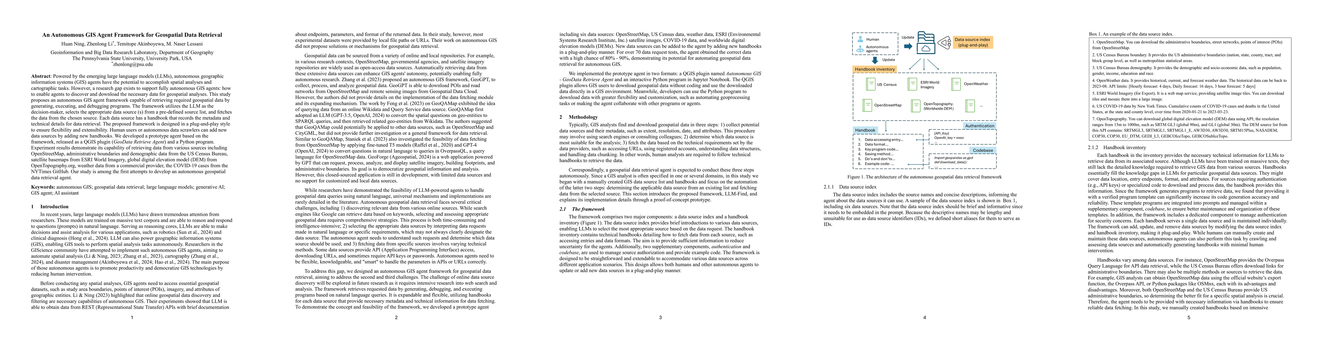
Powered by the emerging large language models (LLMs), autonomous geographic information systems (GIS) agents have the potential to accomplish spatial analyses and cartographic tasks. However, a resear...
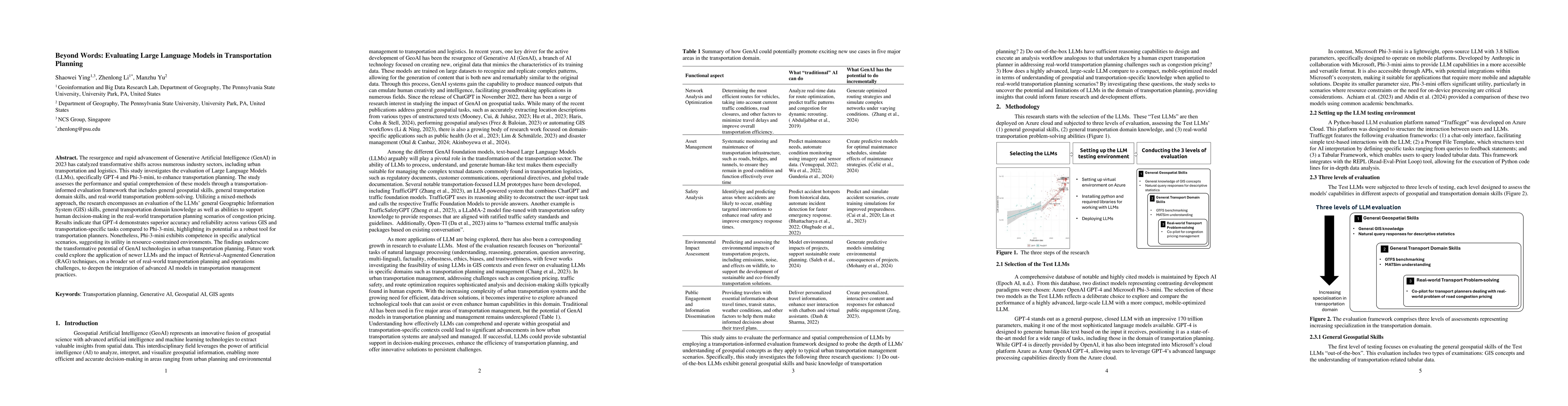
The resurgence and rapid advancement of Generative Artificial Intelligence (GenAI) in 2023 has catalyzed transformative shifts across numerous industry sectors, including urban transportation and logi...
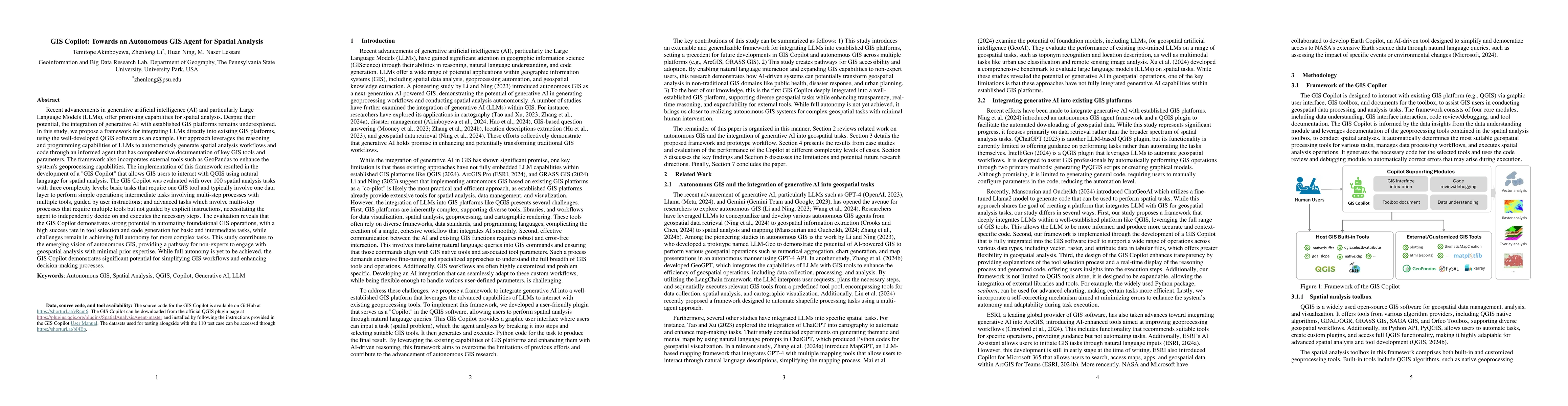
Recent advancements in Generative AI offer promising capabilities for spatial analysis. Despite their potential, the integration of generative AI with established GIS platforms remains underexplored. ...
Numerous researchers have utilized GPS-enabled vehicle data and SafeGraph mobility data to analyze human movements. However, the comparison of their ability to capture human mobility remains unexplore...
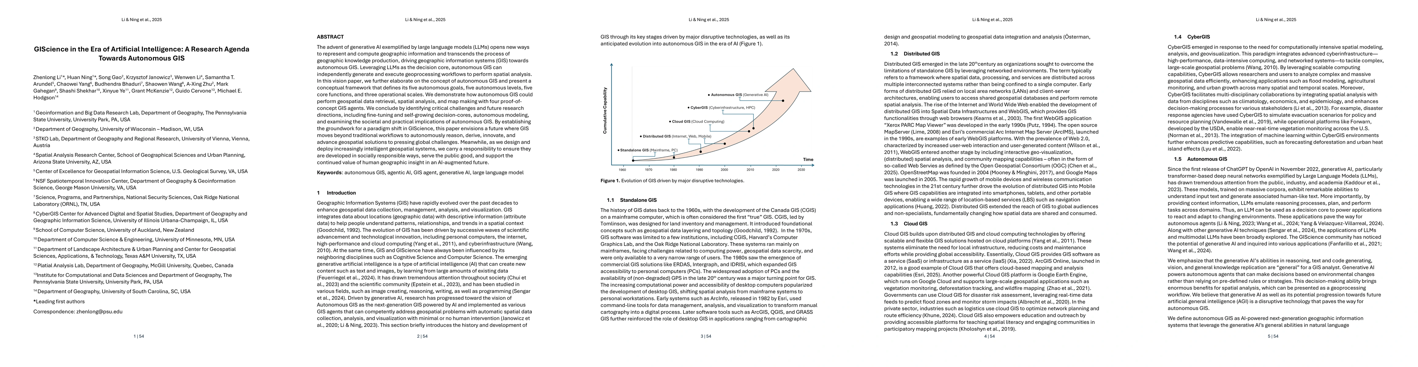
The advent of generative AI exemplified by large language models (LLMs) opens new ways to represent and compute geographic information and transcends the process of geographic knowledge production, dr...
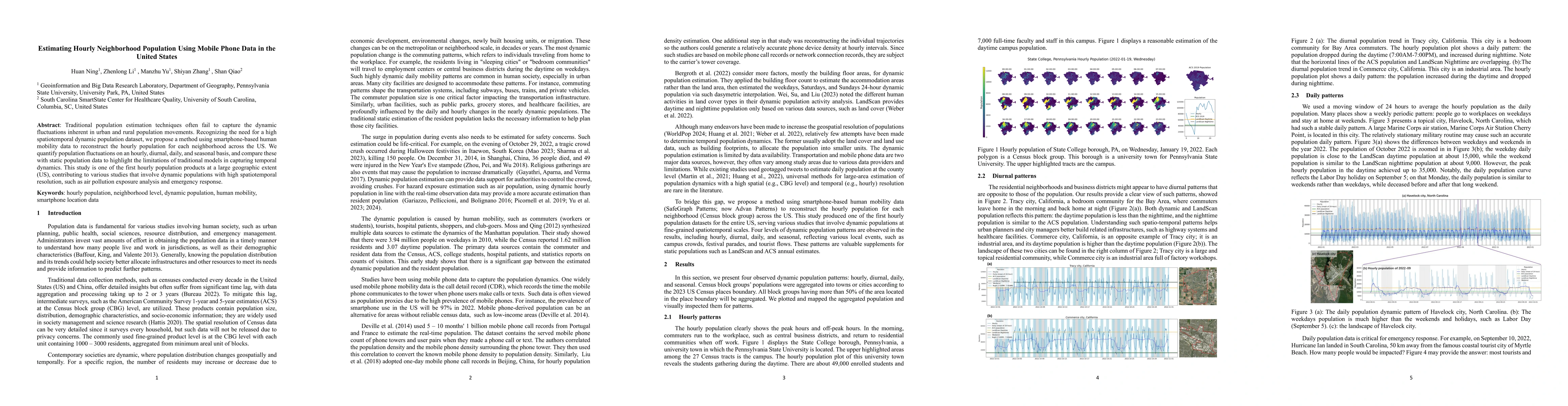
Traditional population estimation techniques often fail to capture the dynamic fluctuations inherent in urban and rural population movements. Recognizing the need for a high spatiotemporal dynamic pop...
Built environment auditing refers to the systematic documentation and assessment of urban and rural spaces' physical, social, and environmental characteristics, such as walkability, road conditions, a...
The complexity of Structured Query Language (SQL) and the specialized nature of geospatial functions in tools like PostGIS present significant barriers to non-experts seeking to analyze spatial data. ...
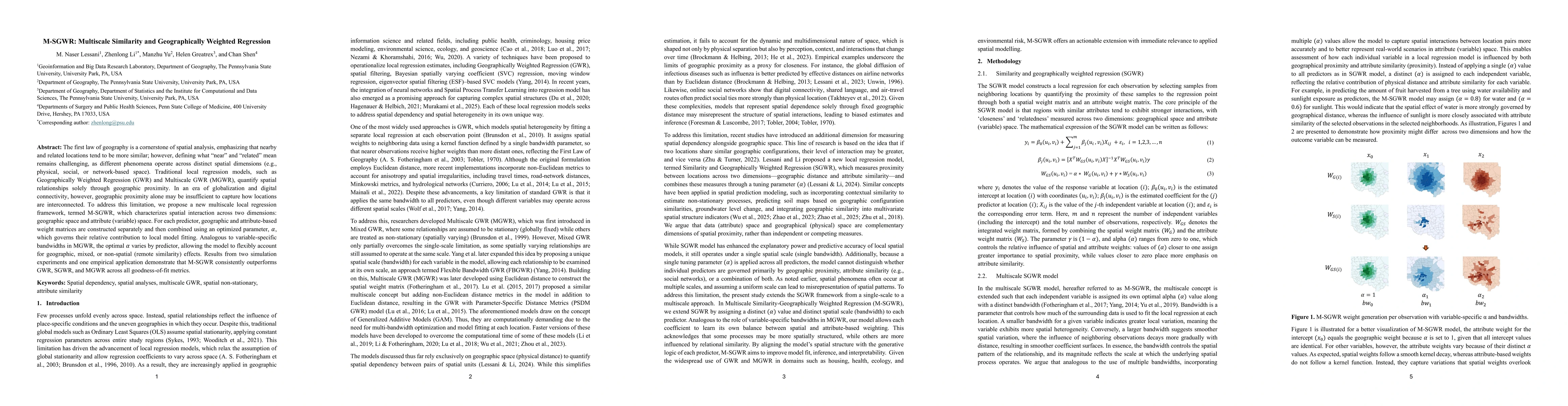
The first law of geography is a cornerstone of spatial analysis, emphasizing that nearby and related locations tend to be more similar, however, defining what constitutes "near" and "related" remains ...
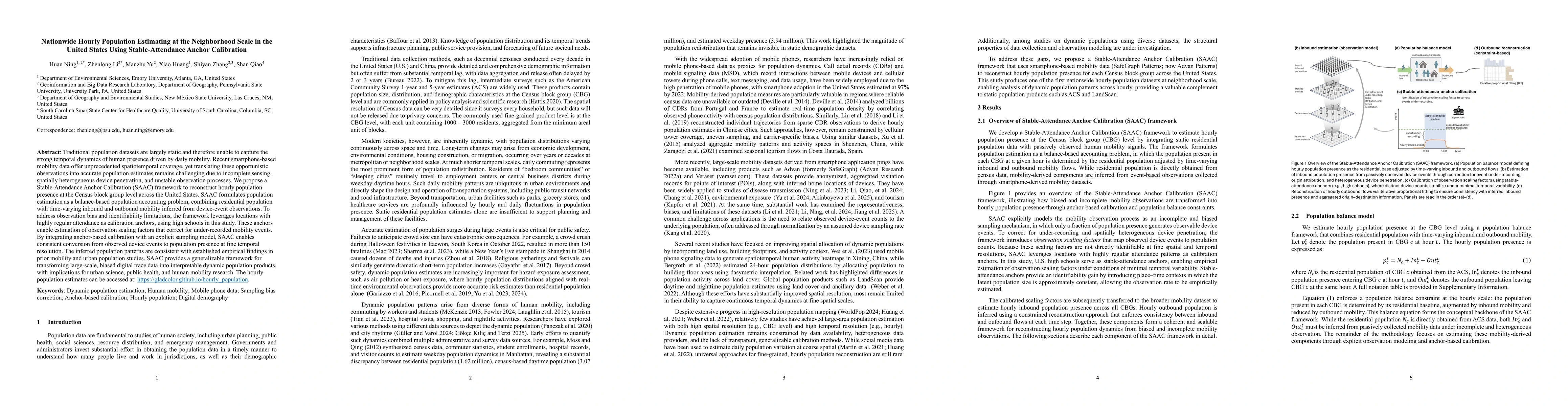
Traditional population datasets are largely static and therefore unable to capture the strong temporal dynamics of human presence driven by daily mobility. Recent smartphone-based mobility data offer ...
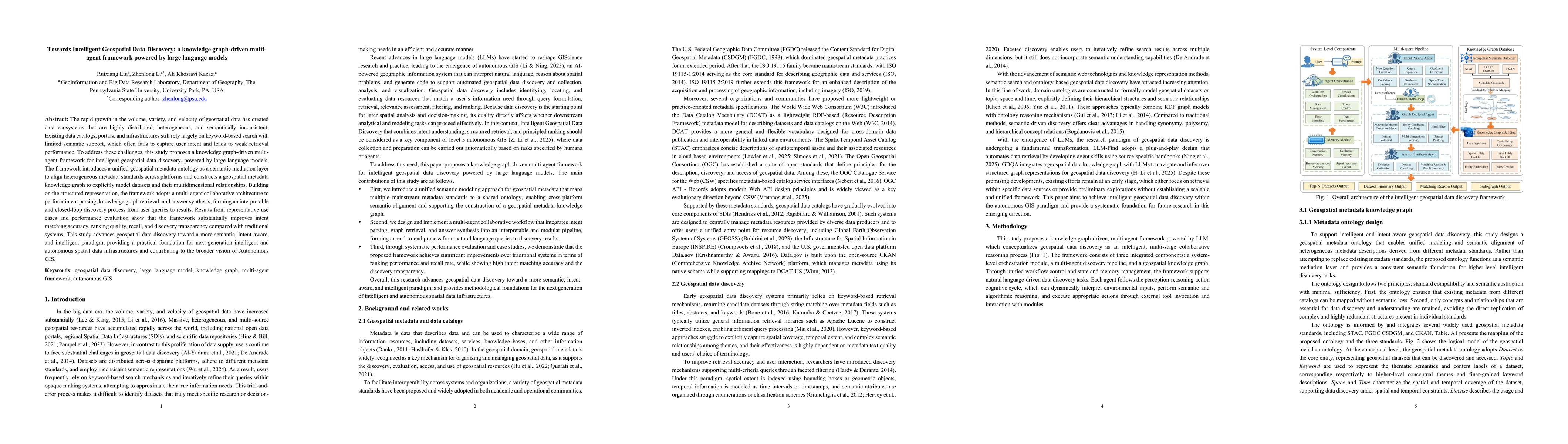
The rapid growth in the volume, variety, and velocity of geospatial data has created data ecosystems that are highly distributed, heterogeneous, and semantically inconsistent. Existing data catalogs, ...
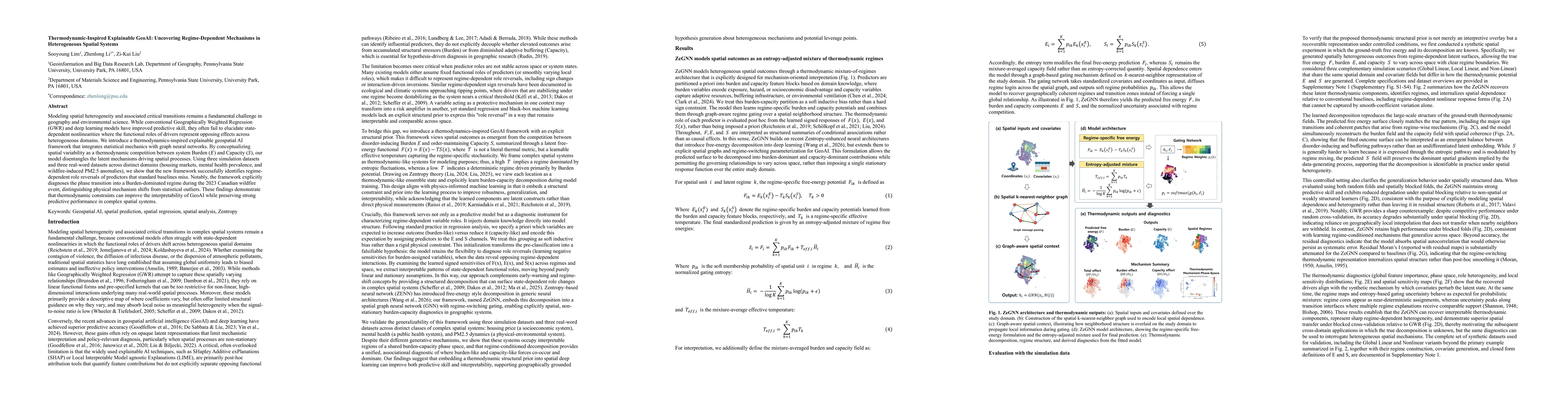
Modeling spatial heterogeneity and associated critical transitions remains a fundamental challenge in geography and environmental science. While conventional Geographically Weighted Regression (GWR) a...