Academic Profile
Statistics
Similar Authors
Papers on arXiv
Street View Imagery (SVI) has emerged as a valuable data form in urban studies, enabling new ways to map and sense urban environments. However, fundamental concerns regarding the representativeness, q...
Street view imagery (SVI) has been instrumental in many studies in the past decade to understand and characterize street features and the built environment. Researchers across a variety of domains, su...
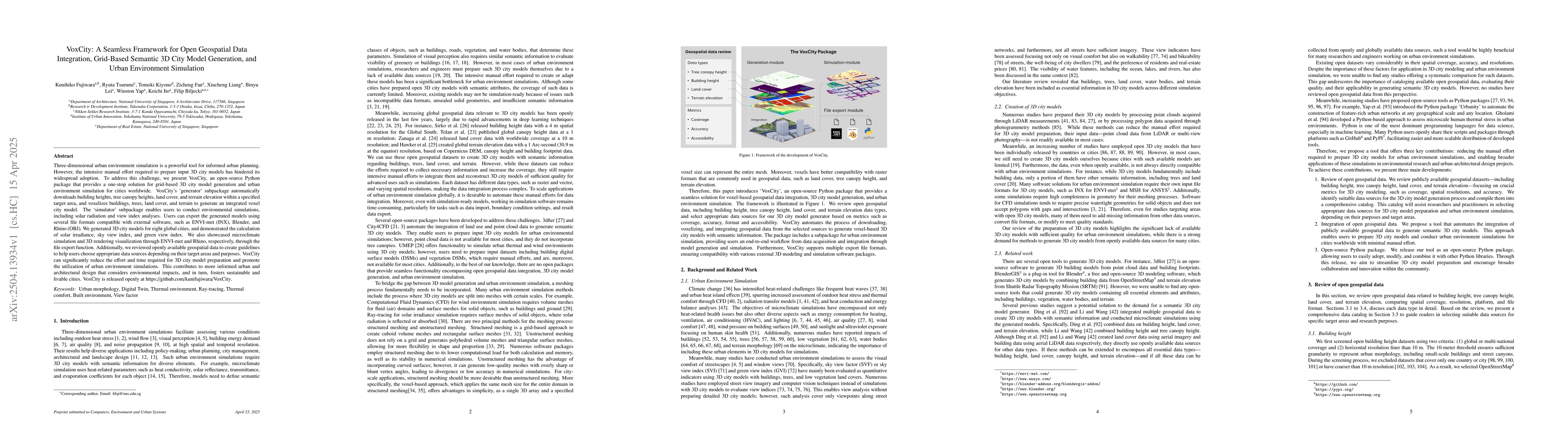
Three-dimensional urban environment simulation is a powerful tool for informed urban planning. However, the intensive manual effort required to prepare input 3D city models has hindered its widespread...
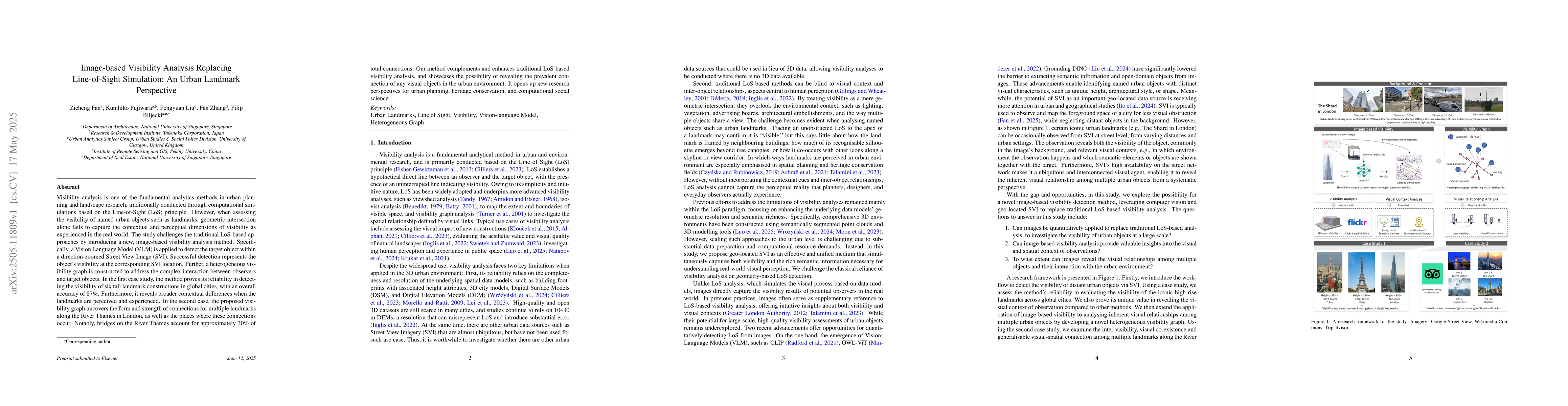
Visibility analysis is one of the fundamental analytics methods in urban planning and landscape research, traditionally conducted through computational simulations based on the Line-of-Sight (LoS) pri...