Deforestation Prediction Using Neural Networks and Satellite Imagery in a Spatial Information System
Publication
Metrics
AI Quick Summary
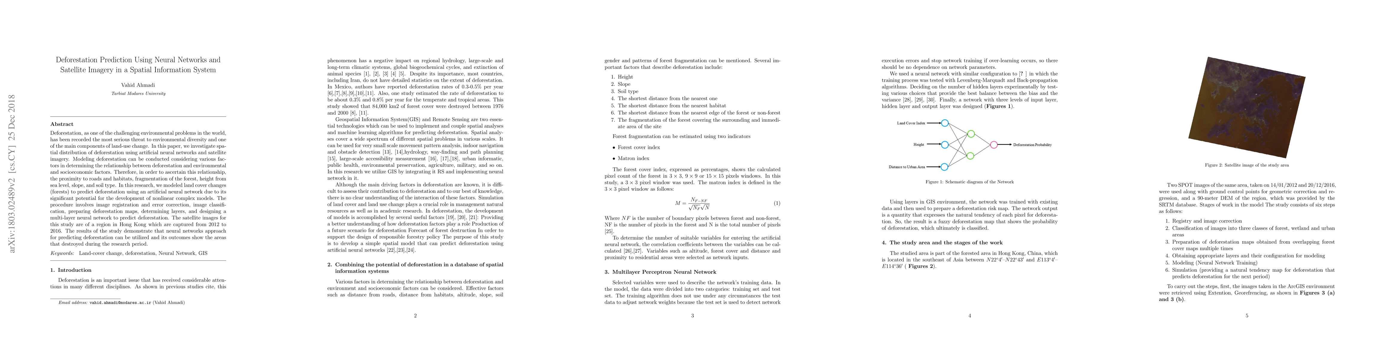
This paper explores the spatial distribution of deforestation in Hong Kong using artificial neural networks and satellite imagery from 2012 to 2016. The study models land cover changes to predict deforestation, incorporating factors like proximity to roads and forest fragmentation, and demonstrates the effectiveness of neural networks in identifying deforested areas.
Paper Preview
Abstract
Deforestation, as one of the challenging environmental problems in the world, has been recorded the most serious threat to environmental diversity and one of the main components of land-use change. In this paper, we investigate spatial distribution of deforestation using artificial neural networks and satellite imagery. Modeling deforestation can be conducted considering various factors in determining the relationship between deforestation and environmental and socioeconomic factors. Therefore, in order to ascertain this relationship, the proximity to roads and habitats, fragmentation of the forest, height from sea level, slope, and soil type. In this research, we modeled land cover changes (forests) to predict deforestation using an artificial neural network due to its significant potential for the development of nonlinear complex models. The procedure involves image registration and error correction, image classification, preparing deforestation maps, determining layers, and designing a multi-layer neural network to predict deforestation. The satellite images for this study are of a region in Hong Kong which are captured from 2012 to 2016. The results of the study demonstrate that neural networks approach for predicting deforestation can be utilized and its outcomes show the areas that destroyed during the research period.
AI Key Findings
Get AI-generated insights about this paper's methodology, results, significance, and more — seven facets brought into focus.
Impact
Paper Details
PDF Preview
Key Terms
Citation Network
Current paper (gray), citations (green), references (blue)
Display is limited for performance on very large graphs.
Discussion 0