Land Cover Segmentation with Sparse Annotations from Sentinel-2 Imagery
Publication
Metrics
AI Quick Summary
This paper introduces SPADA, a framework for land cover segmentation using sparse annotations from Sentinel-2 imagery, employing domain adaptation techniques for semantic segmentation. SPADA outperforms existing methods, achieving a mean Intersection over Union (IoU) of 42.86 and an F1 score of 67.93 on benchmark datasets.
Paper Preview
Abstract
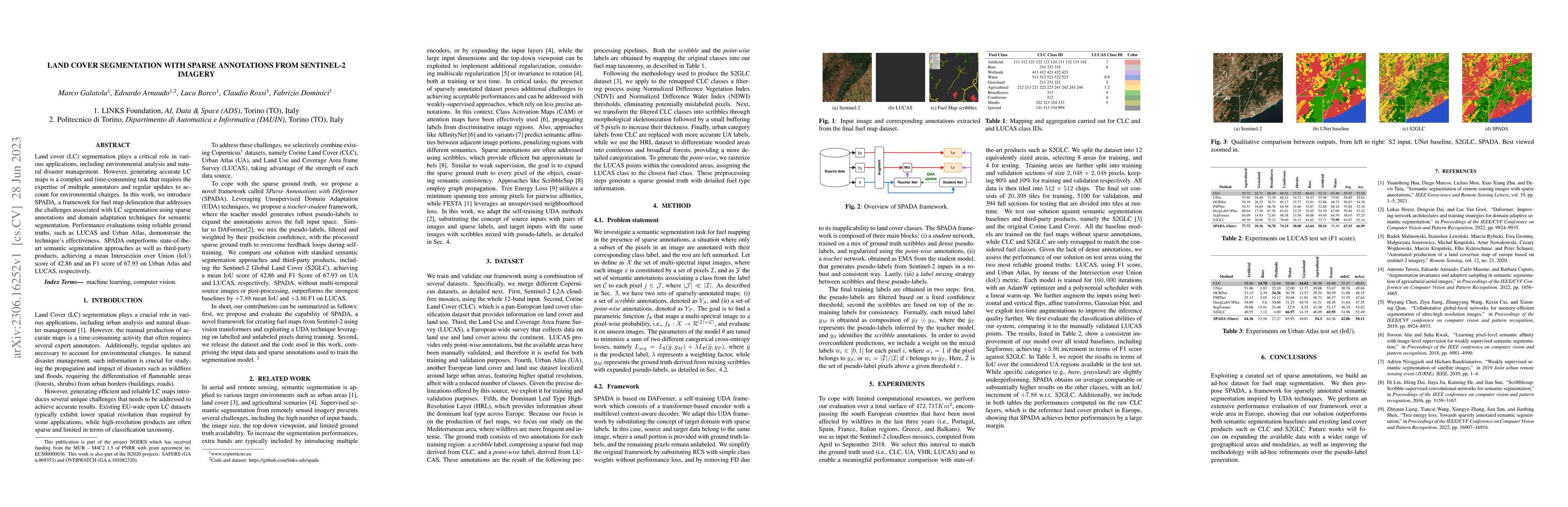
Land cover (LC) segmentation plays a critical role in various applications, including environmental analysis and natural disaster management. However, generating accurate LC maps is a complex and time-consuming task that requires the expertise of multiple annotators and regular updates to account for environmental changes. In this work, we introduce SPADA, a framework for fuel map delineation that addresses the challenges associated with LC segmentation using sparse annotations and domain adaptation techniques for semantic segmentation. Performance evaluations using reliable ground truths, such as LUCAS and Urban Atlas, demonstrate the technique's effectiveness. SPADA outperforms state-of-the-art semantic segmentation approaches as well as third-party products, achieving a mean Intersection over Union (IoU) score of 42.86 and an F1 score of 67.93 on Urban Atlas and LUCAS, respectively.
AI Key Findings
Get AI-generated insights about this paper's methodology, results, significance, and more — seven facets brought into focus.
Impact
Paper Details
Authors
PDF Preview
Key Terms
Citation Network
Current paper (gray), citations (green), references (blue)
Display is limited for performance on very large graphs.
Discussion 0