Luca Barco

8 papers on arXiv

Academic Profile

Name: Luca Barco
Total Papers: 8

Statistics

arXiv Papers 8
Total Publications 8

Papers on arXiv

Thumbnail for FMARS: Annotating Remote Sensing Images for Disaster Management using
  Foundation Models

FMARS: Annotating Remote Sensing Images for Disaster Management using Foundation Models

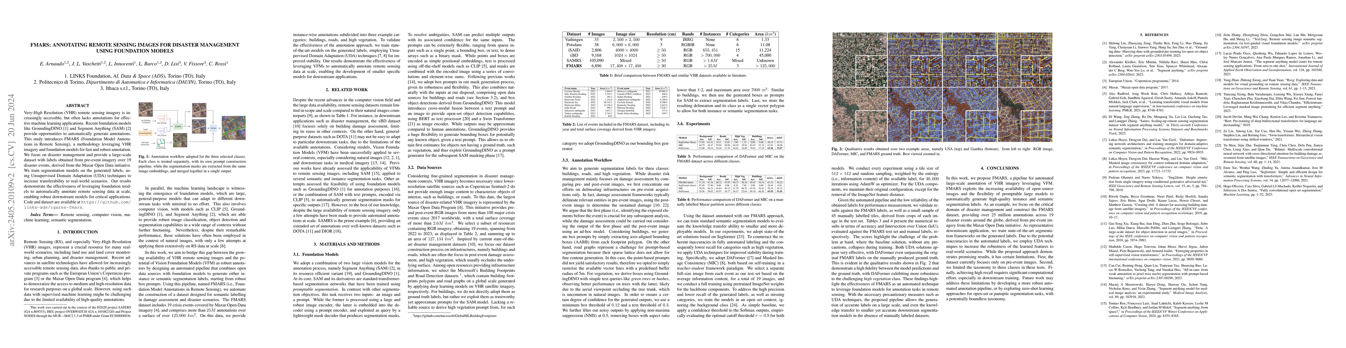
Very-High Resolution (VHR) remote sensing imagery is increasingly accessible, but often lacks annotations for effective machine learning applications. Recent foundation models like GroundingDINO and S...

Thumbnail for Maximum Temperature Prediction Using Remote Sensing Data Via
  Convolutional Neural Network

Maximum Temperature Prediction Using Remote Sensing Data Via Convolutional Neural Network

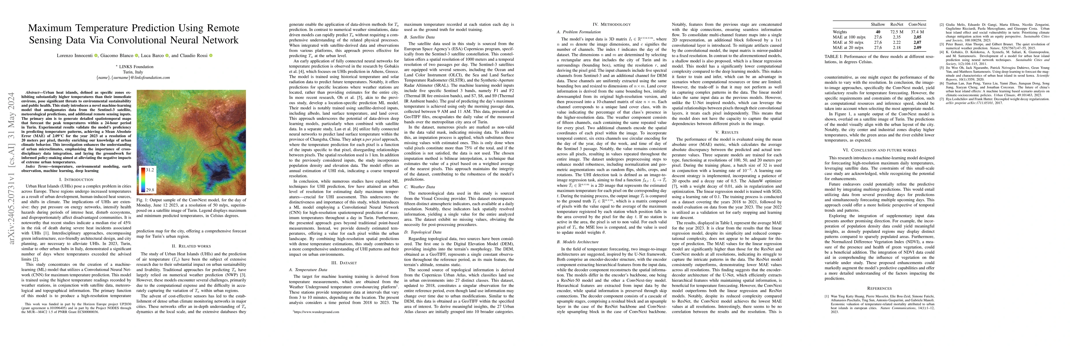
Urban heat islands, defined as specific zones exhibiting substantially higher temperatures than their immediate environs, pose significant threats to environmental sustainability and public health. ...

Thumbnail for Rapid Wildfire Hotspot Detection Using Self-Supervised Learning on
  Temporal Remote Sensing Data

Rapid Wildfire Hotspot Detection Using Self-Supervised Learning on Temporal Remote Sensing Data

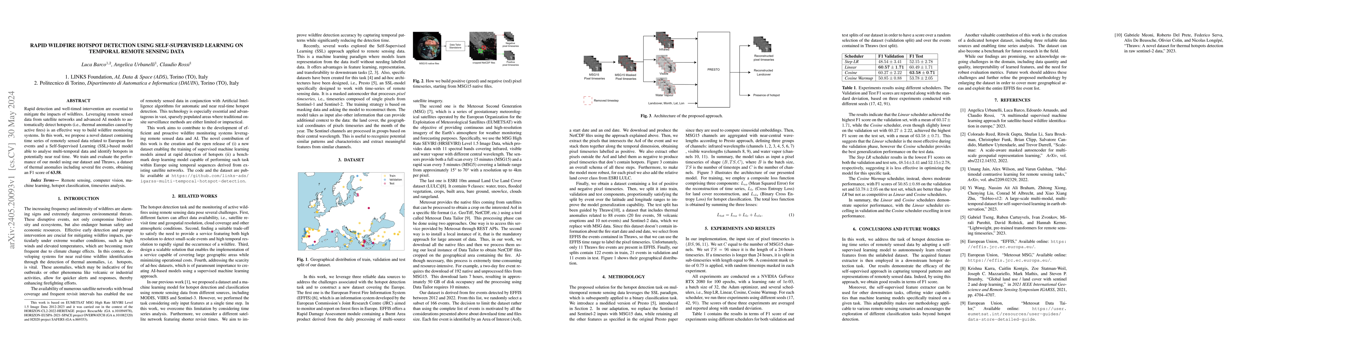
Rapid detection and well-timed intervention are essential to mitigate the impacts of wildfires. Leveraging remote sensed data from satellite networks and advanced AI models to automatically detect h...

Thumbnail for Urban Air Pollution Forecasting: a Machine Learning Approach leveraging
  Satellite Observations and Meteorological Forecasts

Urban Air Pollution Forecasting: a Machine Learning Approach leveraging Satellite Observations and Meteorological Forecasts

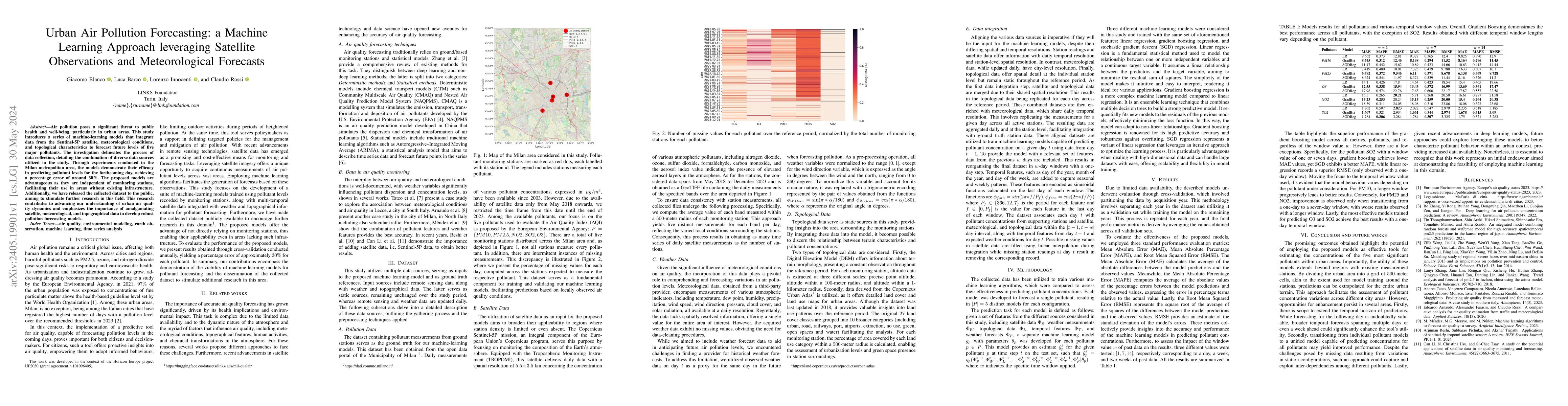
Air pollution poses a significant threat to public health and well-being, particularly in urban areas. This study introduces a series of machine-learning models that integrate data from the Sentinel...

Thumbnail for Robust Burned Area Delineation through Multitask Learning

Robust Burned Area Delineation through Multitask Learning

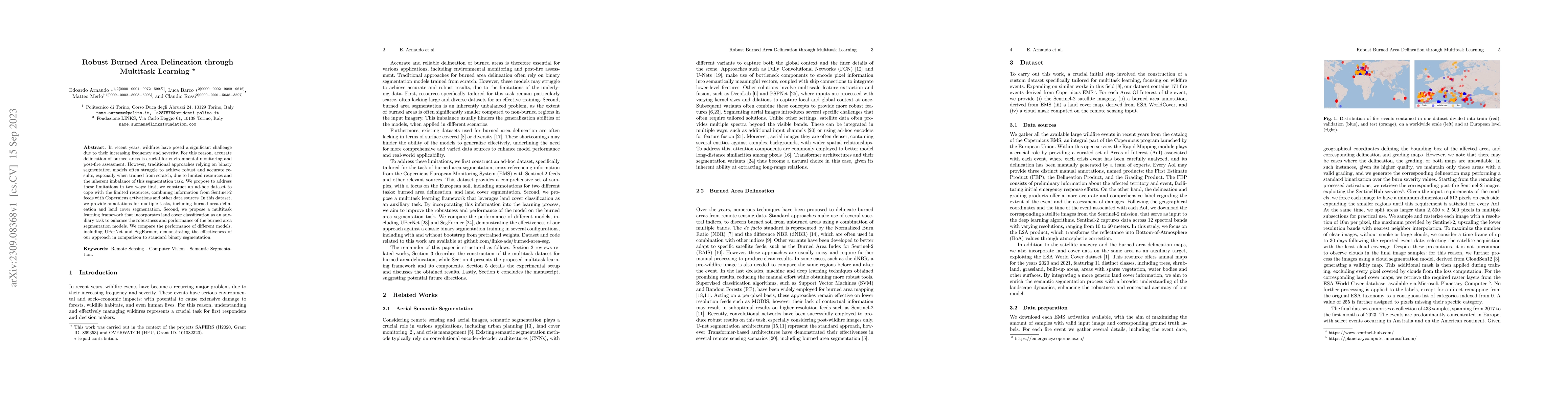
In recent years, wildfires have posed a significant challenge due to their increasing frequency and severity. For this reason, accurate delineation of burned areas is crucial for environmental monit...

Thumbnail for A Multimodal Supervised Machine Learning Approach for Satellite-based
  Wildfire Identification in Europe

A Multimodal Supervised Machine Learning Approach for Satellite-based Wildfire Identification in Europe

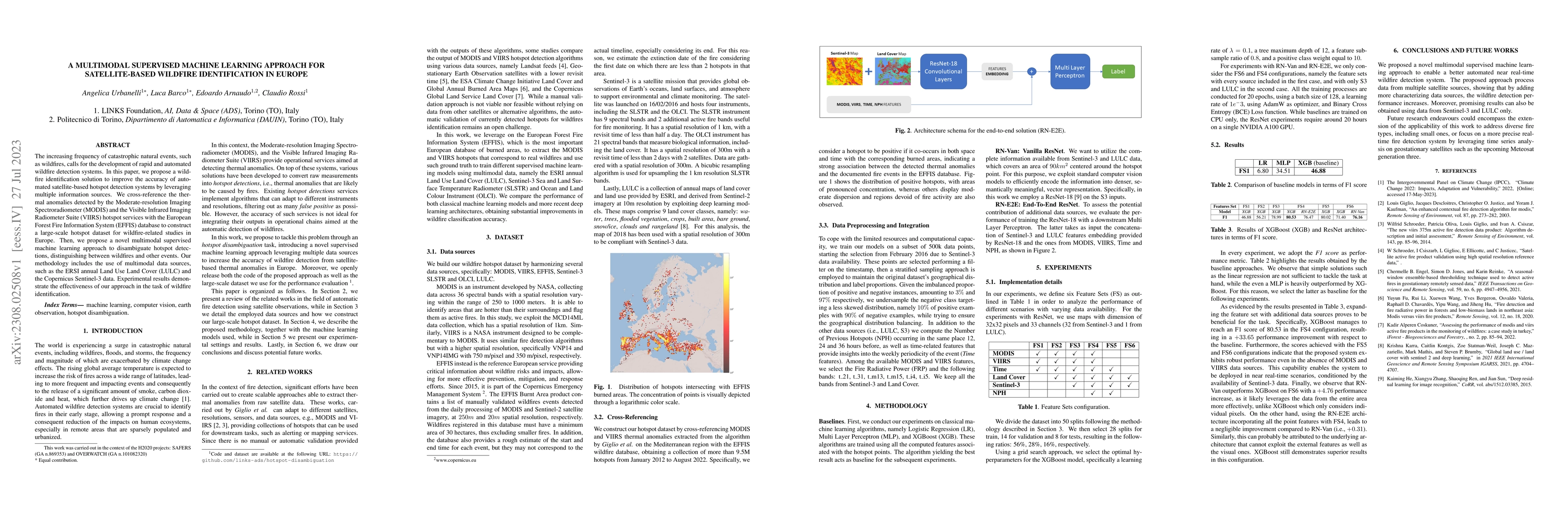
The increasing frequency of catastrophic natural events, such as wildfires, calls for the development of rapid and automated wildfire detection systems. In this paper, we propose a wildfire identifi...

Thumbnail for Land Cover Segmentation with Sparse Annotations from Sentinel-2 Imagery

Land Cover Segmentation with Sparse Annotations from Sentinel-2 Imagery

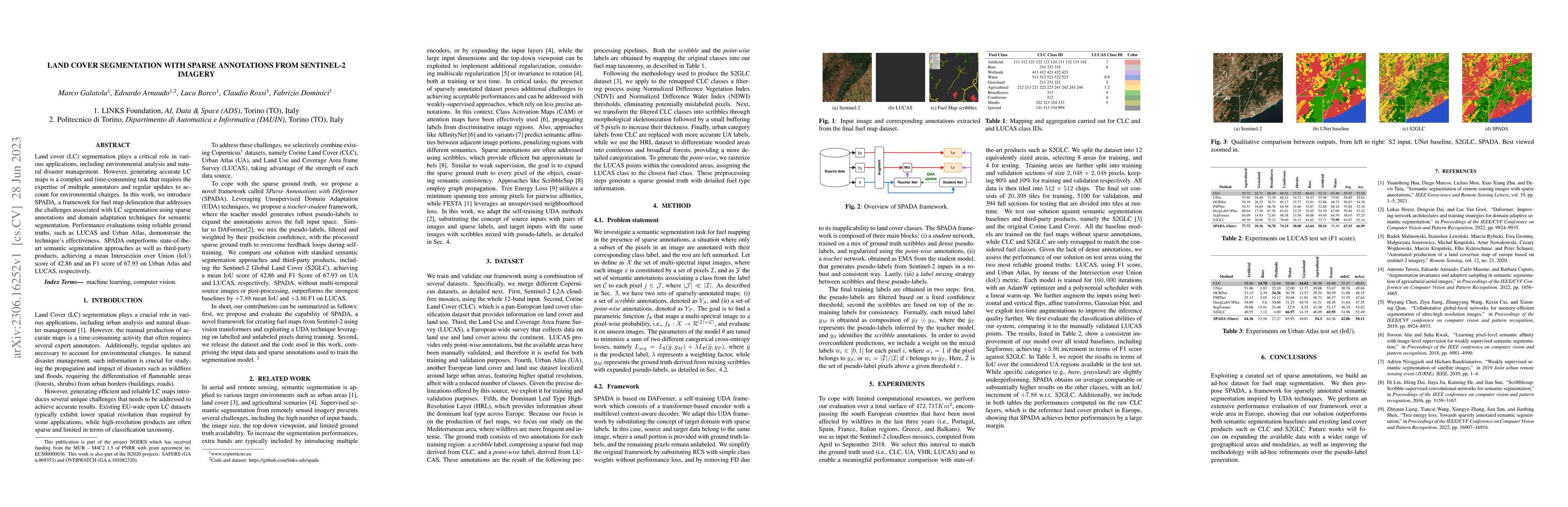
Land cover (LC) segmentation plays a critical role in various applications, including environmental analysis and natural disaster management. However, generating accurate LC maps is a complex and ti...

Thumbnail for Turin3D: Evaluating Adaptation Strategies under Label Scarcity in Urban
  LiDAR Segmentation with Semi-Supervised Techniques

Turin3D: Evaluating Adaptation Strategies under Label Scarcity in Urban LiDAR Segmentation with Semi-Supervised Techniques

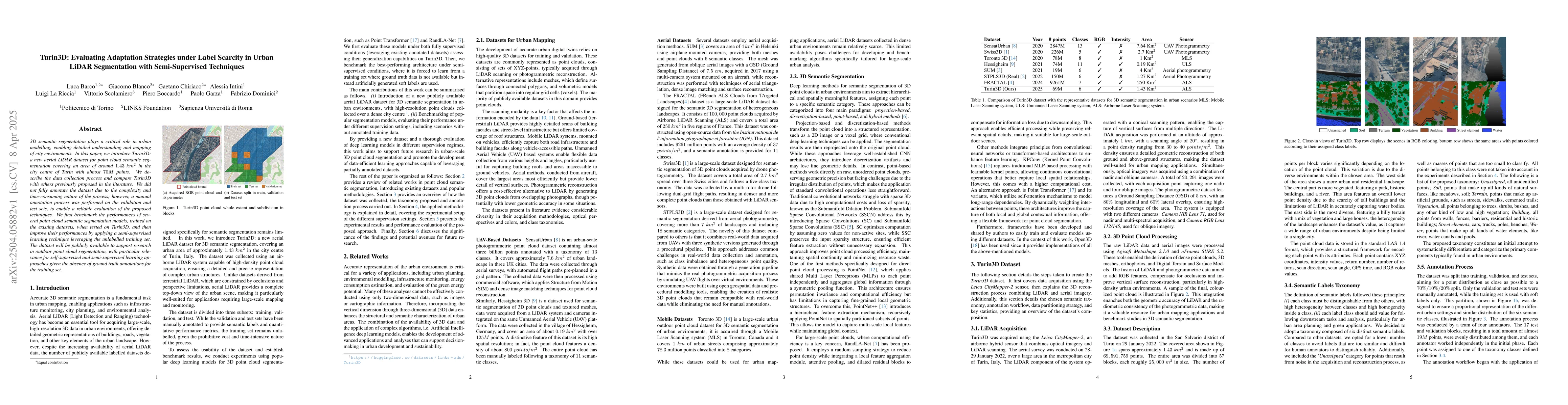
3D semantic segmentation plays a critical role in urban modelling, enabling detailed understanding and mapping of city environments. In this paper, we introduce Turin3D: a new aerial LiDAR dataset for...

This website uses cookies to ensure you get the best experience. Learn more