Academic Profile
Statistics
Similar Authors
Papers on arXiv
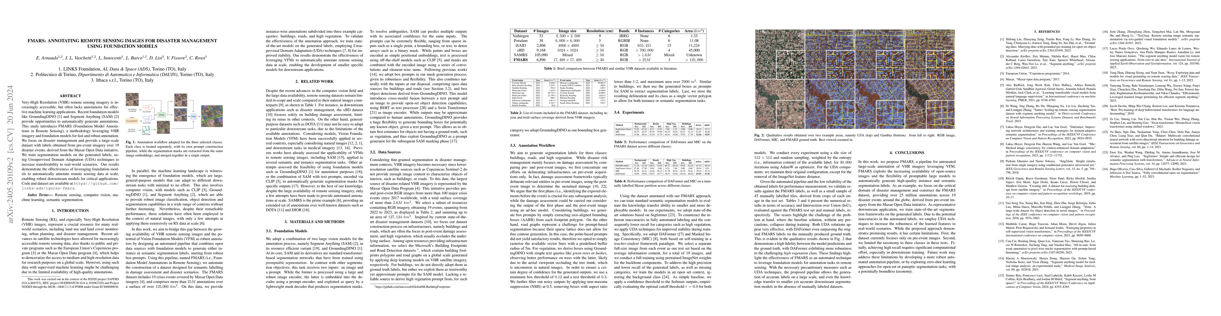
Very-High Resolution (VHR) remote sensing imagery is increasingly accessible, but often lacks annotations for effective machine learning applications. Recent foundation models like GroundingDINO and S...
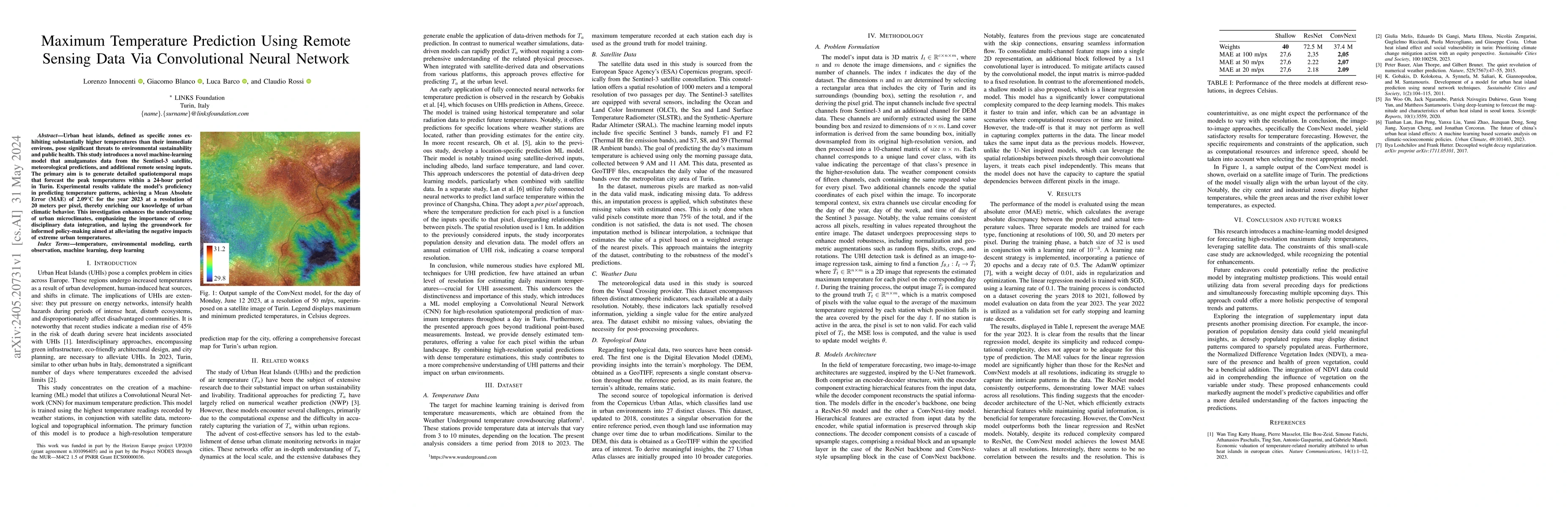
Urban heat islands, defined as specific zones exhibiting substantially higher temperatures than their immediate environs, pose significant threats to environmental sustainability and public health. ...
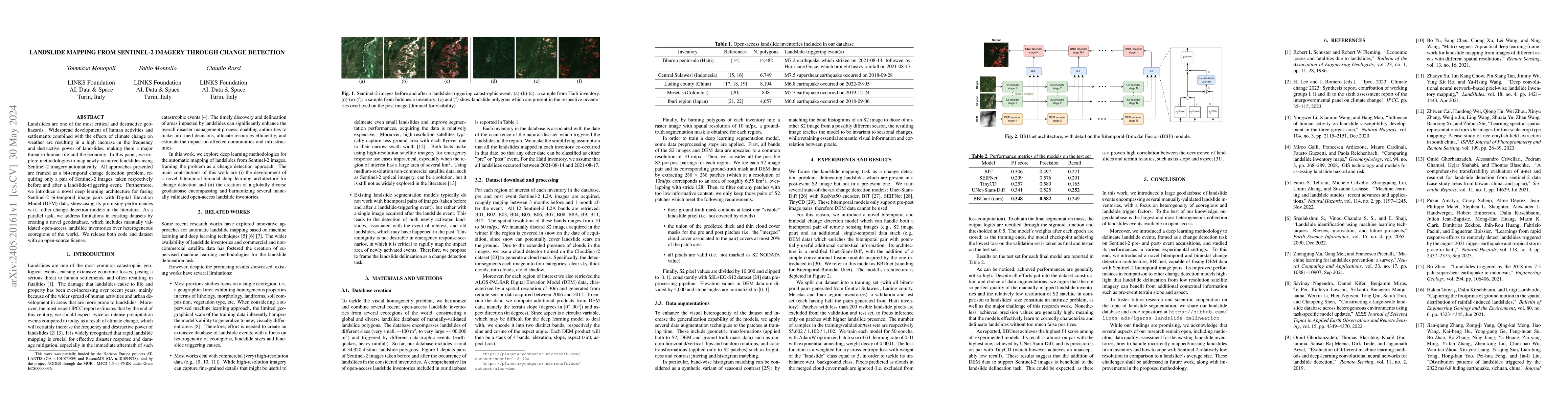
Landslides are one of the most critical and destructive geohazards. Widespread development of human activities and settlements combined with the effects of climate change on weather are resulting in...
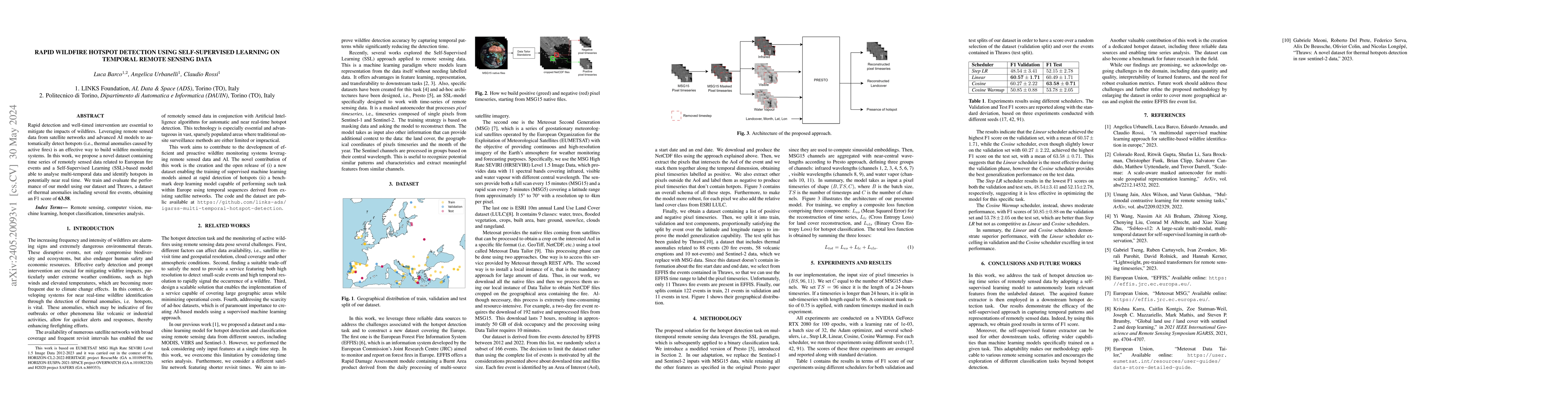
Rapid detection and well-timed intervention are essential to mitigate the impacts of wildfires. Leveraging remote sensed data from satellite networks and advanced AI models to automatically detect h...
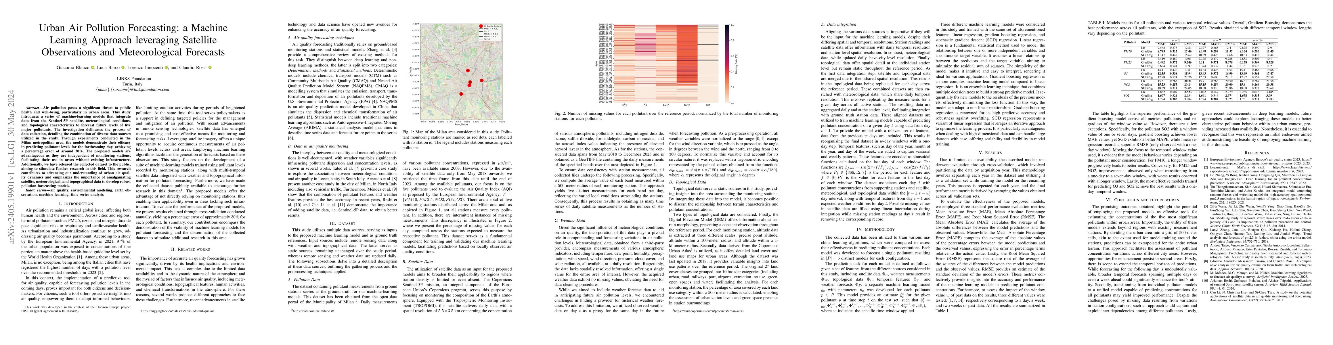
Air pollution poses a significant threat to public health and well-being, particularly in urban areas. This study introduces a series of machine-learning models that integrate data from the Sentinel...
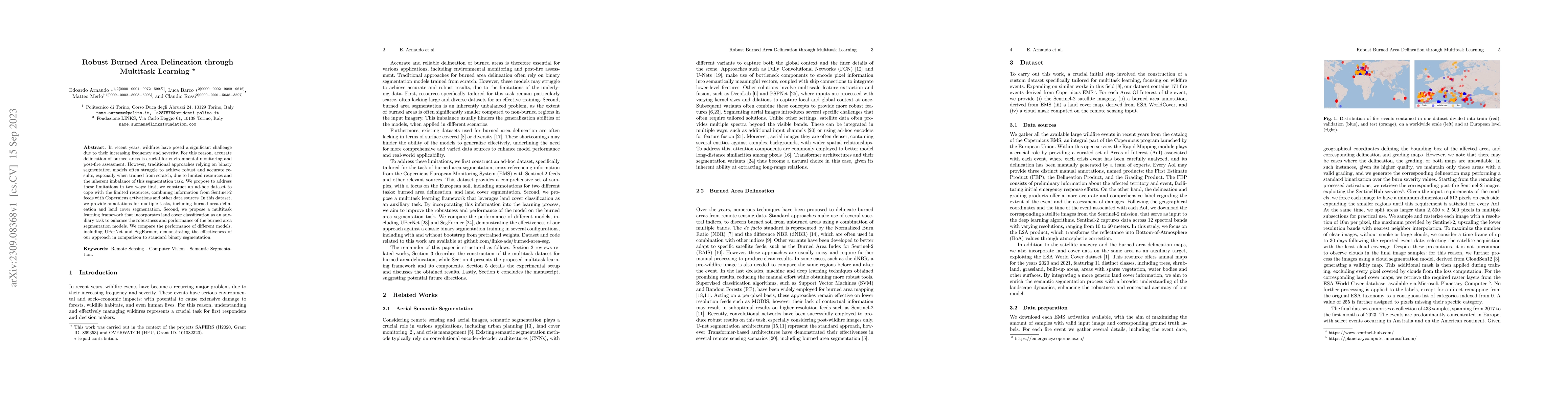
In recent years, wildfires have posed a significant challenge due to their increasing frequency and severity. For this reason, accurate delineation of burned areas is crucial for environmental monit...
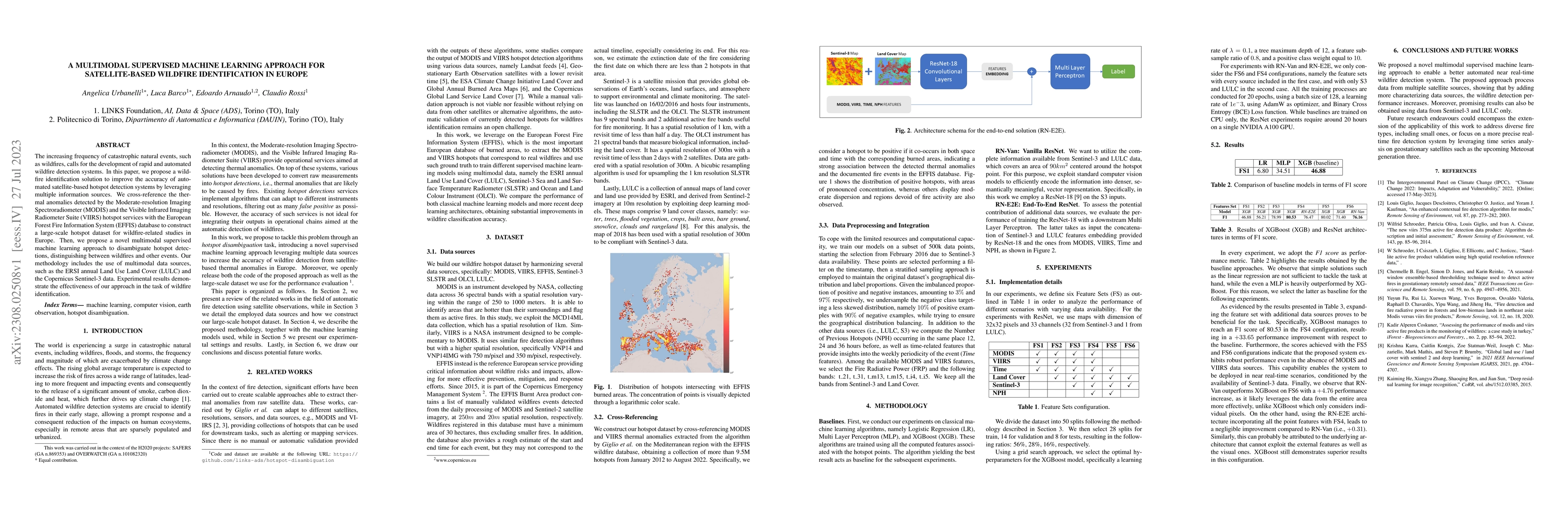
The increasing frequency of catastrophic natural events, such as wildfires, calls for the development of rapid and automated wildfire detection systems. In this paper, we propose a wildfire identifi...
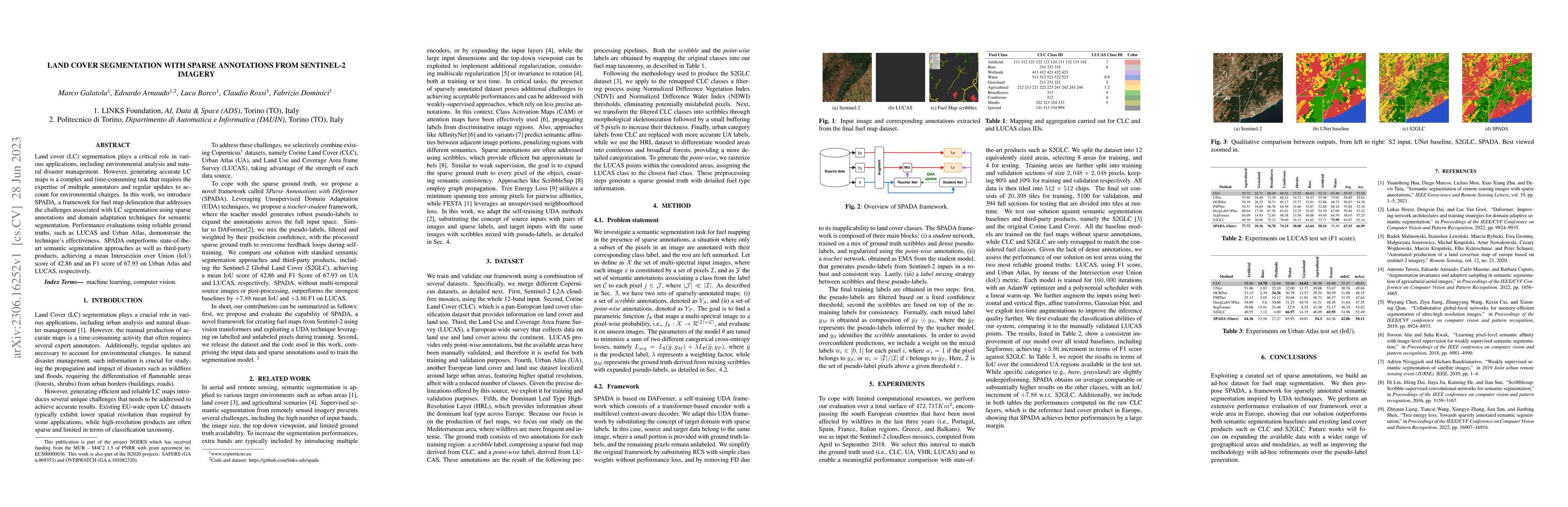
Land cover (LC) segmentation plays a critical role in various applications, including environmental analysis and natural disaster management. However, generating accurate LC maps is a complex and ti...
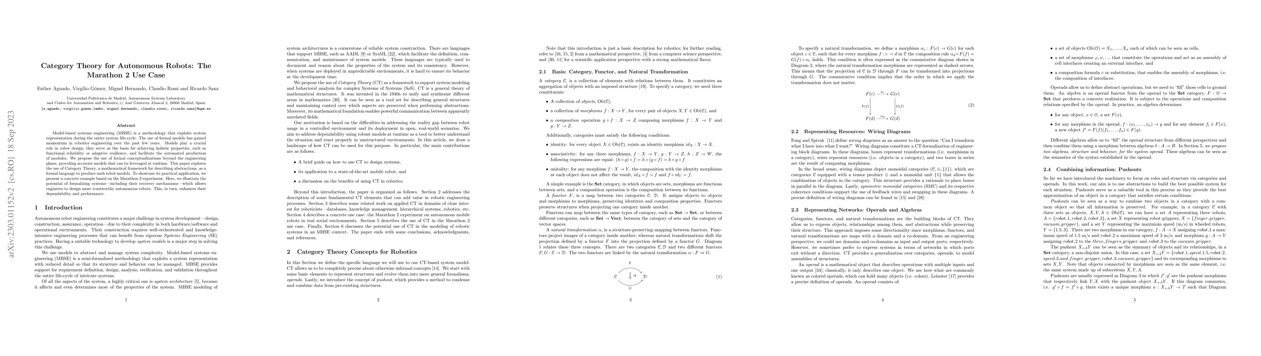
Model-based systems engineering (MBSE) is a methodology that exploits system representation during the entire system life-cycle. The use of formal models has gained momentum in robotics engineering ...
Incremental learning represents a crucial task in aerial image processing, especially given the limited availability of large-scale annotated datasets. A major issue concerning current deep neural a...
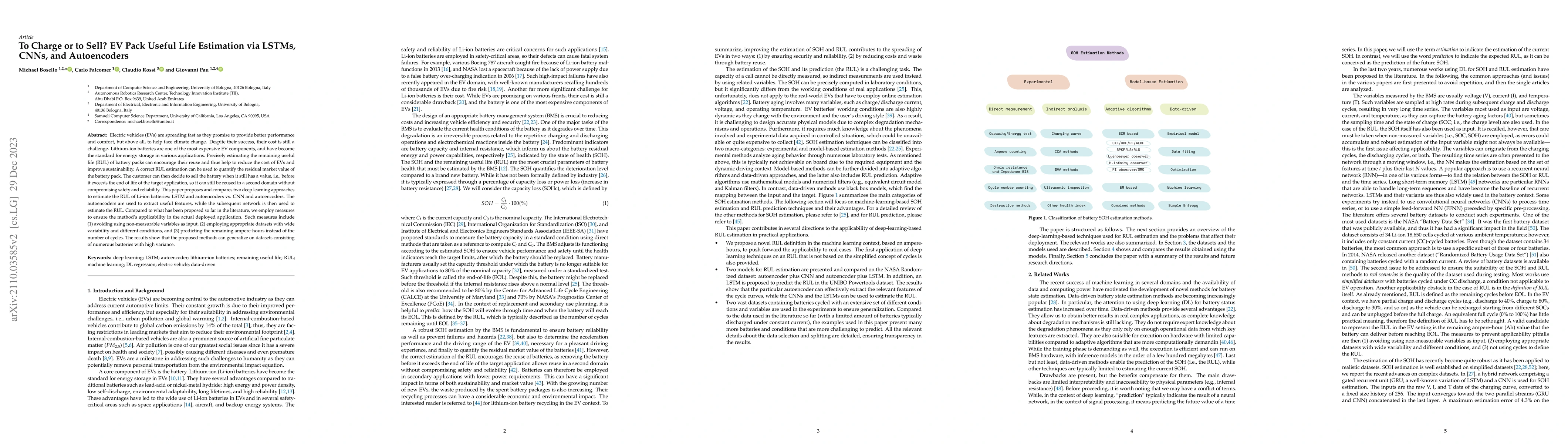
Electric vehicles (EVs) are spreading fast as they promise to provide better performance and comfort, but above all, to help face climate change. Despite their success, their cost is still a challen...
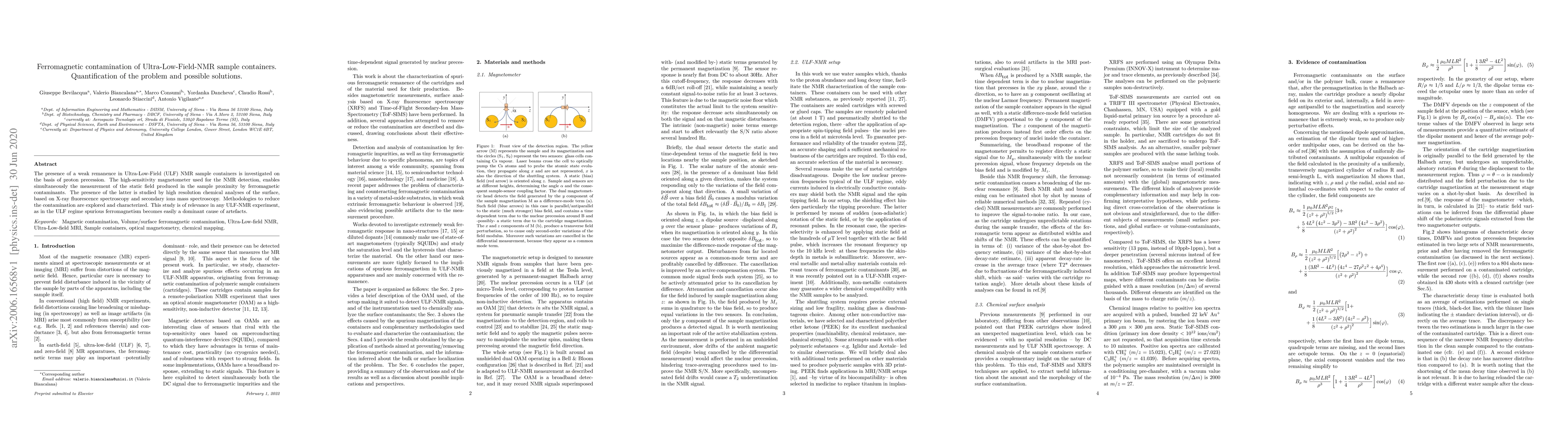
The presence of a weak remanence in Ultra-Low-Field (ULF) NMR sample containers is investigated on the basis of proton precession. The high-sensitivity magnetometer used for the NMR detection, enabl...
The preservation of cultural heritage faces increasing threats from climate change effects and environmental hazards, demanding innovative solutions that can promote awareness and resilience. This pap...