Secure Navigation using Landmark-based Localization in a GPS-denied Environment
Publication
Metrics
AI Quick Summary
This paper proposes a landmark-based localization framework (LanBLoc) integrated with an Extended Kalman Filter (EKF) for secure navigation in GPS-denied environments. The method ensures safe trajectories by incorporating identifiable landmarks and hazard maps, achieving a 6.51% lengthwise error and a 2.97m Average Displacement Error in simulations, demonstrating improved safety and operational effectiveness.
Paper Preview
Abstract
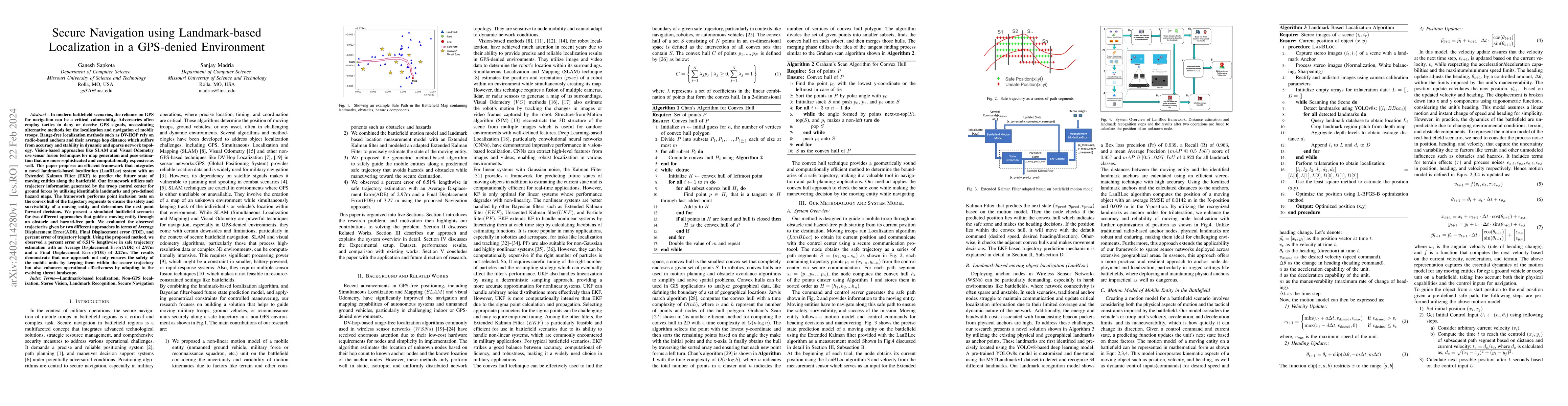
In modern battlefield scenarios, the reliance on GPS for navigation can be a critical vulnerability. Adversaries often employ tactics to deny or deceive GPS signals, necessitating alternative methods for the localization and navigation of mobile troops. Range-free localization methods such as DV-HOP rely on radio-based anchors and their average hop distance which suffers from accuracy and stability in a dynamic and sparse network topology. Vision-based approaches like SLAM and Visual Odometry use sensor fusion techniques for map generation and pose estimation that are more sophisticated and computationally expensive. This paper proposes a novel framework that integrates landmark-based localization (LanBLoc) with an Extended Kalman Filter (EKF) to predict the future state of moving entities along the battlefield. Our framework utilizes safe trajectory information generated by the troop control center by considering identifiable landmarks and pre-defined hazard maps. It performs point inclusion tests on the convex hull of the trajectory segments to ensure the safety and survivability of a moving entity and determines the next point forward decisions. We present a simulated battlefield scenario for two different approaches (with EKF and without EKF) that guide a moving entity through an obstacle and hazard-free path. Using the proposed method, we observed a percent error of 6.51% lengthwise in safe trajectory estimation with an Average Displacement Error (ADE) of 2.97m and a Final Displacement Error (FDE) of 3.27m. The results demonstrate that our approach not only ensures the safety of the mobile units by keeping them within the secure trajectory but also enhances operational effectiveness by adapting to the evolving threat landscape.
AI Key Findings
Get AI-generated insights about this paper's methodology, results, significance, and more — seven facets brought into focus.
Impact
Paper Details
Authors
PDF Preview
Key Terms
Citation Network
Current paper (gray), citations (green), references (blue)
Display is limited for performance on very large graphs.
Discussion 0