Academic Profile
Statistics
Similar Authors
Papers on arXiv
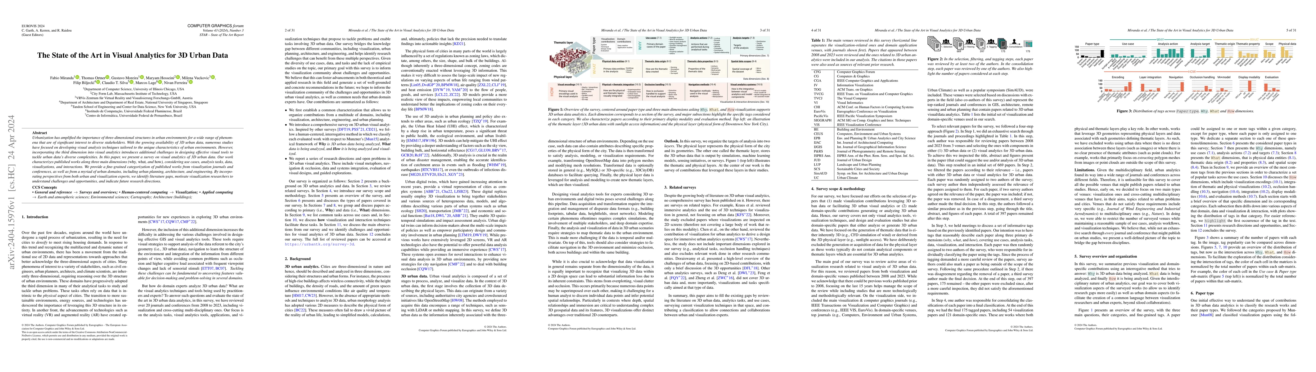
Urbanization has amplified the importance of three-dimensional structures in urban environments for a wide range of phenomena that are of significant interest to diverse stakeholders. With the growi...
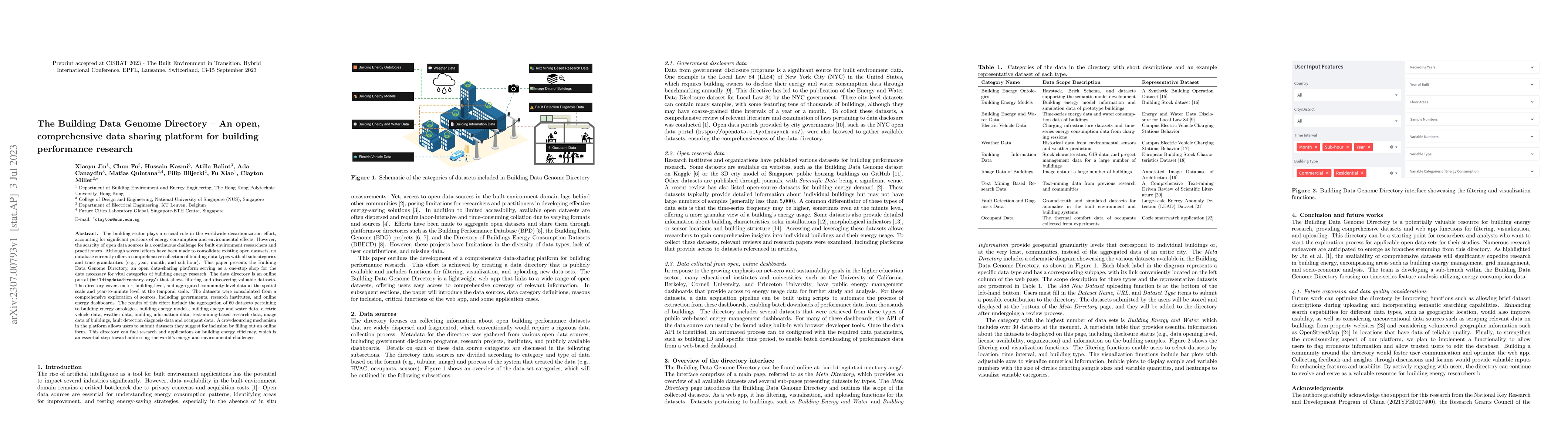
The building sector plays a crucial role in the worldwide decarbonization effort, accounting for significant portions of energy consumption and environmental effects. However, the scarcity of open d...
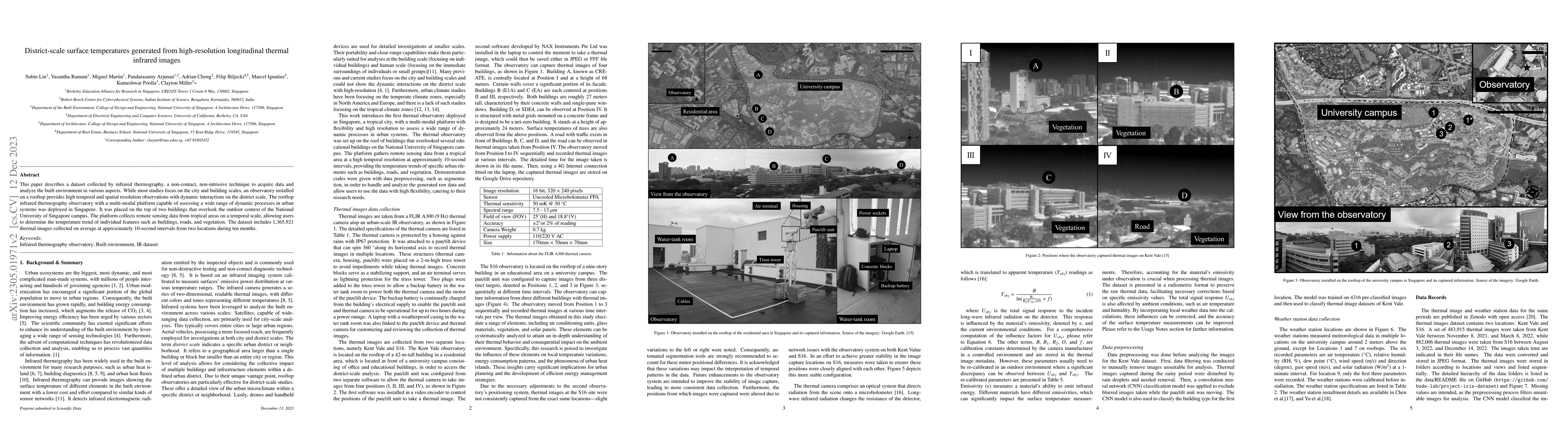
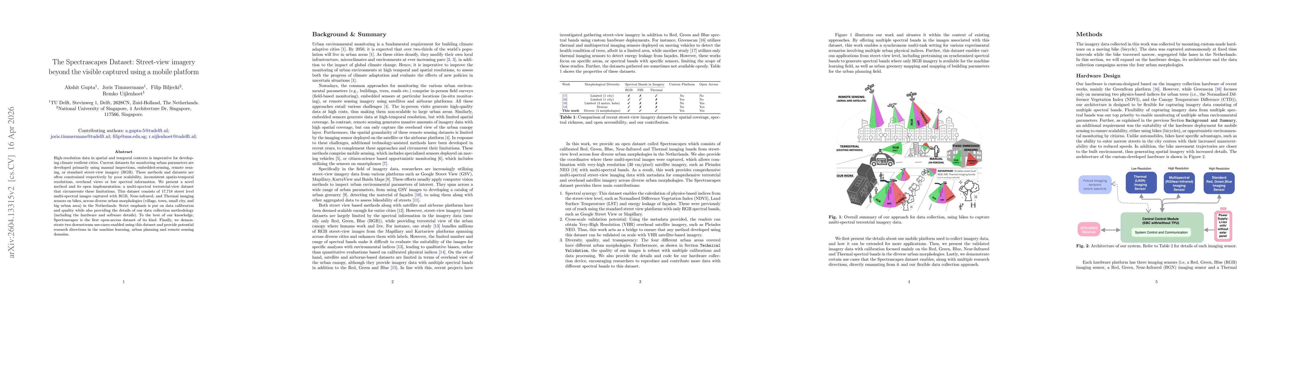
The paper describes a dataset that was collected by infrared thermography, which is a non-contact, non-intrusive technique to collect data and analyze the built environment in various aspects. While...
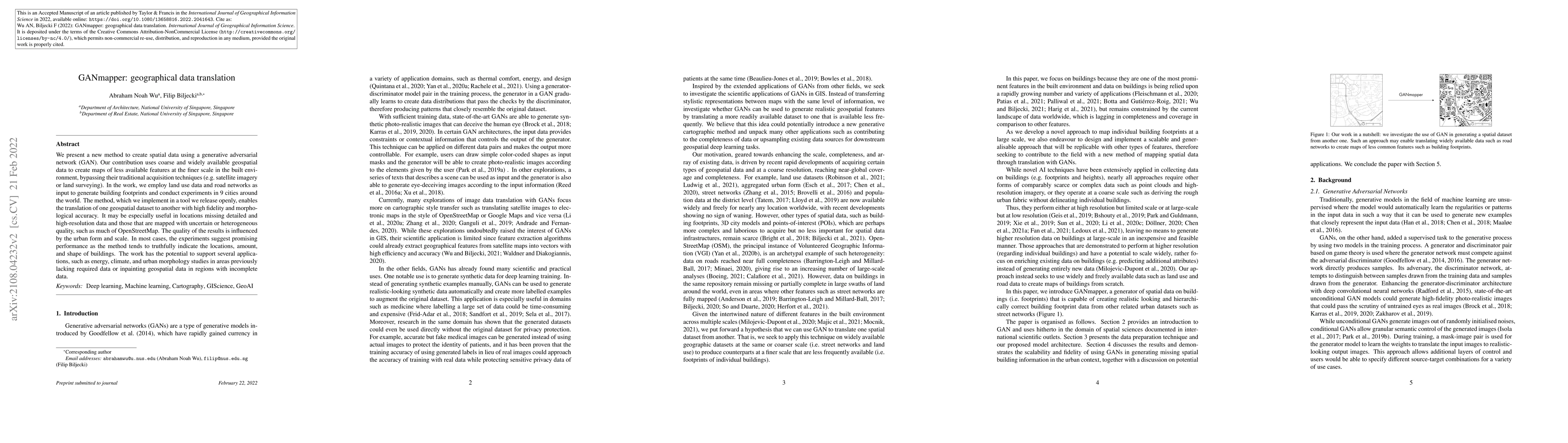
We present a new method to create spatial data using a generative adversarial network (GAN). Our contribution uses coarse and widely available geospatial data to create maps of less available featur...
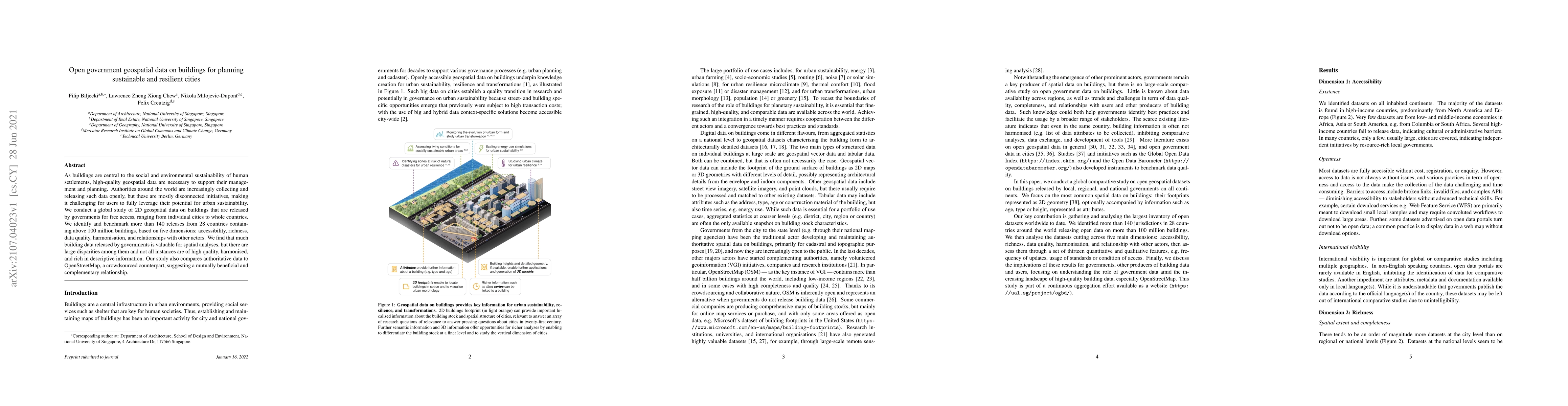
As buildings are central to the social and environmental sustainability of human settlements, high-quality geospatial data are necessary to support their management and planning. Authorities around ...
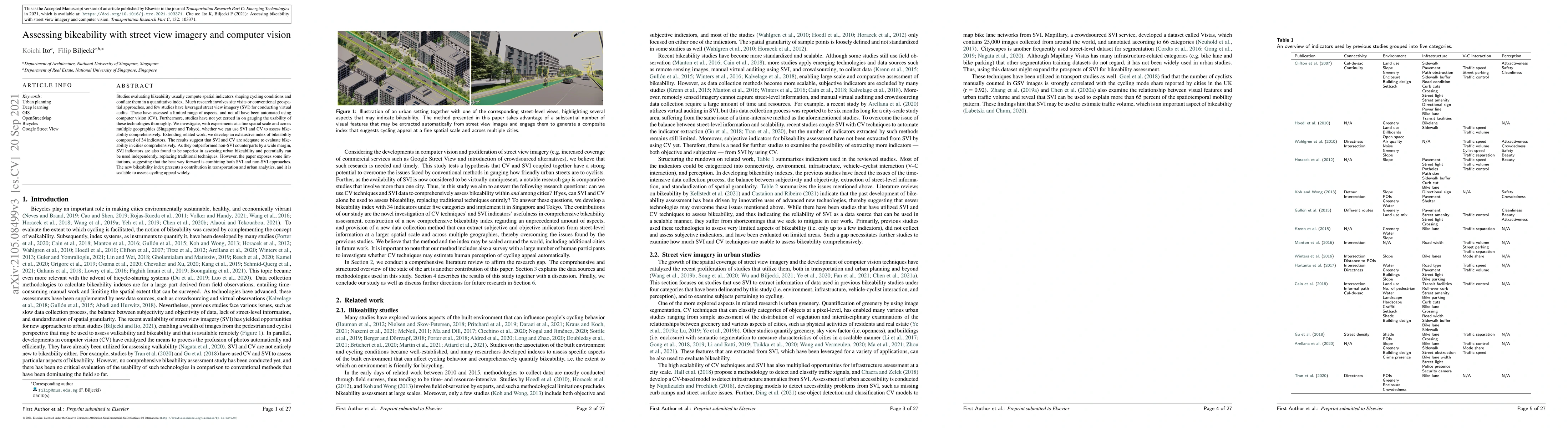
Studies evaluating bikeability usually compute spatial indicators shaping cycling conditions and conflate them in a quantitative index. Much research involves site visits or conventional geospatial ...
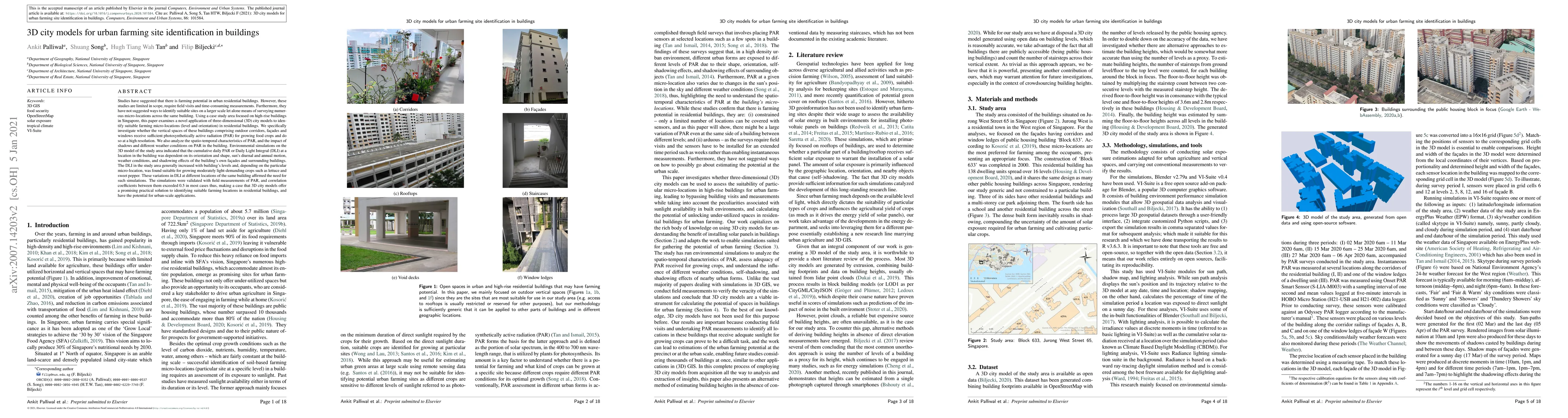
Studies have suggested that there is farming potential in residential buildings. However, these studies are limited in scope, require field visits and time-consuming measurements. Furthermore, they ...
Street View Imagery (SVI) has emerged as a valuable data form in urban studies, enabling new ways to map and sense urban environments. However, fundamental concerns regarding the representativeness, q...
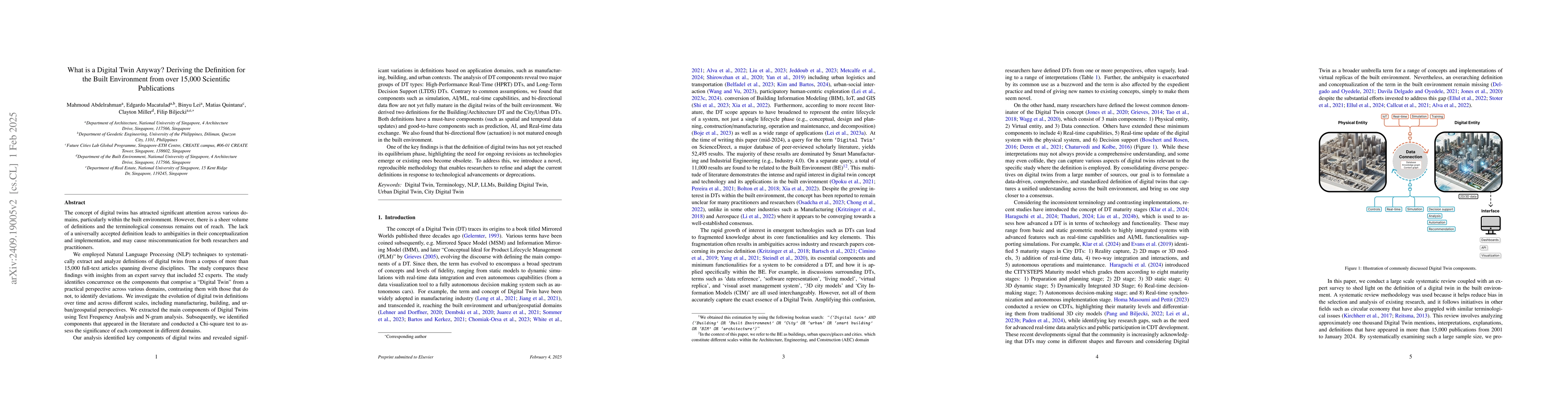
The concept of digital twins has attracted significant attention across various domains, particularly within the built environment. However, there is a sheer volume of definitions and the terminologic...
In response to climate change and urban heat island effects, enhancing human thermal comfort in cities is crucial for sustainable urban development. Traditional methods for investigating the urban the...
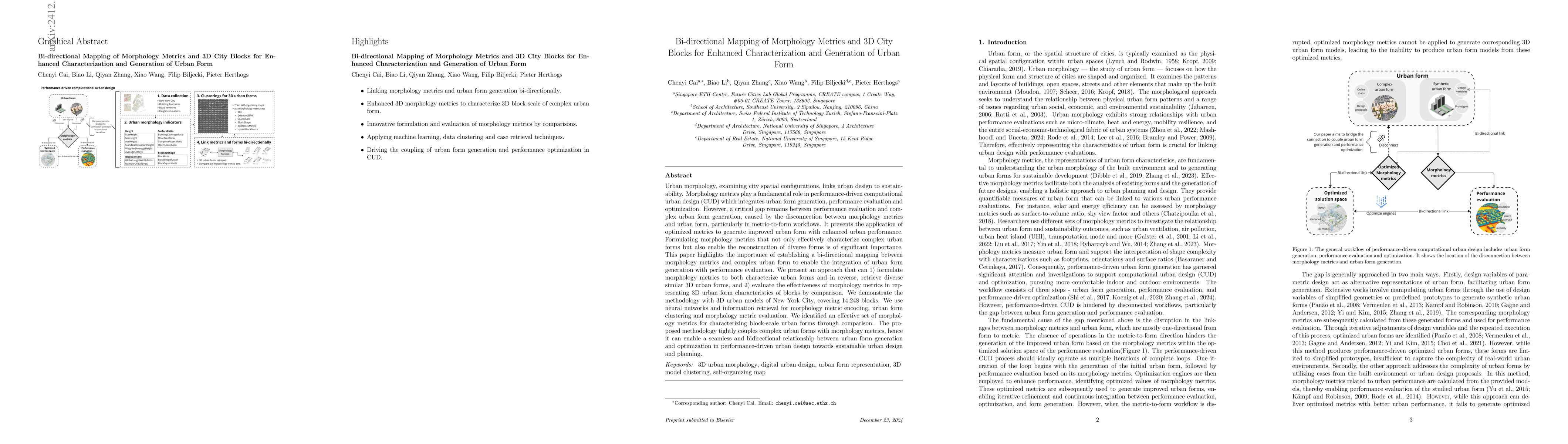
Urban morphology, examining city spatial configurations, links urban design to sustainability. Morphology metrics play a fundamental role in performance-driven computational urban design (CUD) which i...
Street view imagery (SVI) has been instrumental in many studies in the past decade to understand and characterize street features and the built environment. Researchers across a variety of domains, su...
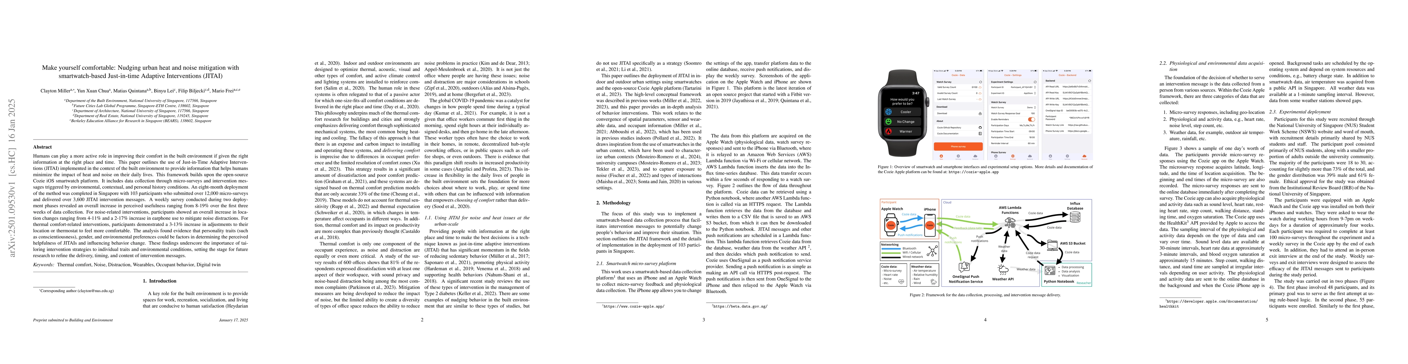
Humans can play a more active role in improving their comfort in the built environment if given the right information at the right place and time. This paper outlines the use of Just-in-Time Adaptive ...
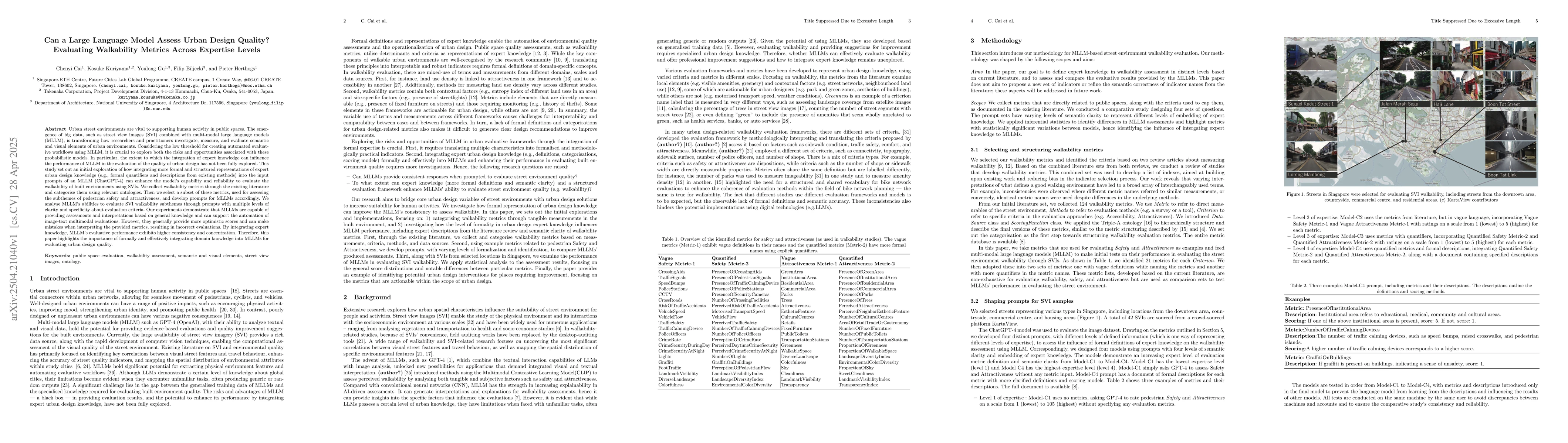
Urban street environments are vital to supporting human activity in public spaces. The emergence of big data, such as street view images (SVIs) combined with multimodal large language models (MLLMs), ...
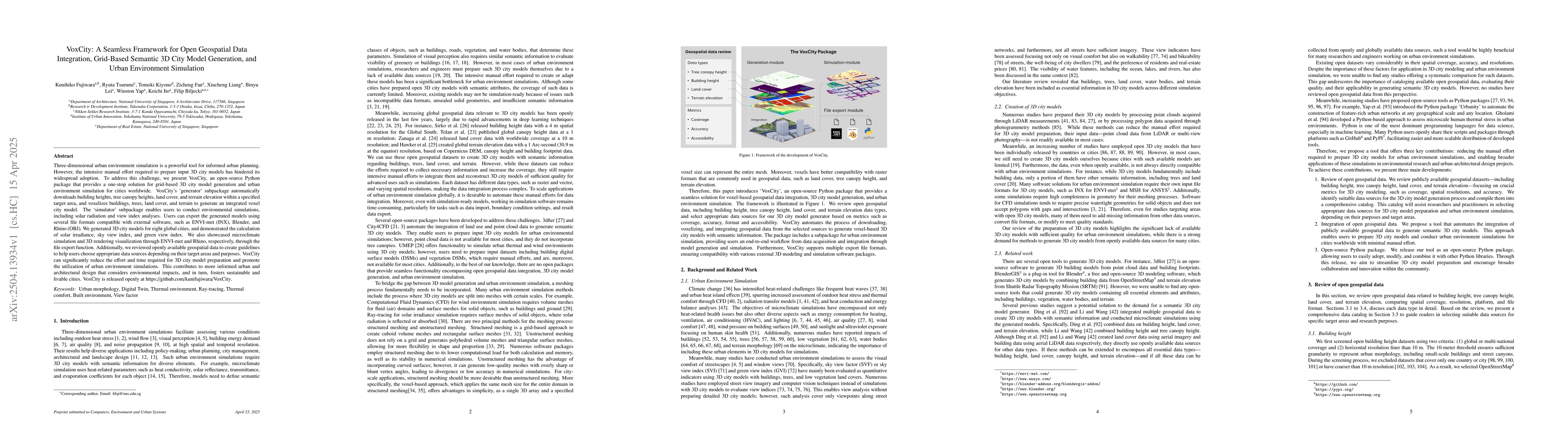
Three-dimensional urban environment simulation is a powerful tool for informed urban planning. However, the intensive manual effort required to prepare input 3D city models has hindered its widespread...
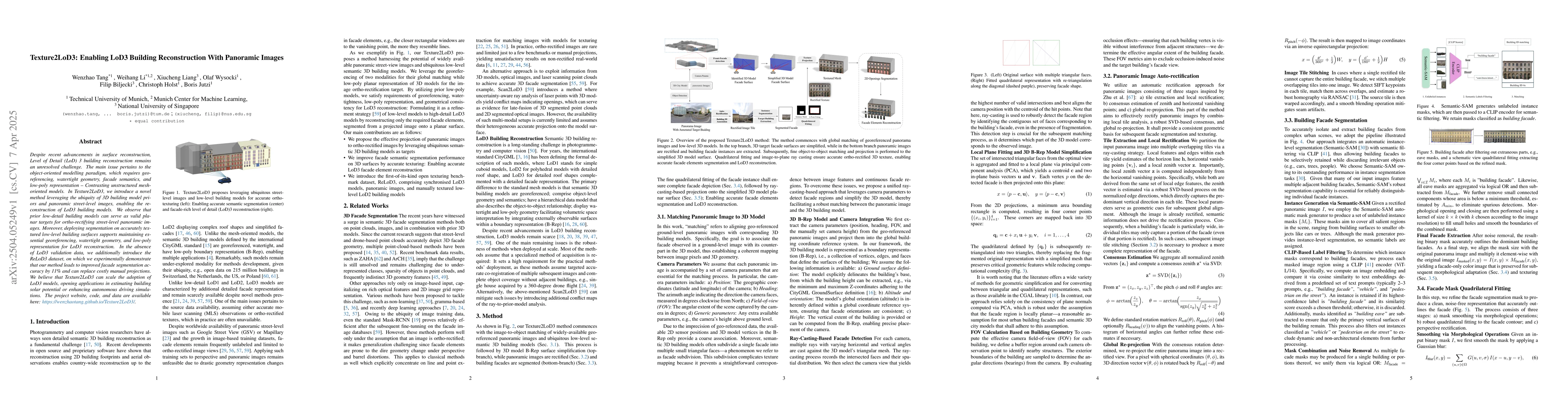
Despite recent advancements in surface reconstruction, Level of Detail (LoD) 3 building reconstruction remains an unresolved challenge. The main issue pertains to the object-oriented modelling paradig...
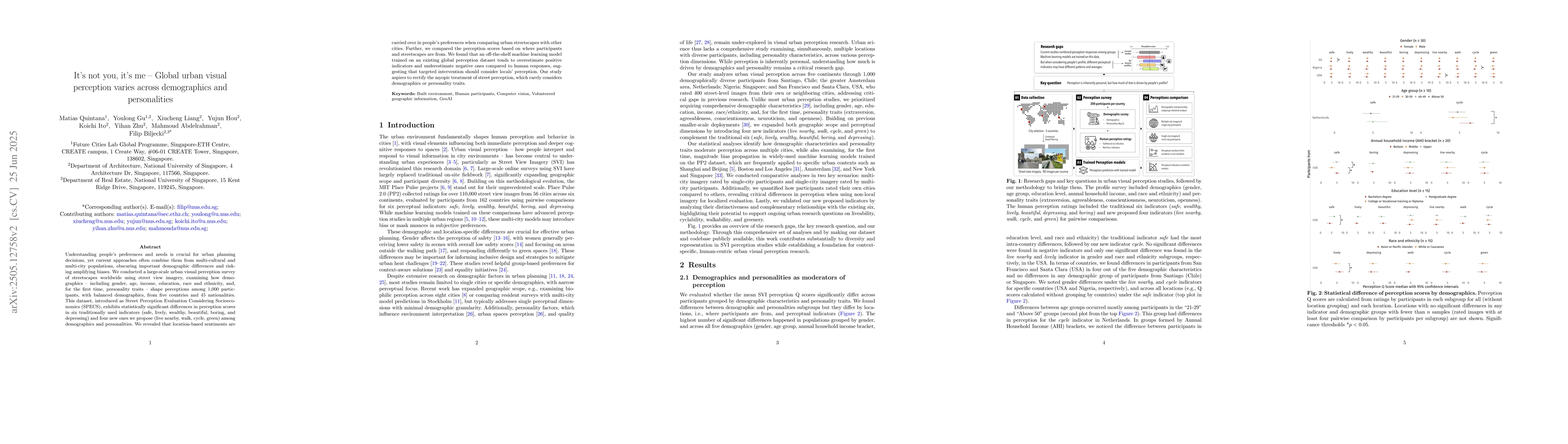
Understanding people's preferences and needs is crucial for urban planning decisions, yet current approaches often combine them from multi-cultural and multi-city populations, obscuring important demo...
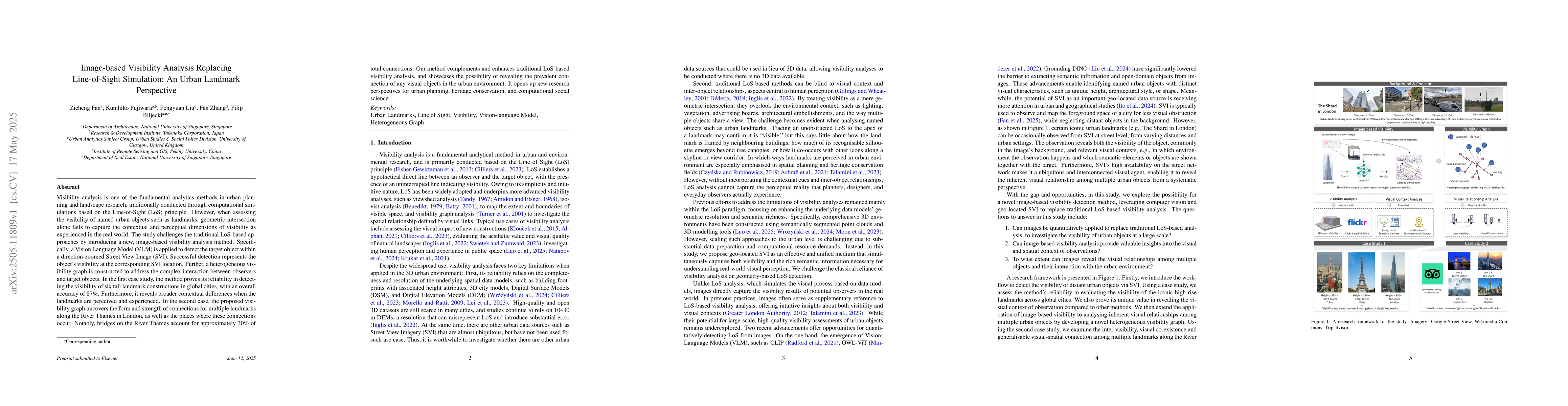
Visibility analysis is one of the fundamental analytics methods in urban planning and landscape research, traditionally conducted through computational simulations based on the Line-of-Sight (LoS) pri...
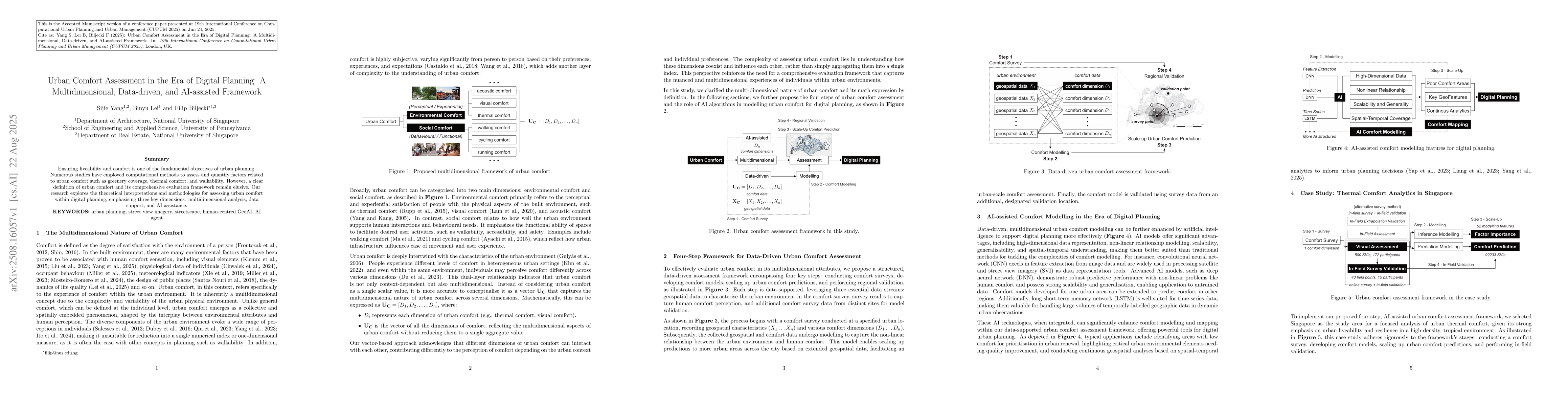
Ensuring liveability and comfort is one of the fundamental objectives of urban planning. Numerous studies have employed computational methods to assess and quantify factors related to urban comfort su...
Quantifying and assessing urban greenery is consequential for planning and development, reflecting the everlasting importance of green spaces for multiple climate and well-being dimensions of cities. ...
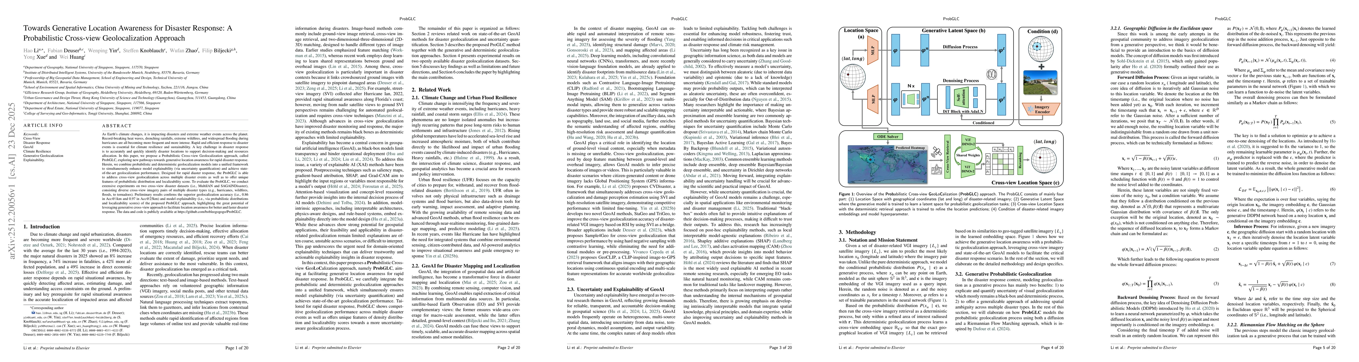
As Earth's climate changes, it is impacting disasters and extreme weather events across the planet. Record-breaking heat waves, drenching rainfalls, extreme wildfires, and widespread flooding during h...
High-resolution data in spatial and temporal contexts is imperative for developing climate resilient cities. Current datasets for monitoring urban parameters are developed primarily using manual inspe...
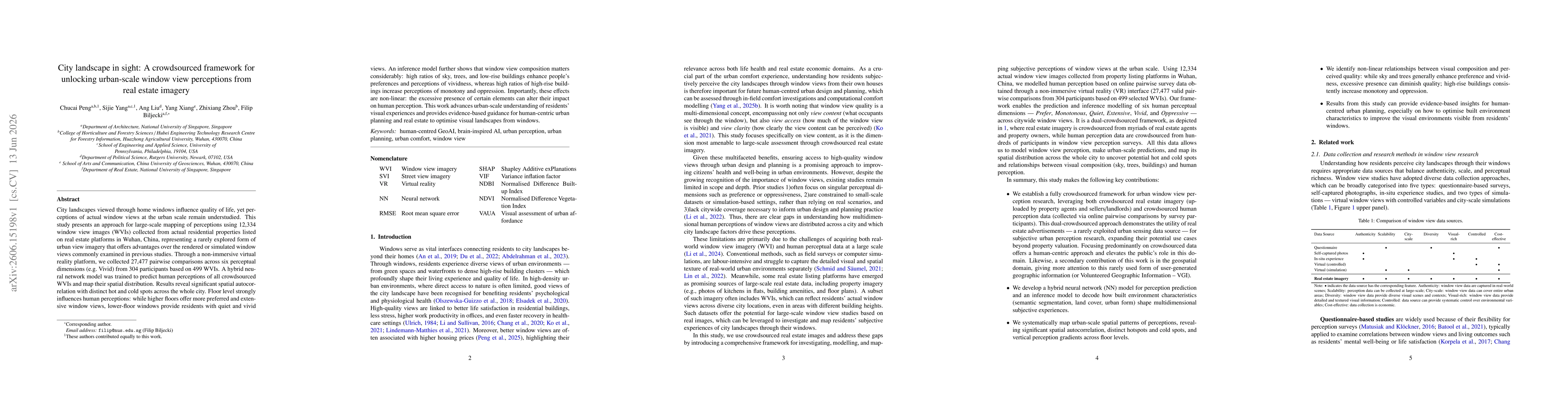
City landscapes viewed through home windows influence quality of life, yet perceptions of actual window views at the urban scale remain understudied. This study presents an approach for large-scale ma...
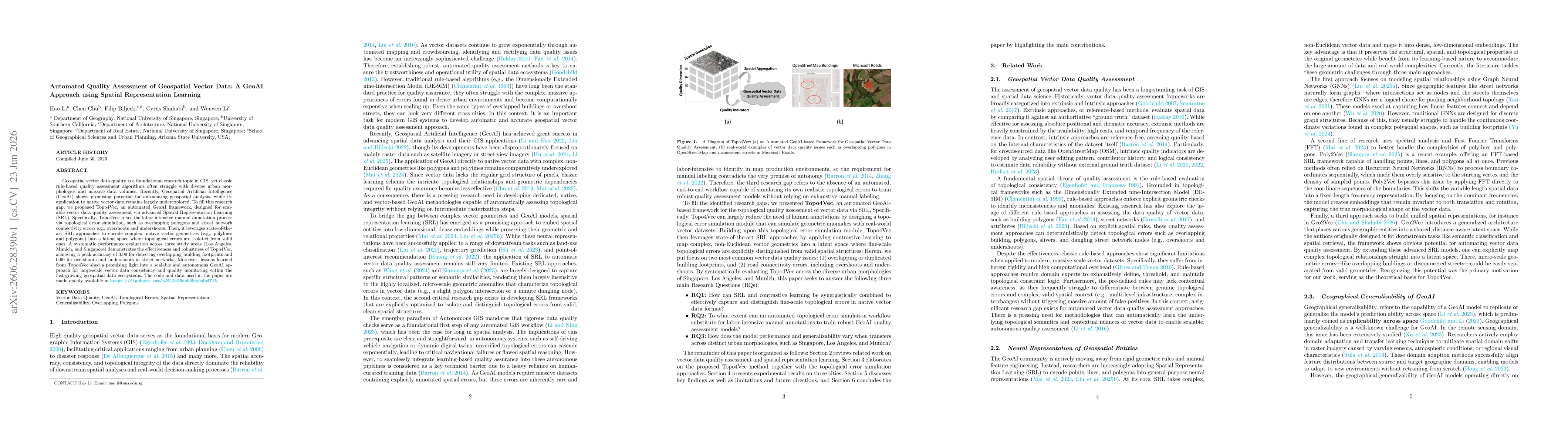
Geospatial vector data quality is a foundational research topic in GIS, yet classic rule-based quality assessment algorithms often struggle with diverse urban morphologies and massive data volumes. Re...