Academic Profile
Statistics
Similar Authors
Papers on arXiv
Transportation networks play a crucial role in human mobility, the exchange of goods, and the spread of invasive species. With 90% of world trade carried by sea, the global network of merchant ships...
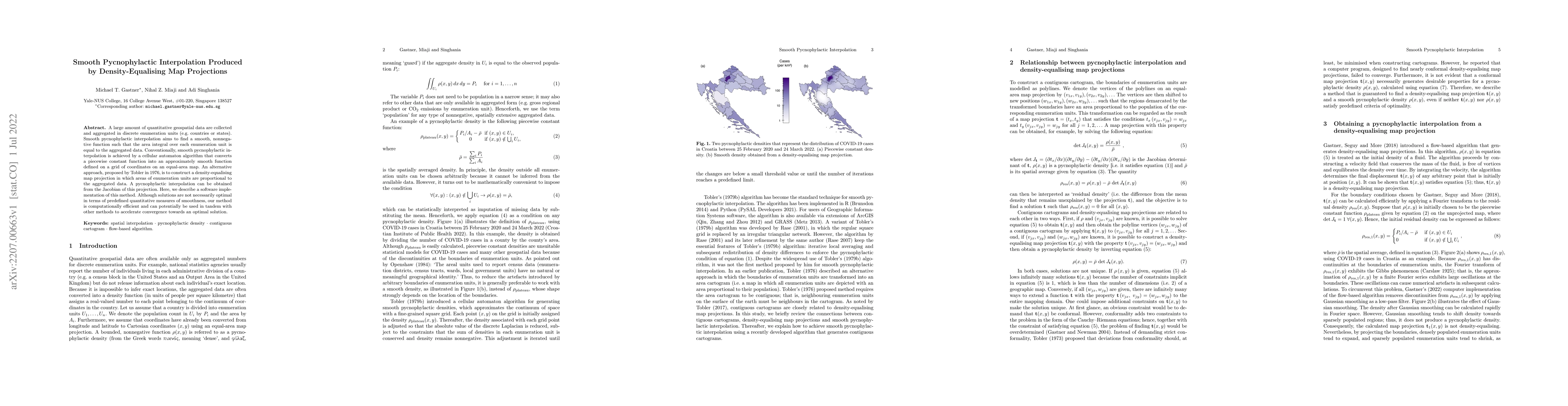
A large amount of quantitative geospatial data are collected and aggregated in discrete enumeration units (e.g. countries or states). Smooth pycnophylactic interpolation aims to find a smooth, nonne...
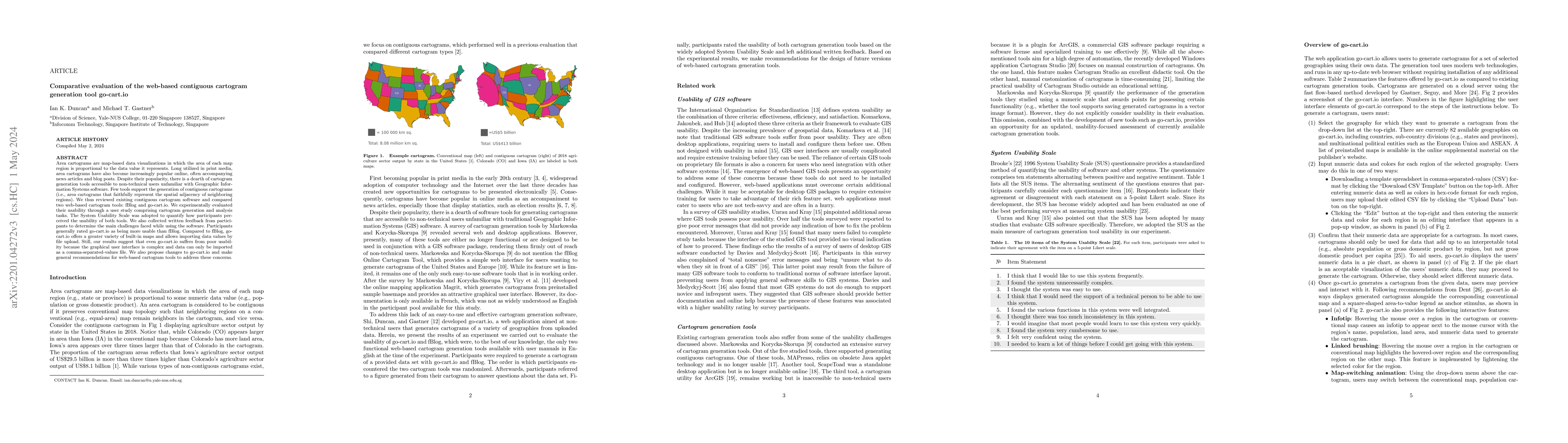
Area cartograms are map-based data visualizations in which the area of each map region is proportional to the data value it represents. Long utilized in print media, area cartograms have also become...
A contiguous area cartogram is a geographic map in which the area of each region is proportional to numerical data (e.g., population size) while keeping neighboring regions connected. In this study,...
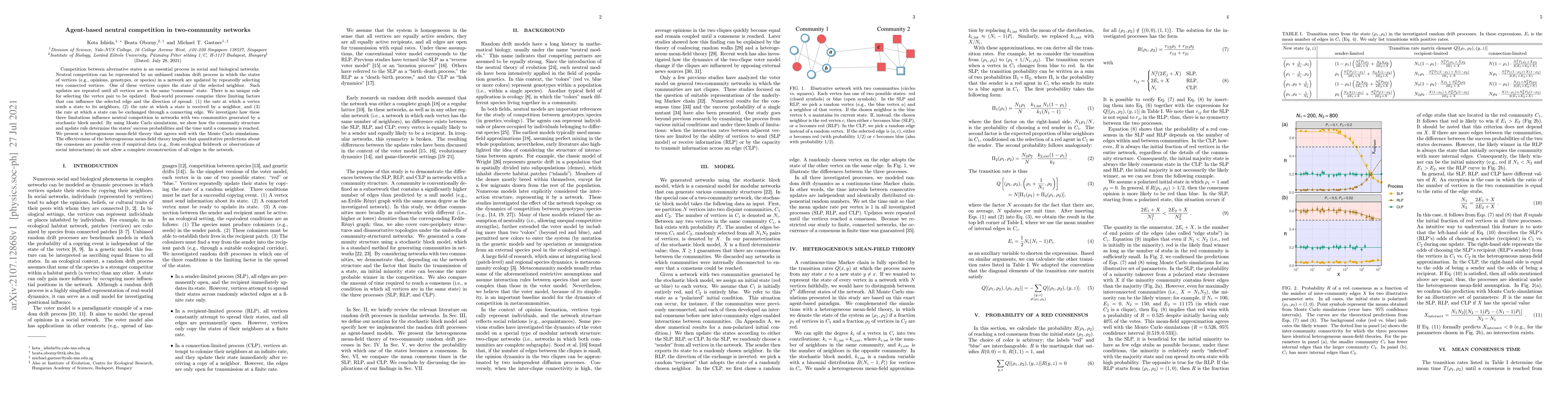
Competition between alternative states is an essential process in social and biological networks. Neutral competition can be represented by an unbiased random drift process in which the states of ve...
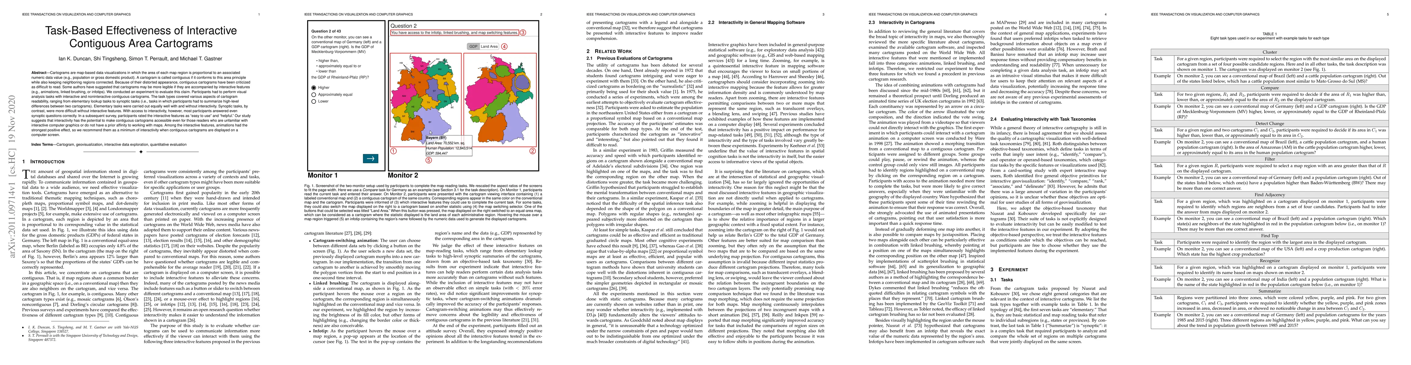
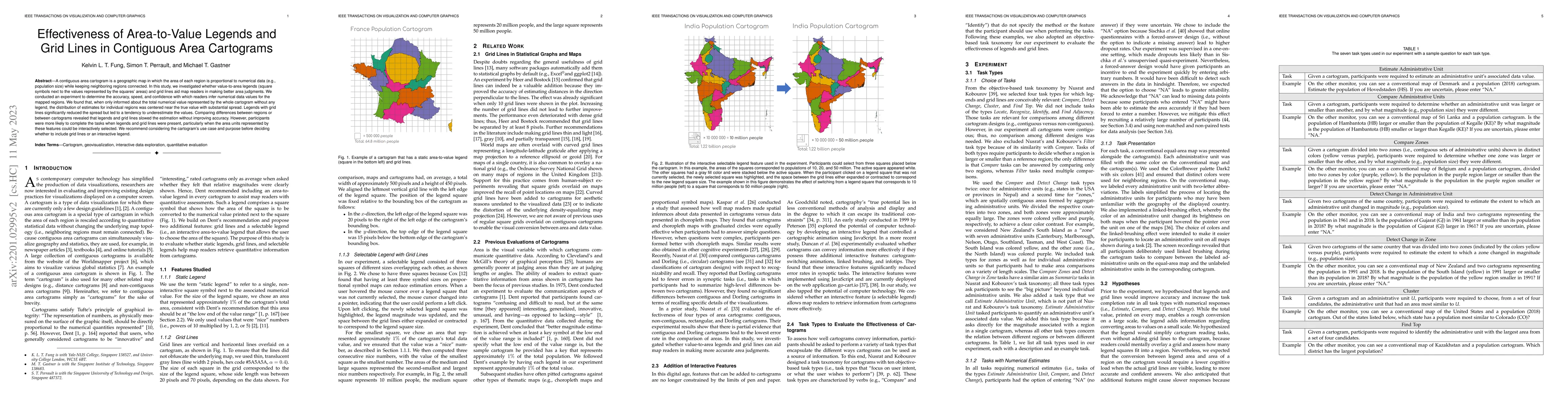
Cartograms are map-based data visualizations in which the area of each map region is proportional to an associated numeric data value (e.g., population or gross domestic product). A cartogram is cal...
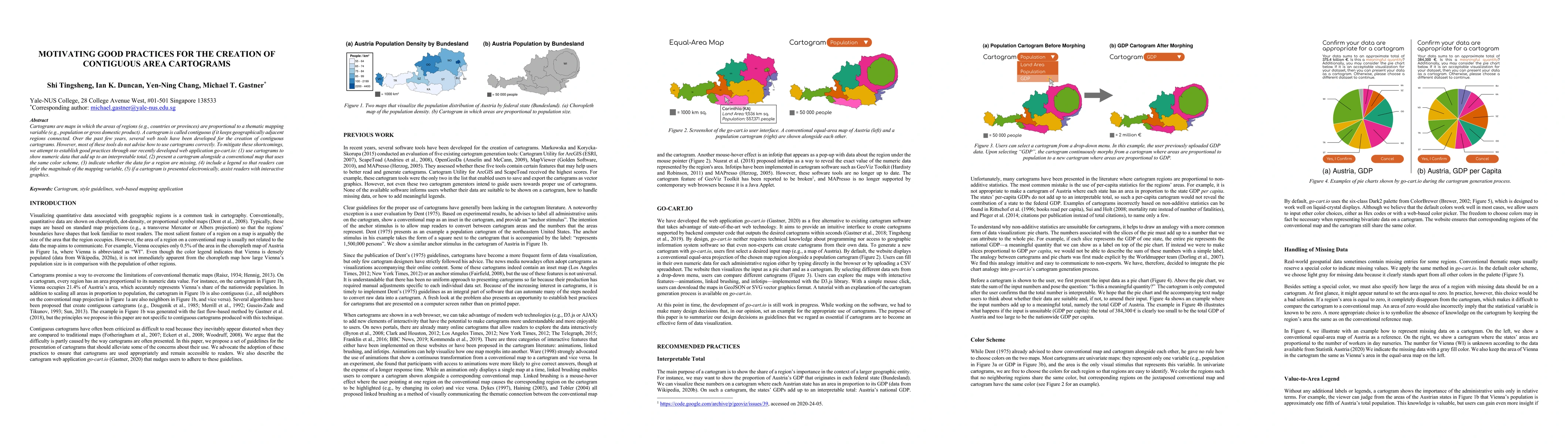
Cartograms are maps in which the areas of regions (e.g., countries or provinces) are proportional to a thematic mapping variable (e.g., population or gross domestic product). A cartogram is called c...
In many countries, the representation of women on corporate boards of directors has become a topic of intense political debate. Social networking plays a crucial role in the appointment to a board s...
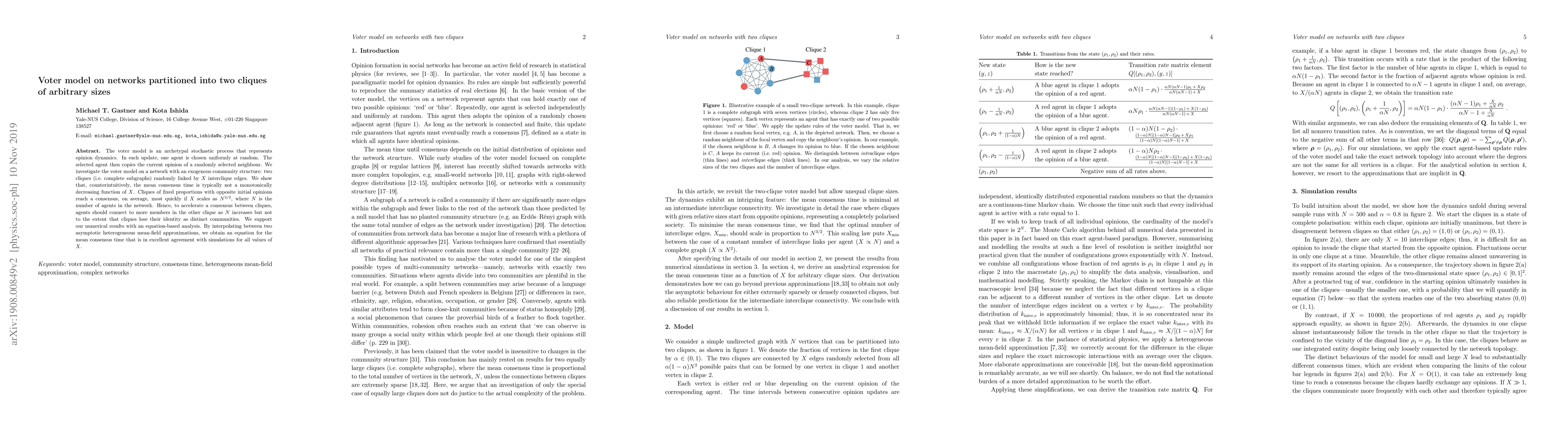
The voter model is an archetypal stochastic process that represents opinion dynamics. In each update, one agent is chosen uniformly at random. The selected agent then copies the current opinion of a...
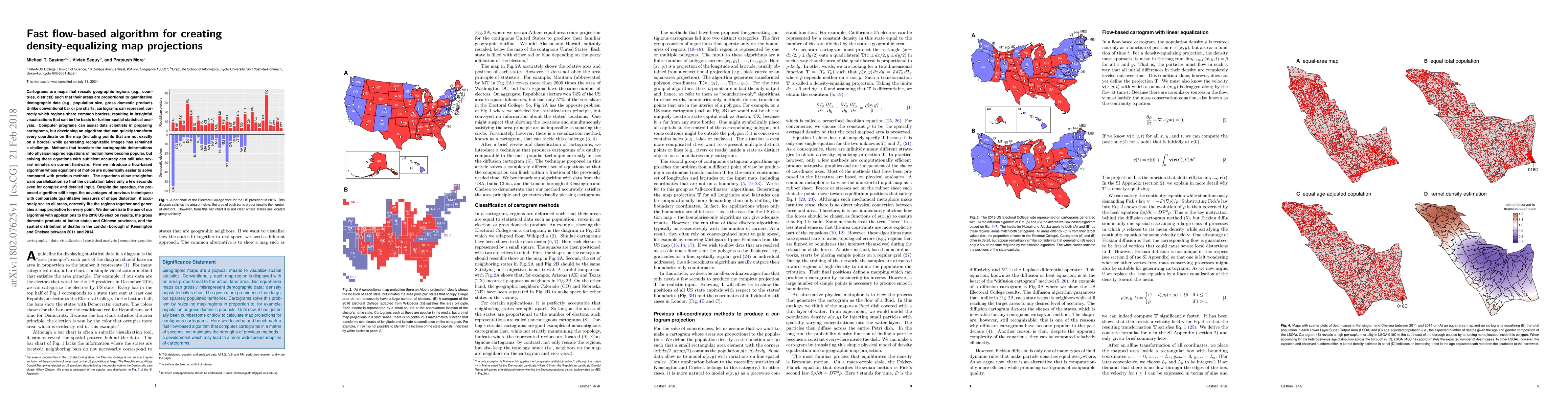
Cartograms are maps that rescale geographic regions (e.g., countries, districts) such that their areas are proportional to quantitative demographic data (e.g., population size, gross domestic produc...
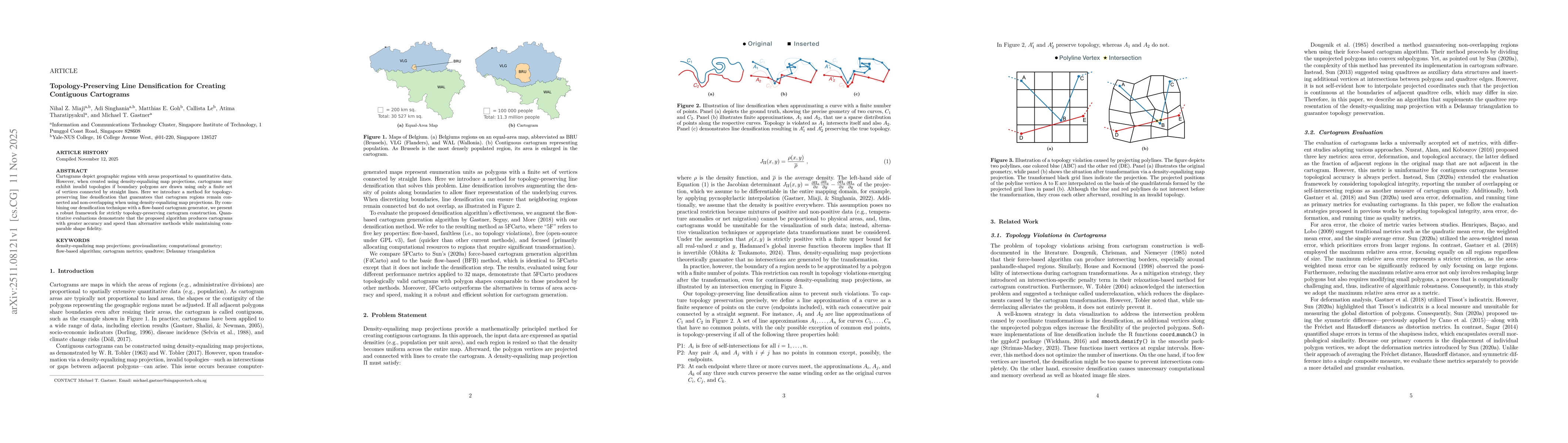
Cartograms depict geographic regions with areas proportional to quantitative data. However, when created using density-equalizing map projections, cartograms may exhibit invalid topologies if boundary...