Academic Profile
Statistics
Similar Authors
Papers on arXiv
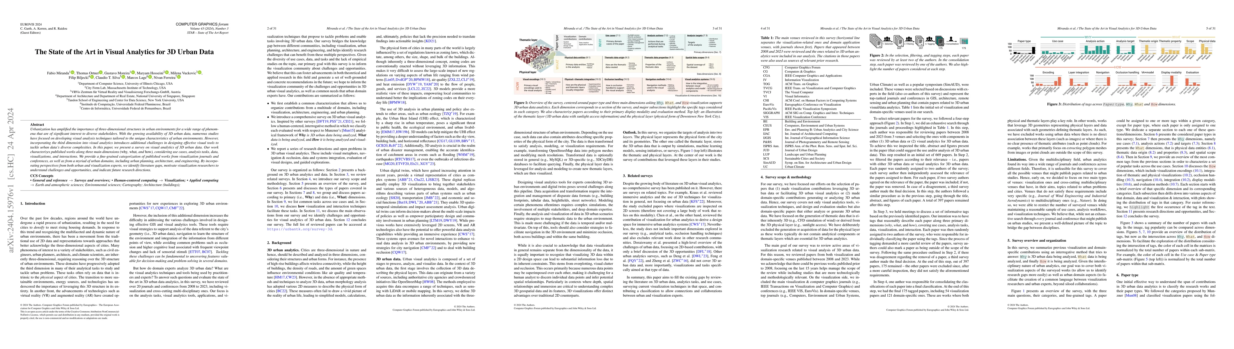
Urbanization has amplified the importance of three-dimensional structures in urban environments for a wide range of phenomena that are of significant interest to diverse stakeholders. With the growi...
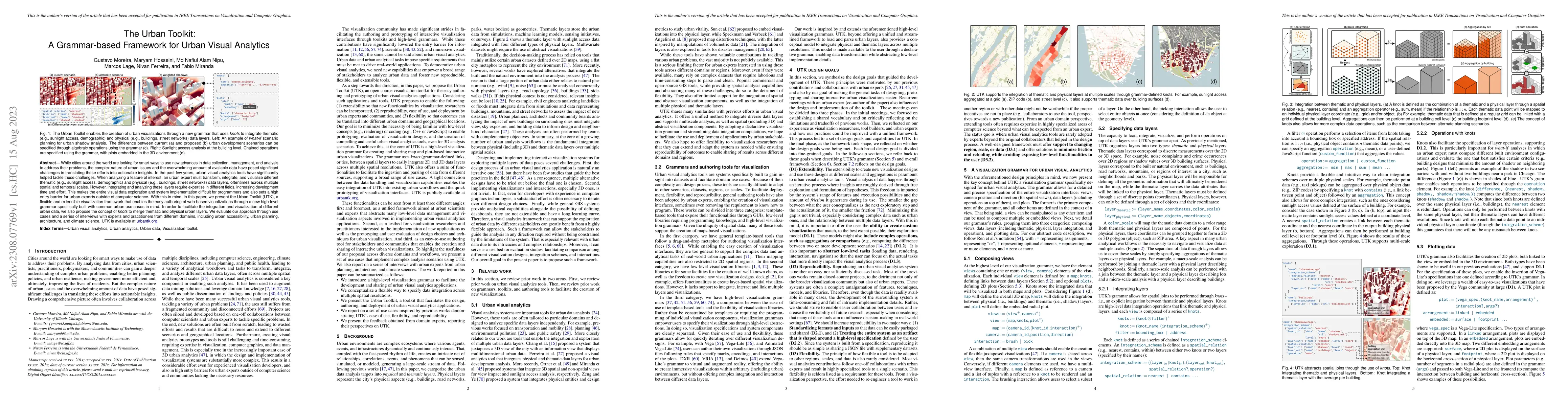
While cities around the world are looking for smart ways to use new advances in data collection, management, and analysis to address their problems, the complex nature of urban issues and the overwh...
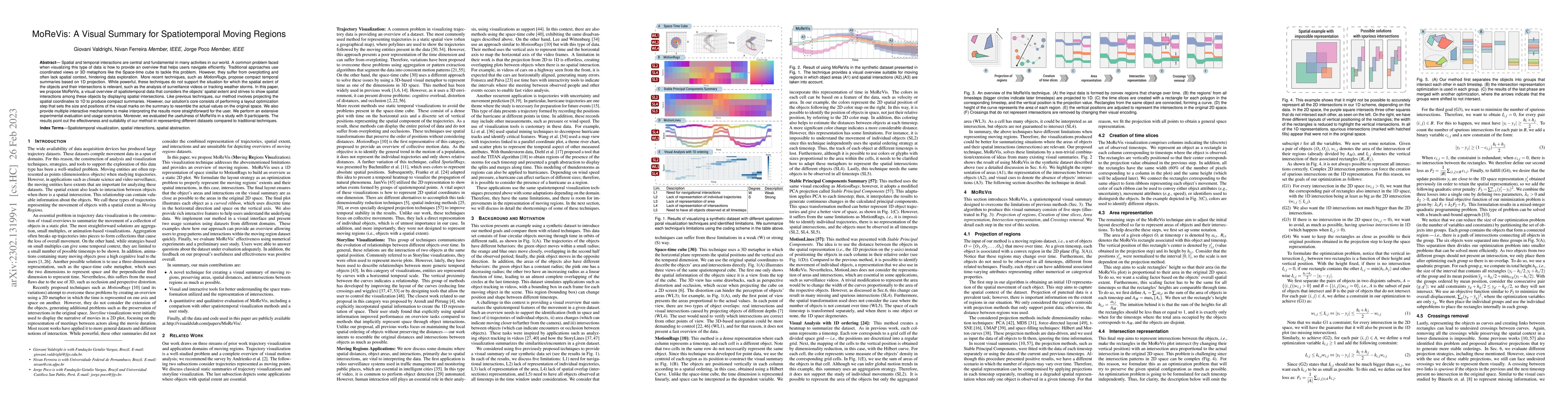
Spatial and temporal interactions are central and fundamental in many activities in our world. A common problem faced when visualizing this type of data is how to provide an overview that helps user...
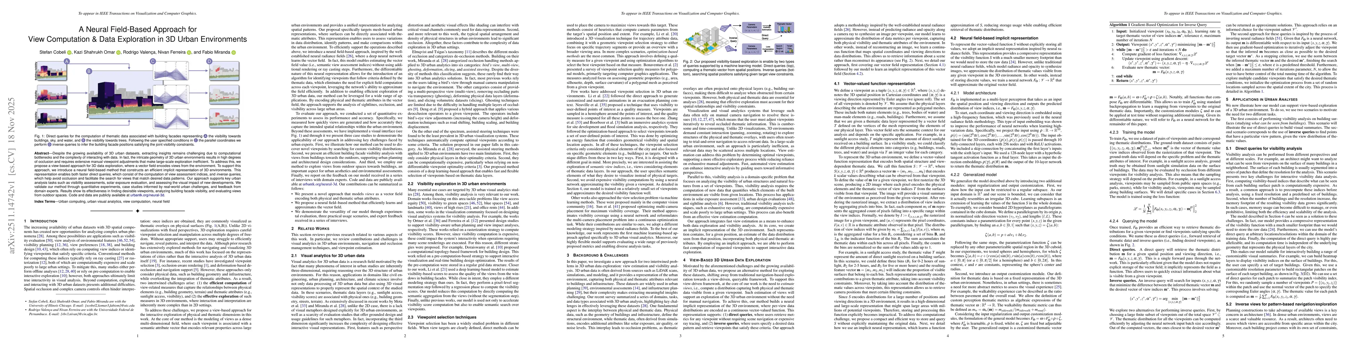
Recent technological innovations have led to an increase in the availability of 3D urban data, such as shadow, noise, solar potential, and earthquake simulations. These spatiotemporal datasets creat...
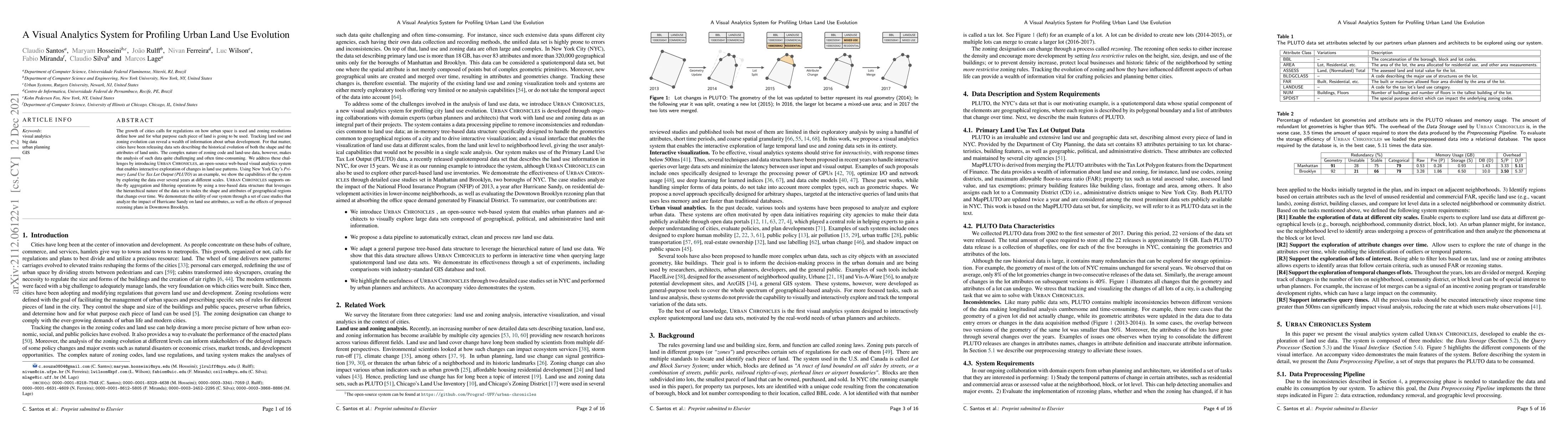
The growth of cities calls for regulations on how urban space is used and zoning resolutions define how and for what purpose each piece of land is going to be used. Tracking land use and zoning evol...
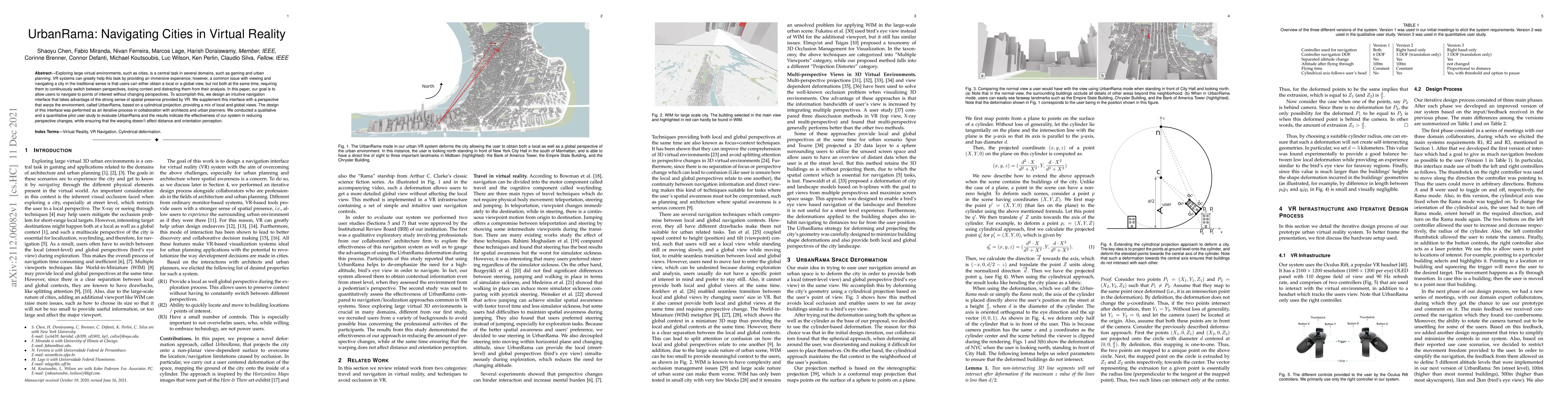
Exploring large virtual environments, such as cities, is a central task in several domains, such as gaming and urban planning. VR systems can greatly help this task by providing an immersive experie...
Providing efficient human mobility services and infrastructure is one of the major concerns of most mid-sized to large cities around the world. A proper understanding of the dynamics of commuting fl...
Over the past decade, several urban visual analytics systems and tools have been proposed to tackle a host of challenges faced by cities, in areas as diverse as transportation, weather, and real estat...
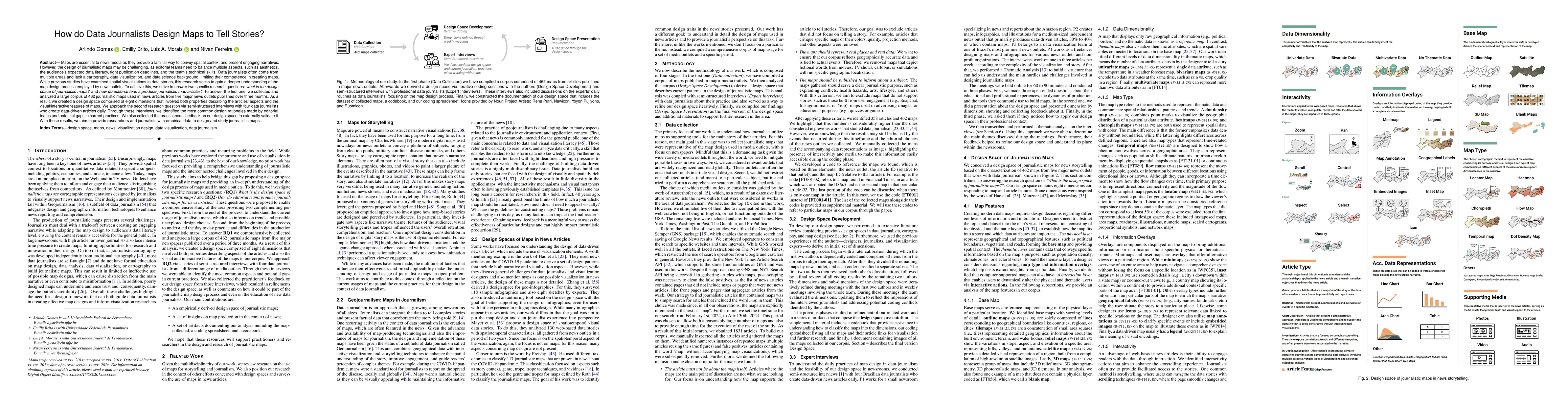
Maps are essential to news media as they provide a familiar way to convey spatial context and present engaging narratives. However, the design of journalistic maps may be challenging, as editorial tea...
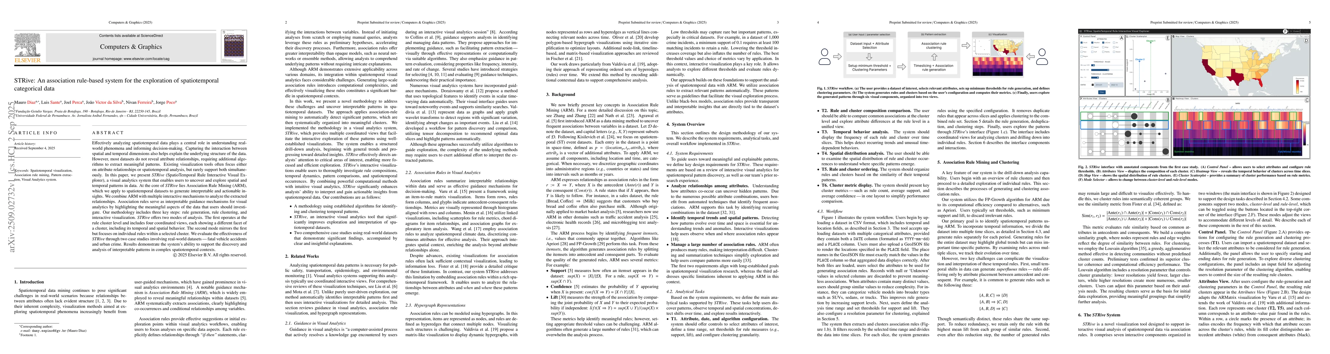
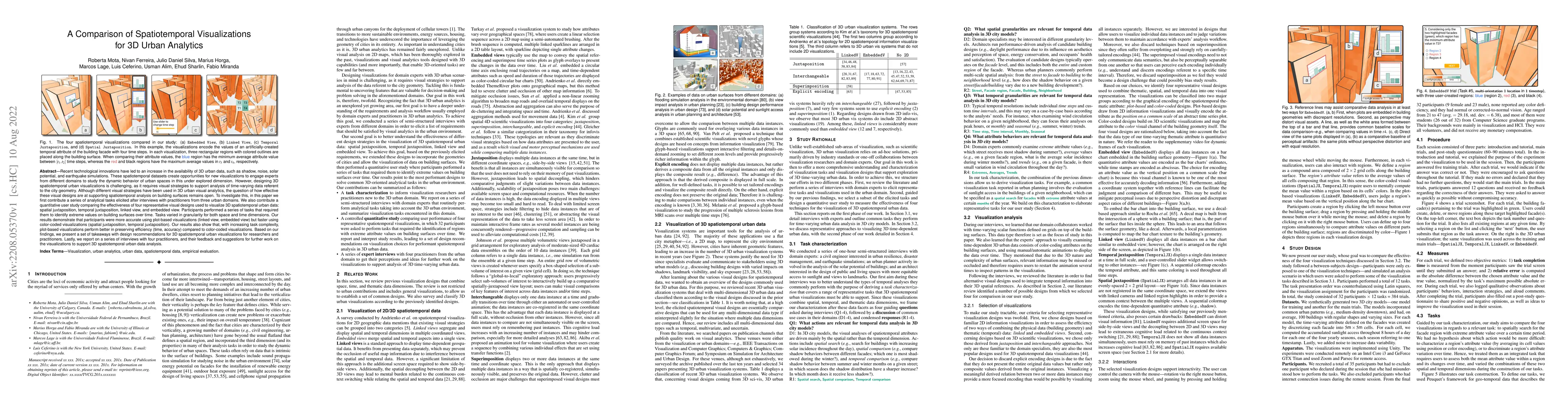
Effectively analyzing spatiotemporal data plays a central role in understanding real-world phenomena and informing decision-making. Capturing the interaction between spatial and temporal dimensions al...
Despite the growing availability of 3D urban datasets, extracting insights remains challenging due to computational bottlenecks and the complexity of interacting with data. In fact, the intricate geom...
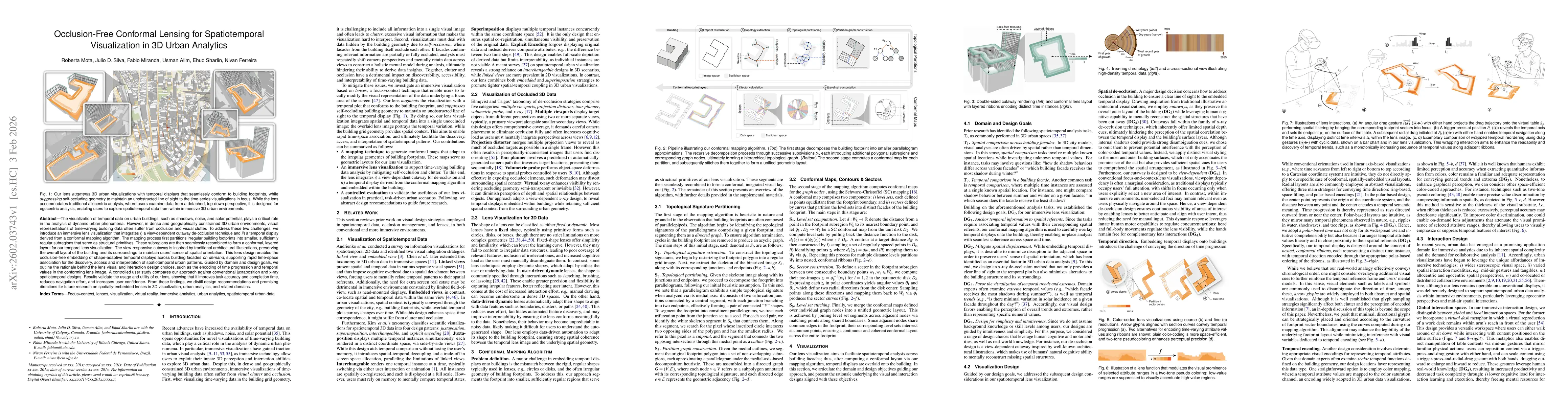
The visualization of temporal data on urban buildings, such as shadows, noise, and solar potential, plays a critical role in the analysis of dynamic urban phenomena. However, in dense and geographical...