Academic Profile
Statistics
Similar Authors
Papers on arXiv
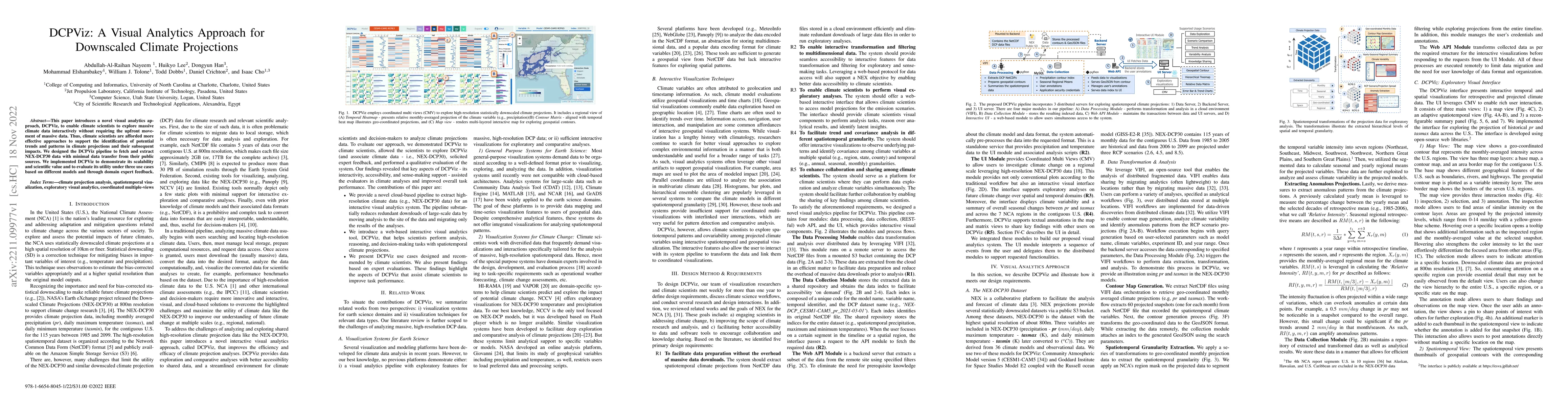
This paper introduces a novel visual analytics approach, DCPViz, to enable climate scientists to explore massive climate data interactively without requiring the upfront movement of massive data. Th...
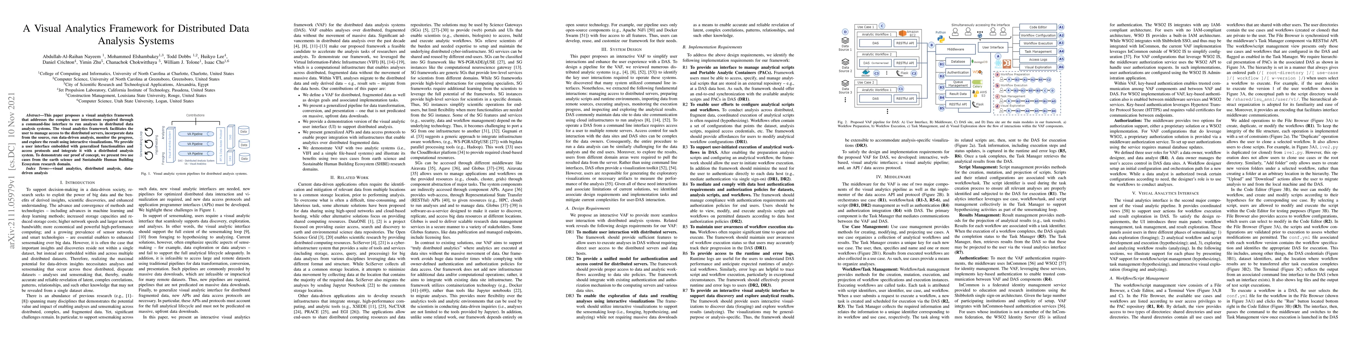
This paper proposes a visual analytics framework that addresses the complex user interactions required through a command-line interface to run analyses in distributed data analysis systems. The visu...
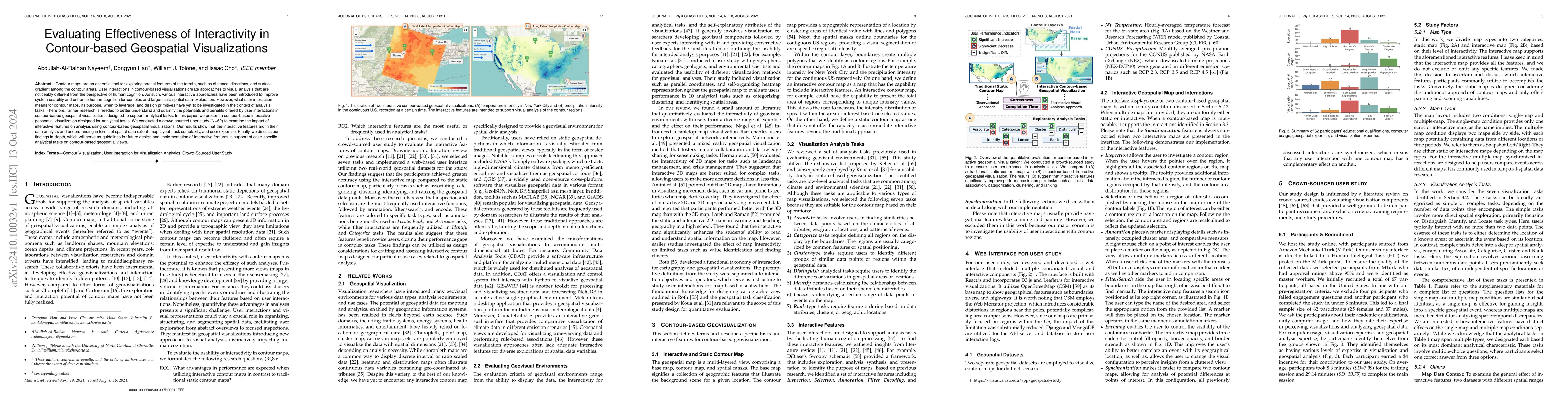
Contour maps are an essential tool for exploring spatial features of the terrain, such as distance, directions, and surface gradient among the contour areas. User interactions in contour-based visuali...
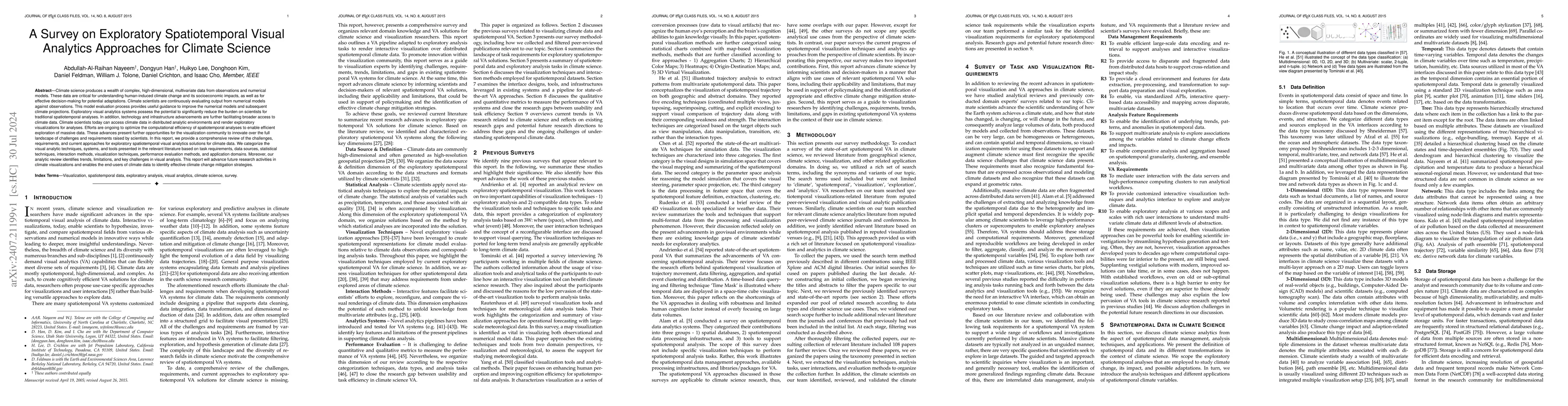
Climate science produces a wealth of complex, high-dimensional, multivariate data from observations and numerical models. These data are critical for understanding climate changes and their socioecono...