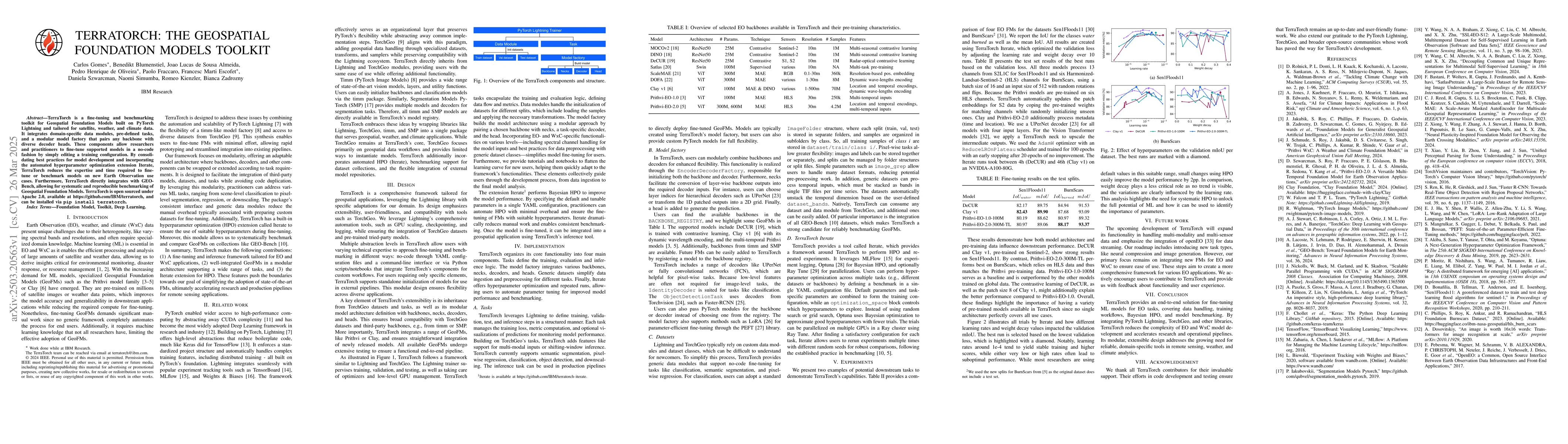
TerraTorch is a fine-tuning and benchmarking toolkit for Geospatial
Foundation Models built on PyTorch Lightning and tailored for satellite,
weather, and climate data. It integrates domain-specific data modules,
pre-defined tasks, and a modular model factory that pairs any backbone with
diverse decoder heads. These components allow researchers and practitioners to
fine-tune supported models in a no-code fashion by simply editing a training
configuration. By consolidating best practices for model development and
incorporating the automated hyperparameter optimization extension Iterate,
TerraTorch reduces the expertise and time required to fine-tune or benchmark
models on new Earth Observation use cases. Furthermore, TerraTorch directly
integrates with GEO-Bench, allowing for systematic and reproducible
benchmarking of Geospatial Foundation Models. TerraTorch is open sourced under
Apache 2.0, available at https://github.com/IBM/terratorch, and can be
installed via pip install terratorch.
Discussion 0