Academic Profile
Statistics
Similar Authors
Papers on arXiv
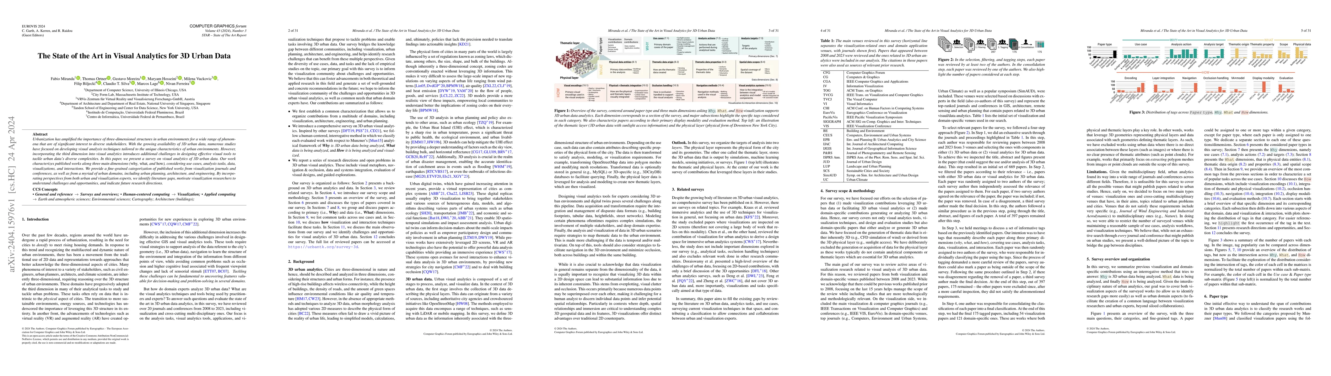
Urbanization has amplified the importance of three-dimensional structures in urban environments for a wide range of phenomena that are of significant interest to diverse stakeholders. With the growi...
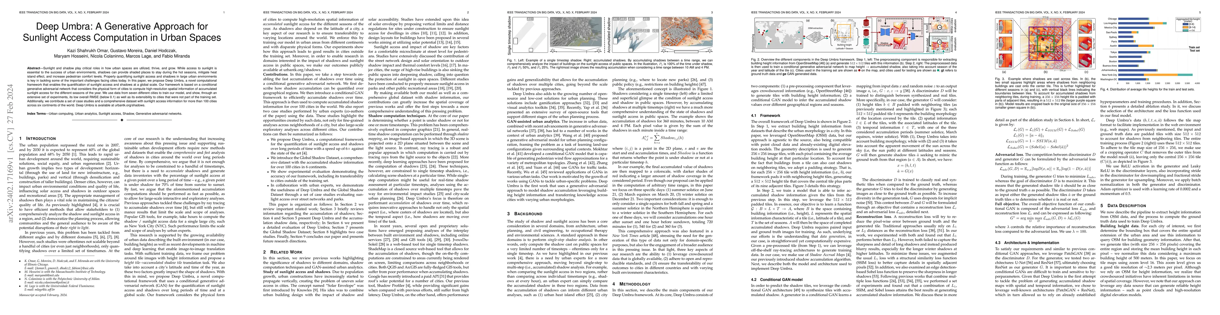
Sunlight and shadow play critical roles in how urban spaces are utilized, thrive, and grow. While access to sunlight is essential to the success of urban environments, shadows can provide shaded pla...
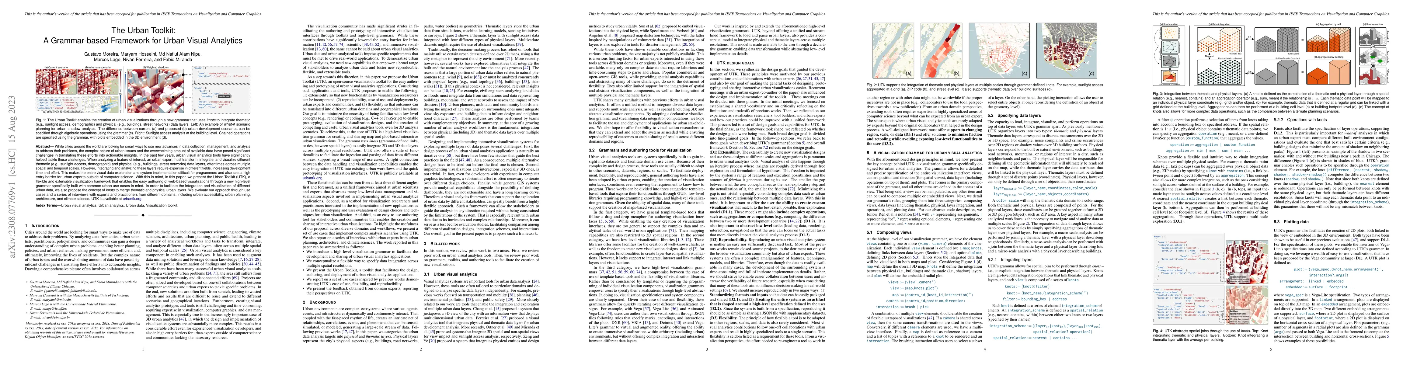
While cities around the world are looking for smart ways to use new advances in data collection, management, and analysis to address their problems, the complex nature of urban issues and the overwh...
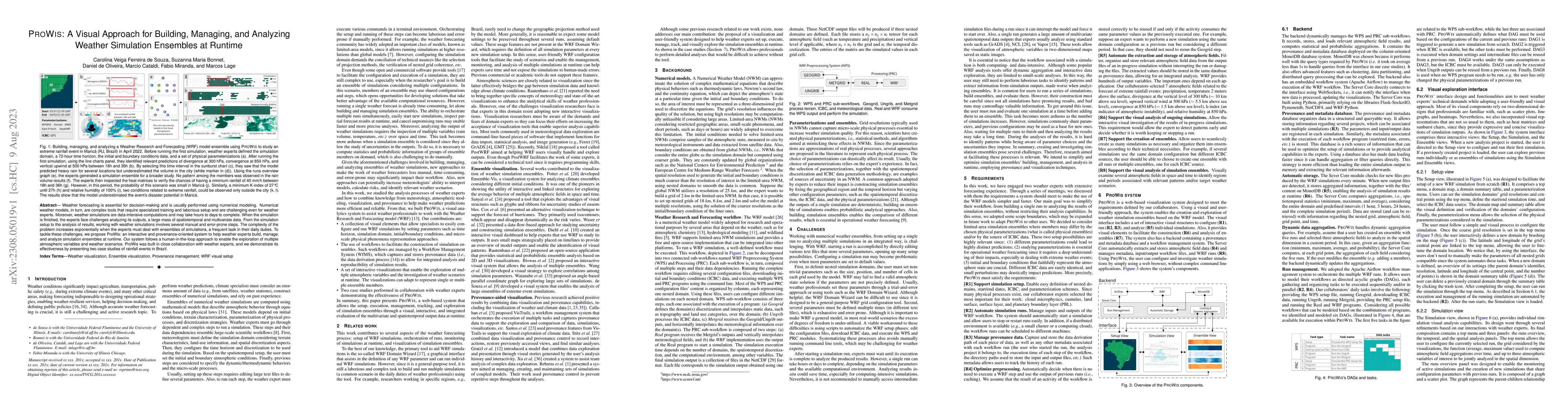
Weather forecasting is essential for decision-making and is usually performed using numerical modeling. Numerical weather models, in turn, are complex tools that require specialized training and lab...
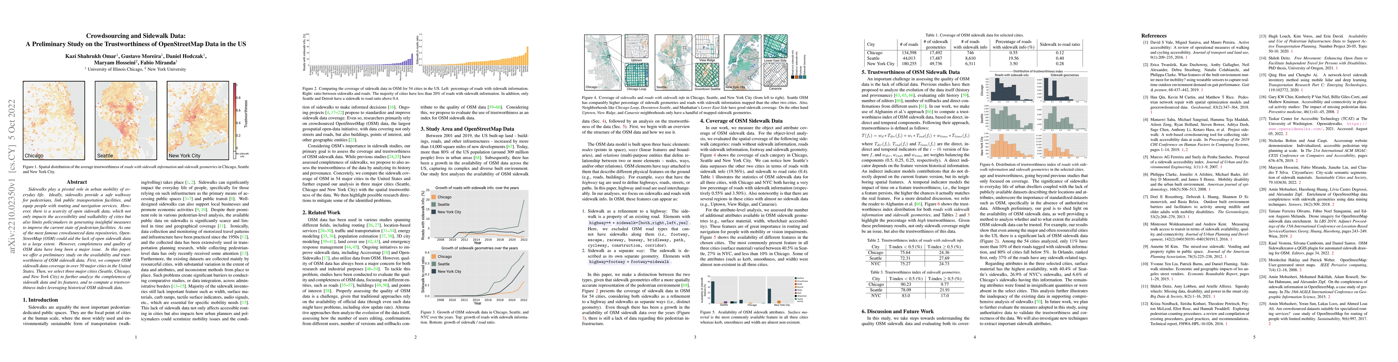
Sidewalks play a pivotal role in urban mobility of everyday life. Ideally, sidewalks provide a safe walkway for pedestrians, link public transportation facilities, and equip people with routing and ...
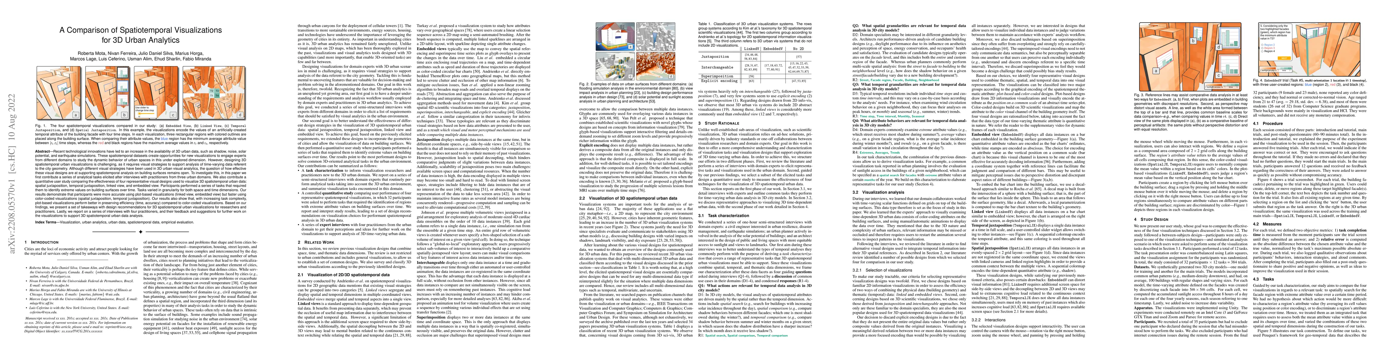
Recent technological innovations have led to an increase in the availability of 3D urban data, such as shadow, noise, solar potential, and earthquake simulations. These spatiotemporal datasets creat...
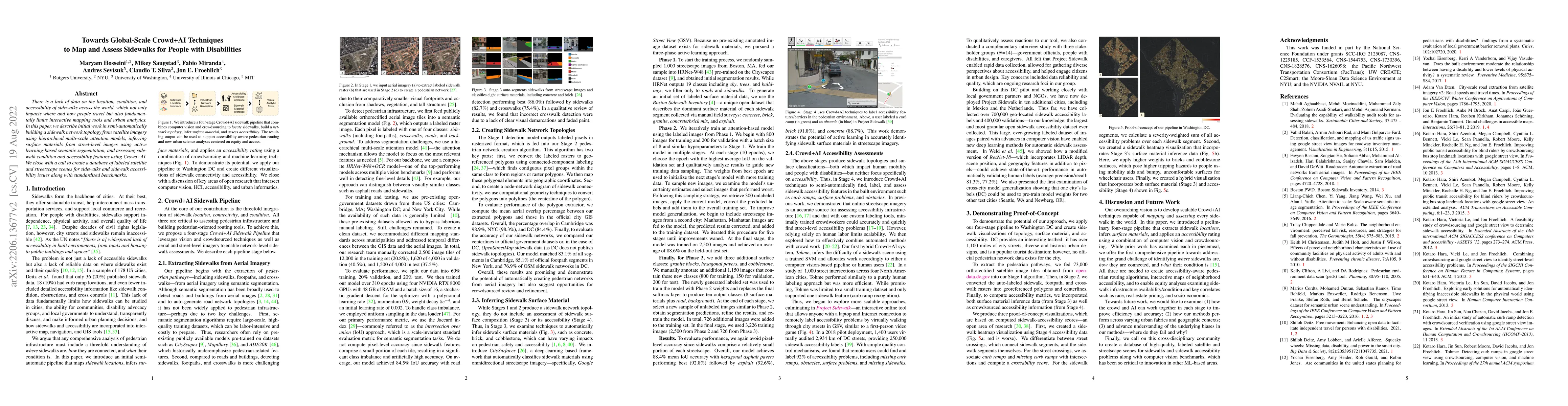
There is a lack of data on the location, condition, and accessibility of sidewalks across the world, which not only impacts where and how people travel but also fundamentally limits interactive mapp...

Noise is one of the primary quality-of-life issues in urban environments. In addition to annoyance, noise negatively impacts public health and educational performance. While low-cost sensors can be ...
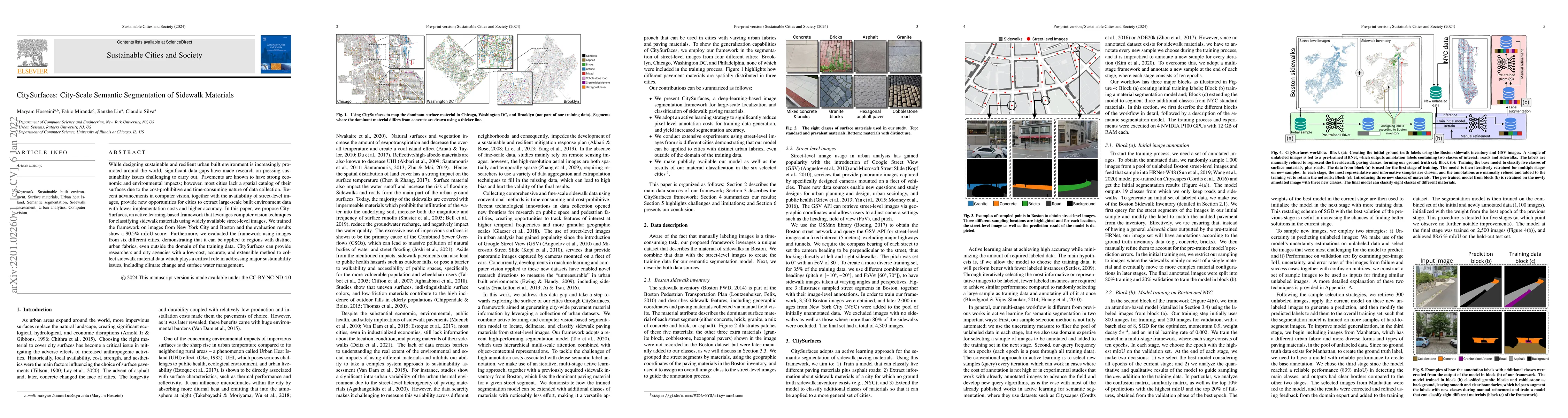
While designing sustainable and resilient urban built environment is increasingly promoted around the world, significant data gaps have made research on pressing sustainability issues challenging to...
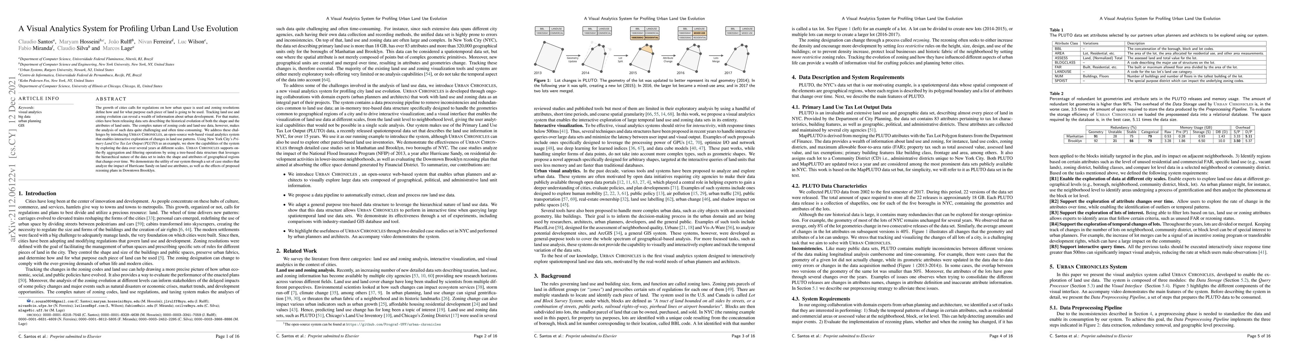
The growth of cities calls for regulations on how urban space is used and zoning resolutions define how and for what purpose each piece of land is going to be used. Tracking land use and zoning evol...
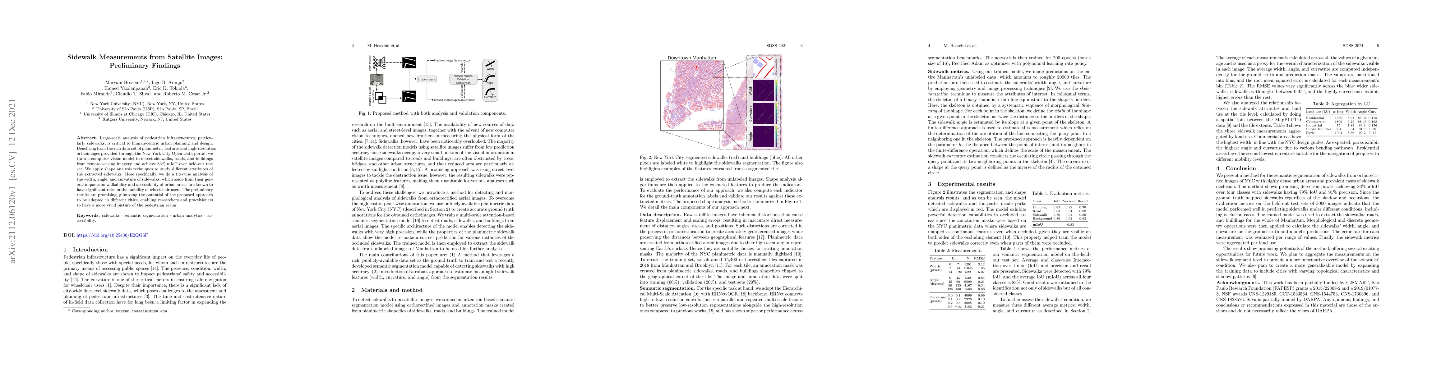
Large-scale analysis of pedestrian infrastructures, particularly sidewalks, is critical to human-centric urban planning and design. Benefiting from the rich data set of planimetric features and high...
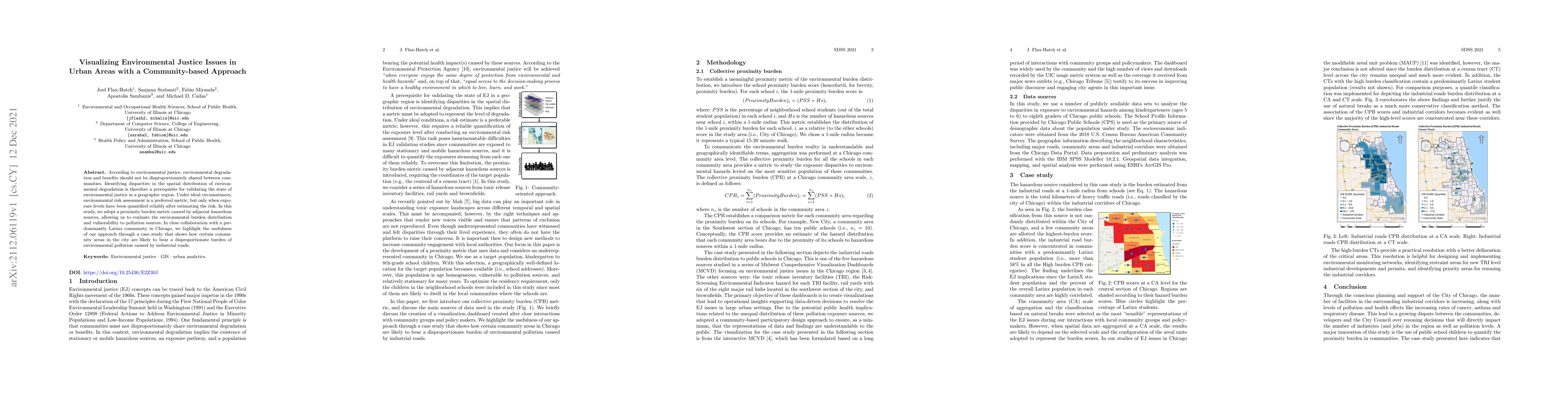
According to environmental justice, environmental degradation and benefits should not be disproportionately shared between communities. Identifying disparities in the spatial distribution of environ...
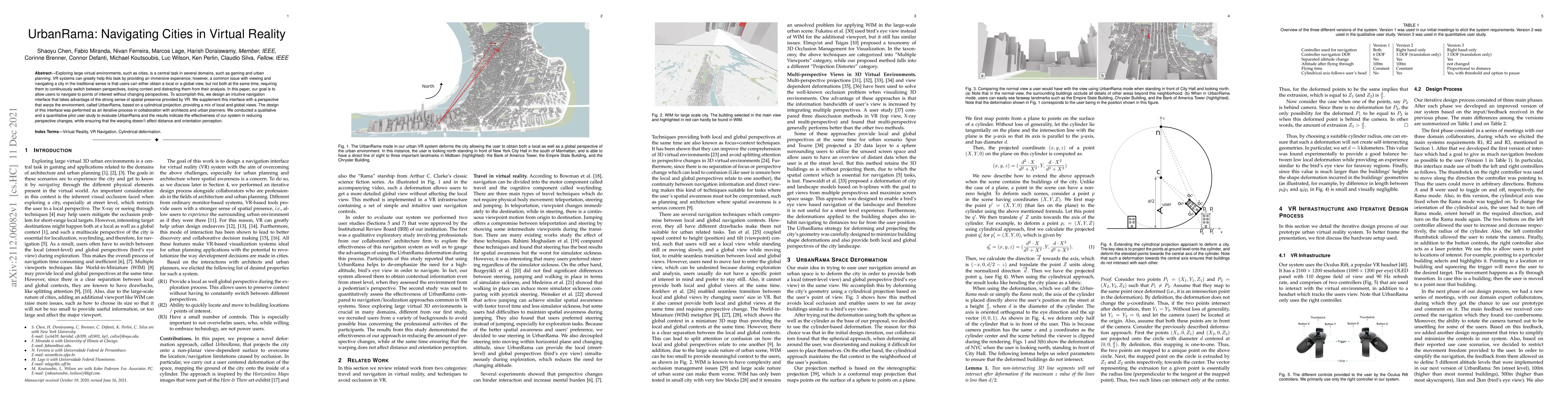
Exploring large virtual environments, such as cities, is a central task in several domains, such as gaming and urban planning. VR systems can greatly help this task by providing an immersive experie...
Providing efficient human mobility services and infrastructure is one of the major concerns of most mid-sized to large cities around the world. A proper understanding of the dynamics of commuting fl...
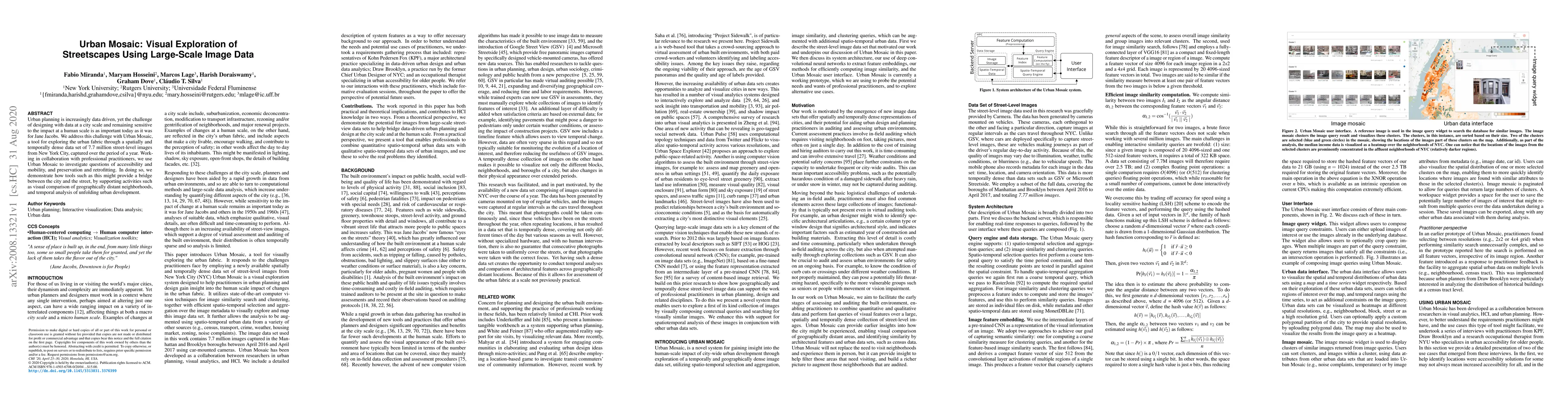
Urban planning is increasingly data driven, yet the challenge of designing with data at a city scale and remaining sensitive to the impact at a human scale is as important today as it was for Jane J...
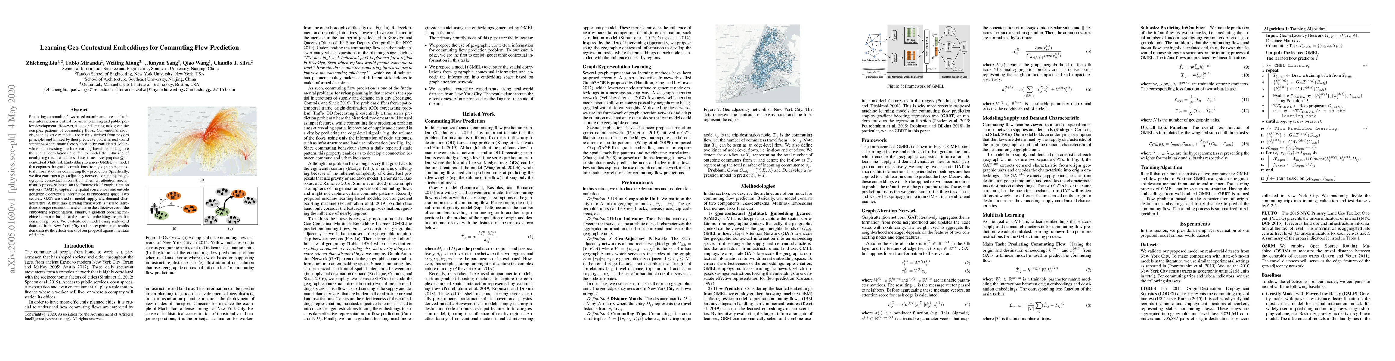
Predicting commuting flows based on infrastructure and land-use information is critical for urban planning and public policy development. However, it is a challenging task given the complex patterns...
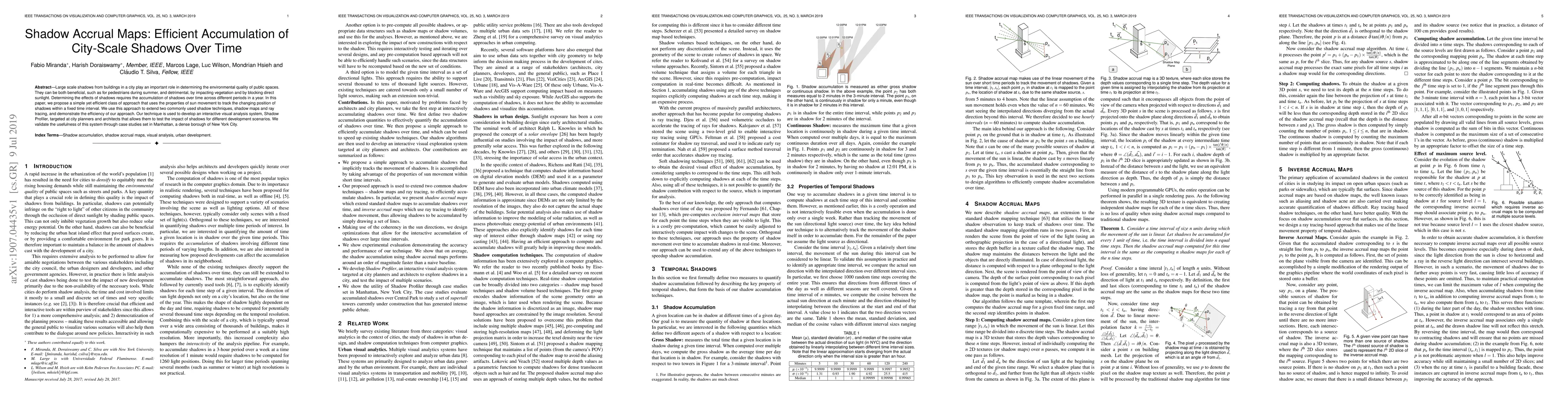
Large scale shadows from buildings in a city play an important role in determining the environmental quality of public spaces. They can be both beneficial, such as for pedestrians during summer, and...
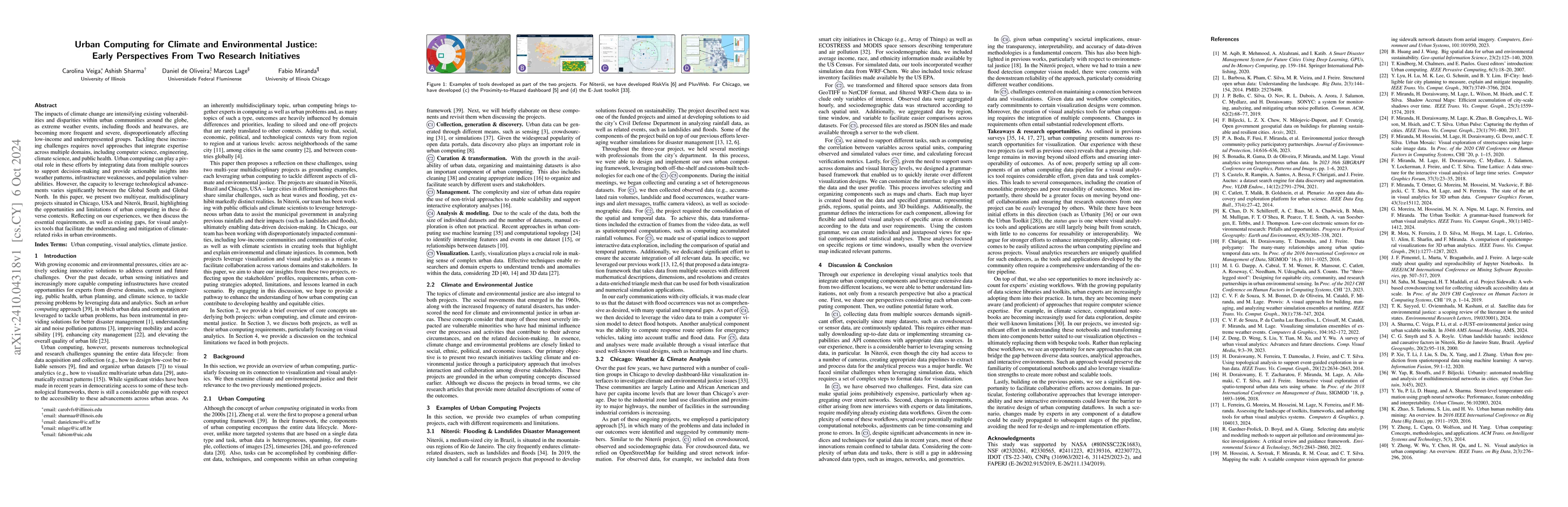
The impacts of climate change are intensifying existing vulnerabilities and disparities within urban communities around the globe, as extreme weather events, including floods and heatwaves, are becomi...
Over the past decade, several urban visual analytics systems and tools have been proposed to tackle a host of challenges faced by cities, in areas as diverse as transportation, weather, and real estat...
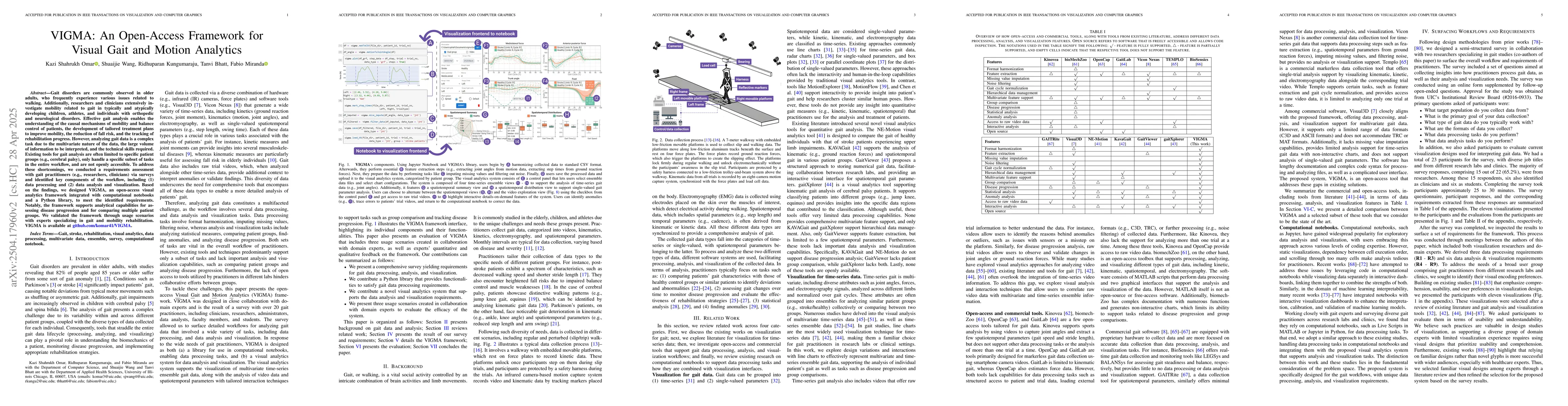
Gait disorders are commonly observed in older adults, who frequently experience various issues related to walking. Additionally, researchers and clinicians extensively investigate mobility related to ...
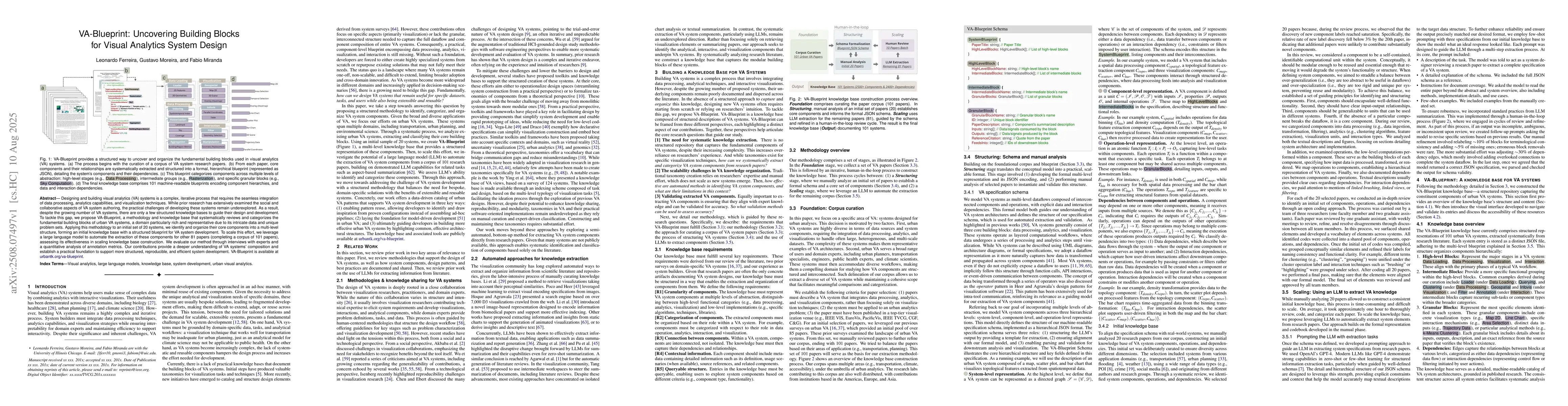
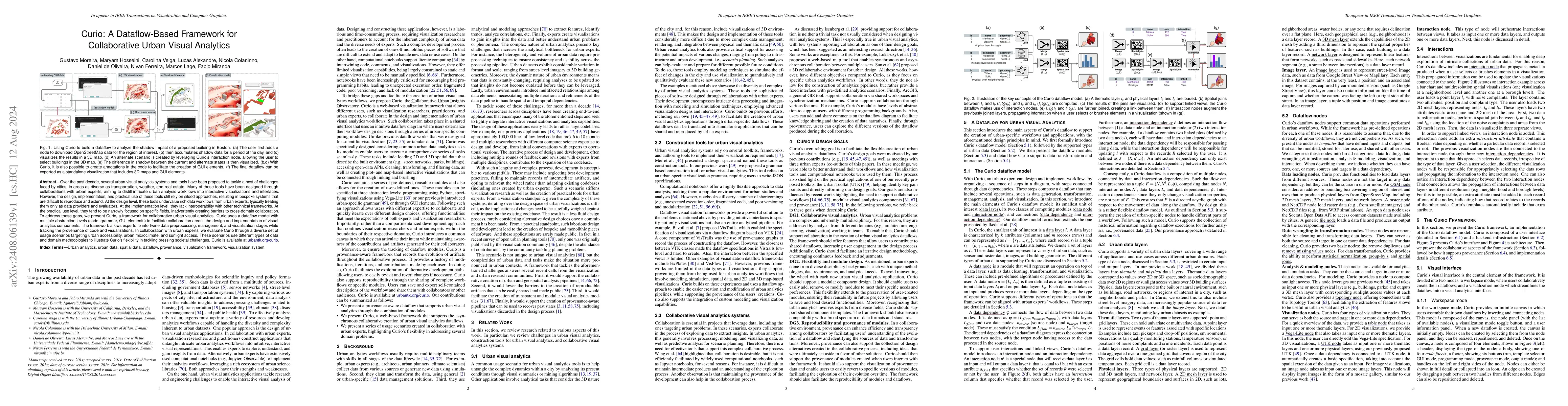
Designing and building visual analytics (VA) systems is a complex, iterative process that requires the seamless integration of data processing, analytics capabilities, and visualization techniques. Wh...
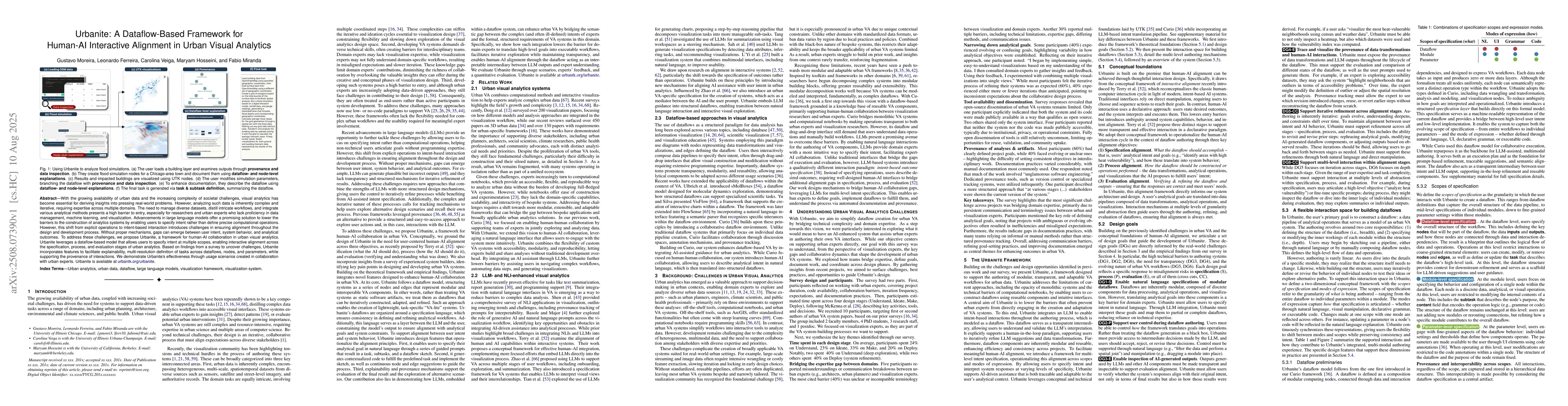
With the growing availability of urban data and the increasing complexity of societal challenges, visual analytics has become essential for deriving insights into pressing real-world problems. However...
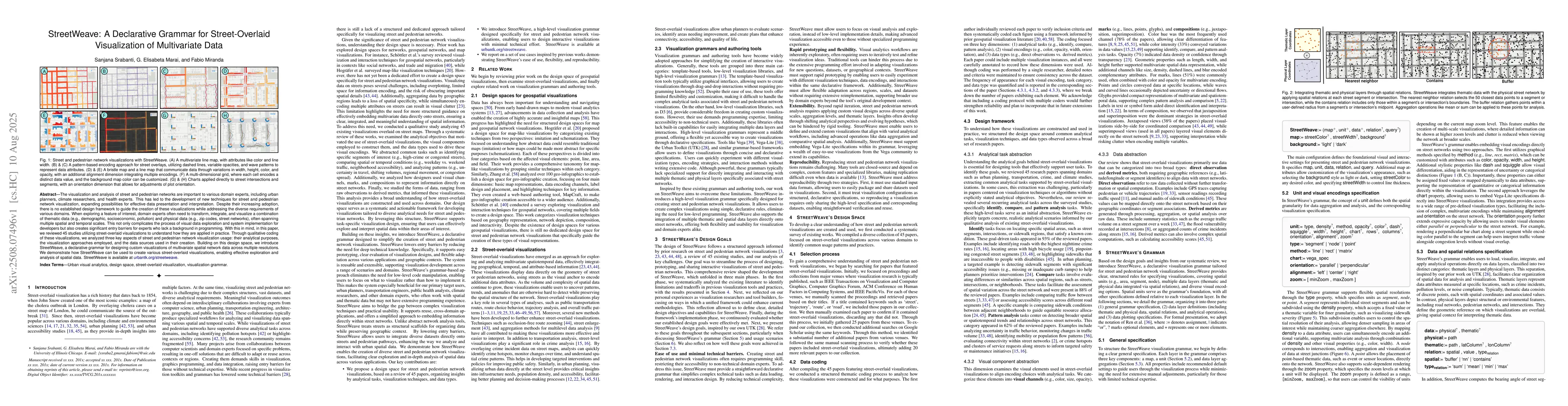
The visualization and analysis of street and pedestrian networks are important to various domain experts, including urban planners, climate researchers, and health experts. This has led to the develop...
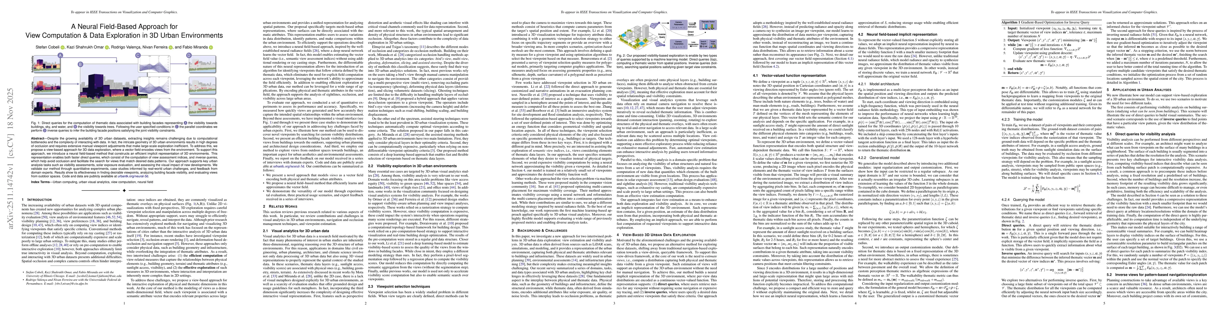
Despite the growing availability of 3D urban datasets, extracting insights remains challenging due to computational bottlenecks and the complexity of interacting with data. In fact, the intricate geom...
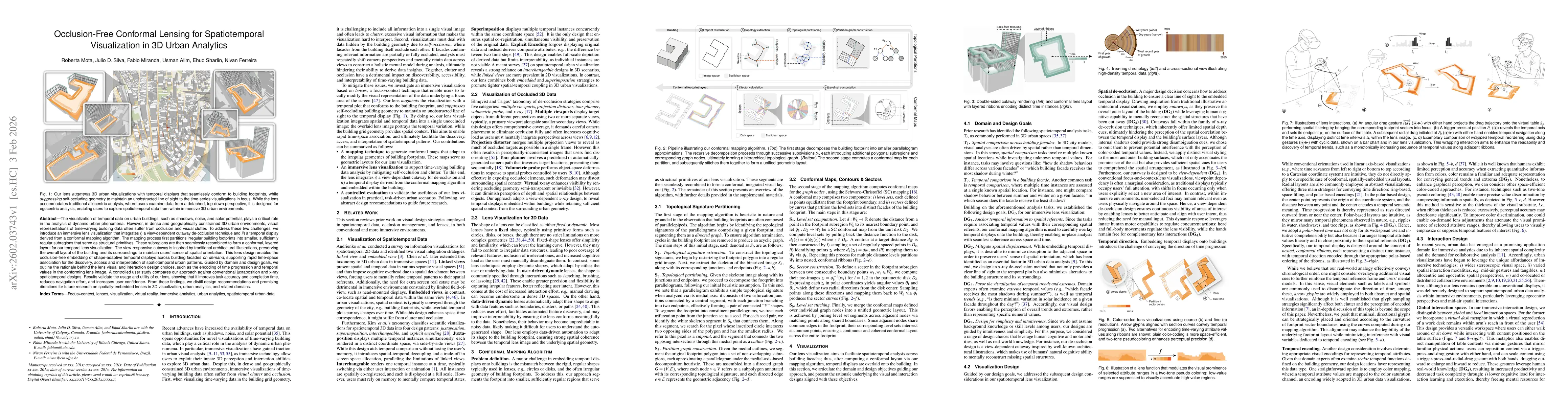
The visualization of temporal data on urban buildings, such as shadows, noise, and solar potential, plays a critical role in the analysis of dynamic urban phenomena. However, in dense and geographical...
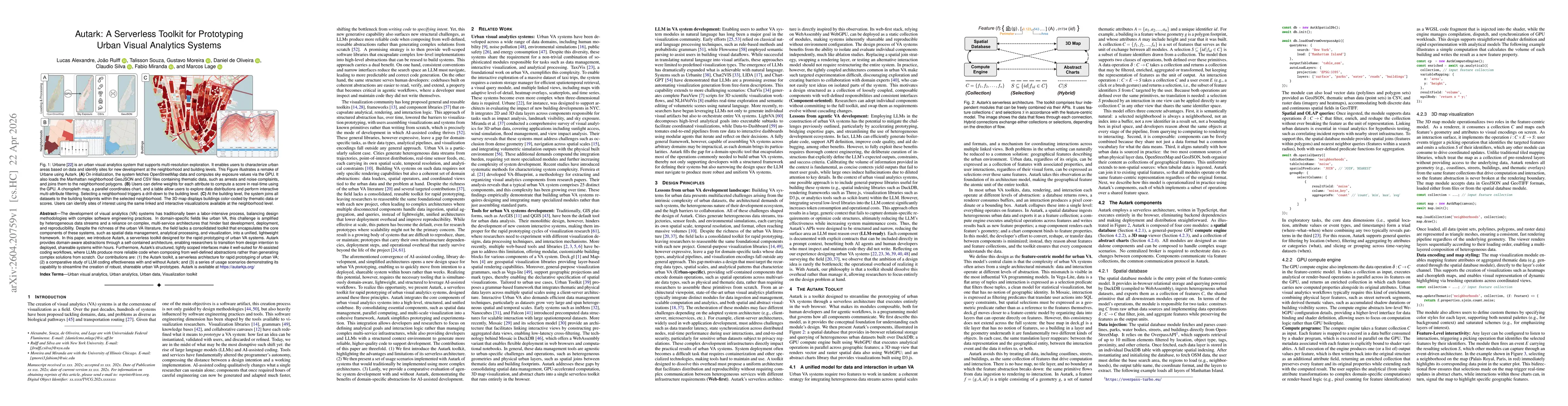
The development of visual analytics (VA) systems has traditionally been a labor-intensive process, balancing design methodologies with complex software engineering practices. In domain-specific fields...